
“There is not a single place in Kashmir which is not holy”
Kalhana – 12th century Historian
.
.
The trip to Kashmir was not a run-of-the-mill sightseeing trip, but to visit the ancient temples of Kashmir, many of them in remote and terrorist-affected areas. After my recent trips to the temples of Karnataka and Goa, this was icing on the cake. I was lucky to learn about this trip and grabbed the opportunity which had dropped into my lap. One has often read about Kashmir being Rishi Bhoomi and the land of Shaivism since ancient times, a place for learning and study which was traversed by great sages like Kashyap, the progenitor of mankind.
.

.
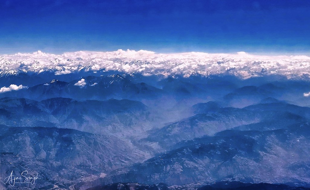
Before taking the reader to the mostly forgotten sites of the temples, most of which are in ruins, it will be instructive to know a little about the itihaas of the region, which have always played an important role for Sanatan Dharma, and in the history of Bharat. I had a foggy idea about Kashmir’s past, and it was only when I visited the places did the urge to know more push me to carry out some research on the subject.
.
.
Note: Readers wishing to read about the history of Kashmir and of the important shrines I visited, can read my blog Kashmir – The Land of Rishis: Part 2 – History.
.
The History portion also has a summary of the exploits of Emperor Lalitaditya Muktapida, one of the greatest emperors of Bharat, and probably in the world, and whose empire extended from the Caspian Sea to the Sundarbans at its peak in the 8th century CE.
.
.
General Impressions
.
My trip to Kashmir, more of a yatra, was for 10 days, during which we crisscrossed the whole valley. The road network was generally good, and travel was not uncomfortable, except for some of the remote or mountainous regions where there were narrow roads, like Pahalgam to Aru Valley. Considering the mountainous terrain and relatively low traffic density, the roads were excellent. Another striking observation during our travels even to the remote parts of Kashmir was the apparent affluence visible everywhere. I never saw anyone begging, and even in small and remote villages I saw no shanties, they were all permanent modern houses, often glass-fronted multi-storied palatial structures, and many under various stages of construction. The profusion of cars on the roads, complemented by swanky car dealers’ showrooms, service stations, and well-maintained petrol outlets were visible everywhere. Of a standard that I would expect in a metro city. The shops displayed fashionable dresses; a profusion of well-stocked fruit vendors existed everywhere having fruits of all varieties. The only exception to this affluence was the few villages with a predominantly Gujjar and Bakerwaal population. The question arises, where does this affluence come from when hardly any employment opportunities exist in the State and agricultural income would be limited to only a small portion of the population? We saw numerous well-manicured gardens, which were packed with locals picnicking, and families enjoying the outdoors. The general impression of Kashmir being hugely impacted by terrorism and consequently, a devastated place with most people staying indoors is totally misplaced! On the contrary, in many of the gardens and scenic spots we visited in the smaller towns, it appeared that we were intruders disturbing the environment.
.
.
Notwithstanding the hordes of tourists and locals crowding every venue we went to, the other spectacle that couldn’t be missed was the large number of security personnel deployed everywhere. Srinagar itself had armed soldiers at nearly every street corner; so was the case in the other towns. Barricaded vehicles and check posts dotted the landscape.
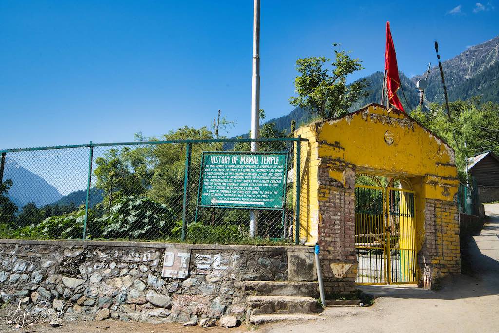
Another observation which I must mention is concerning the state of temples. As we know, most of the ancient temples have been destroyed and only ruins remain. Even those under the charge of the Archaeological Survey of India (ASI), a central government organization, suffered from two major drawbacks. Firstly, hardly any attempt seems to have been made to protect from encroachments or to rebuild the monuments e.g., the temple complex at Naranag or even the more famous Martand Sun Temple; and, secondly, many of the ‘living’ temples where offerings were being made by devotees were being looked after by Muslim staff. Quite a contradiction! Some of them we found to be quite rude, like the one at the ancient Mamal Temple at Pahalgam. What was sad to see was that all the temples we visited, especially the ‘living’ temples, were under the protection of a large contingent of security forces. They were heavily fenced and gates were kept closed/locked. And in a poor state of maintenance.
.
.
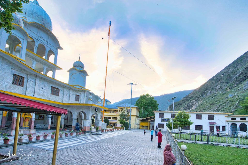
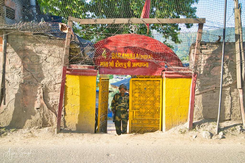
To ensure that the temples were not attacked, the security forces had included them inside their encampment; if not, then a permanent detachment was located inside the temple complex. We have to guard our places of worship in our own country! Strikingly, no guards were visible in places of worship of other religions, including the Gurdwaras, which we visited.
However, at many of the ancient temples, their divinity and power for eons continued to attract devotees of all faiths, including Muslims. Some, like the Martand Surya Temple holy spring at Mattan, had as many Muslims visiting the complex as Hindus. I learned that they only avoided praying to the murtis, but otherwise came in large numbers because of the tradition of receiving blessings regardless of faith.
.
Route
.
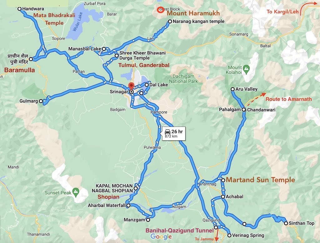
The places we visited are marked on the map below. It shows how we crisscrossed across the whole of Kashmir. A very well-planned tour indeed!
.
.
Day 1
.
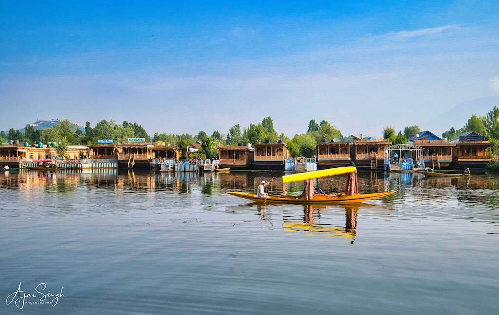
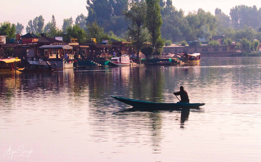
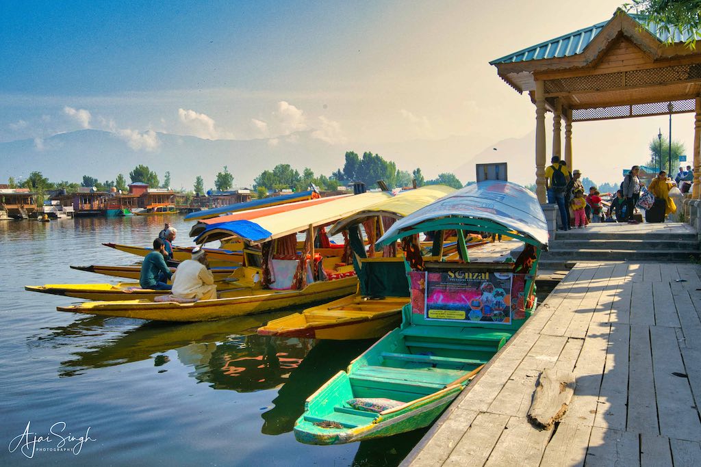
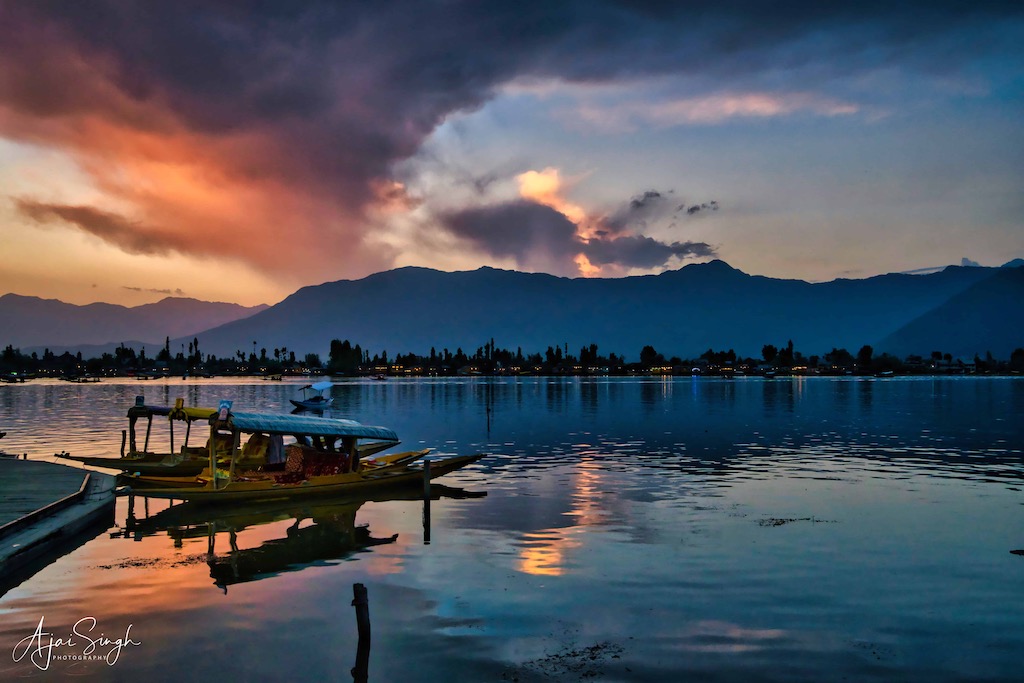
The first day went in receiving our large group of 20 members throughout the day and settling down. Our hotel was not far from Dal Lake, and finally, we could be shepherded together to visit the iconic lake by late evening. We glimpsed the breathtaking sunset views over the lake with the majestic mountain range in the background. The long waterfront was teeming with tourists, with hardly any space on the footpath, and there was an endless traffic jam on the narrow road running along the shore. We did manage to jump into the waiting shikaras for a ride across the lake and row past the network of waterways lined with rows of houseboats and floating shops. Not to forget the numerous boats coming alongside us, selling everything conceivable, from flowers, saffron, and semi-precious stones, to gol gappas and fruit chat!
.
.
Dal Lake
.
Dal is a lake in Srinagar, the summer capital of Jammu and Kashmir. It is an urban lake, the second-largest lake in Jammu and Kashmir. It is integral to tourism and recreation in the Kashmir valley and is variously known as the “Lake of Flowers”, “Jewel in the crown of Kashmir” or “Srinagar’s Jewel”. The lake is also an important source for commercial operations in fishing and water plant harvesting. The shoreline of the lake is about 15.5 kilometers and is encompassed by a boulevard lined with Mughal-era gardens, parks, houseboats, and hotels. Scenic views of the lake can be witnessed from the Mughal gardens, such as Shalimar Bagh and Nishat Bagh built during the reign of Mughal Emperor Jahangir, and from the colourful shikaras. The lake covers an area of 18 square kilometers with a catchment area of 316 square kilometers in the Zabarwan mountain valley and the Shankaracharya Hill, which surrounds it on three sides.
Dal is mentioned as Mahasarit (महासरित्) in ancient Sanskrit texts. Ancient history records mention that a village named Isabar to the east of Dal was the residence of Durga. This place was known as Sureshwari on the bank of the lake, which was sourced by a spring called the Satadhara.
.
.
During the Mughal period, they designated Kashmir, and Srinagar in particular, as their summer resort and developed the precincts with sprawling Mughal-type gardens and pavilions as pleasure resorts to enjoy the salubrious cool climate. After the death of Aurangzeb in 1707, which led to the disintegration of the Mughal Empire, Pashtun tribes in the area around the lake and city increased, and the Afghan Durrani Empire ruled the city for several decades. In 1814 a significant part of the Kashmir valley, including Srinagar, was annexed from the Afghans by Maharaja Ranjit Singh to his kingdom, and the Sikhs grew in influence in the region for 27 years. During the subsequent Dogra Raj, Srinagar became the capital of the Dogra kingdom. Although the Dogra Maharaja of Kashmir restricted the building of houses in the valley to prevent overcrowding the city, the British circumvented this rule by commissioning lavish houseboats to be built on the Dal, creating the legacy of houseboats in the lake, which do not move and remain permanently anchored. Unlike elsewhere, like in the backwaters of Kerala.
To read more about the history of the Dal Lake, read my blog Kashmir – The Land of Rishis: Part 2 – History.
.
Day 2
.
Shankaracharya Temple
.
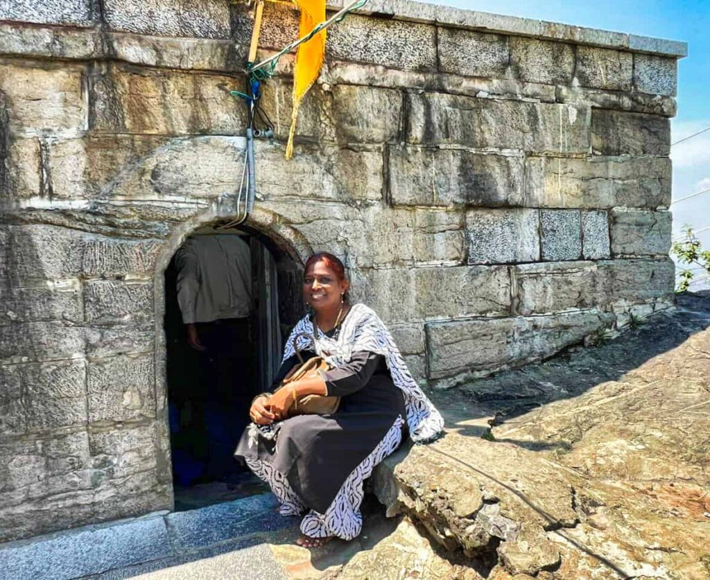
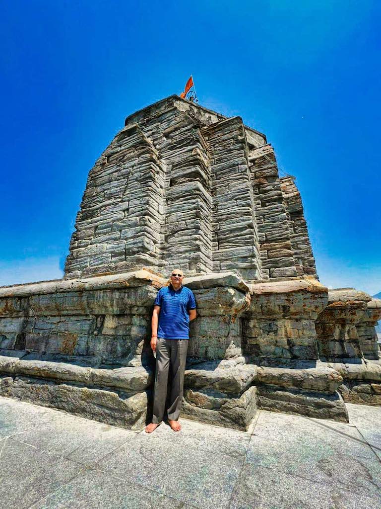
The tour started with our visit to the famous Shankaracharya Temple or Jyeshteshwara Temple, which is situated on top of the Shankaracharya Hill on the Zabarwan Range. It is dedicated to Shiva (Jyeshteshwara). The temple is at a height of 1,100 feet above the valley floor and overlooks Srinagar. The structure is considered the oldest temple in Kashmir, historically and traditionally. The earliest historical reference to the hill comes from Kalhana, the famous 12th century historian of Kashmir. He called the mountain ‘Gopadri’ or ‘Gopa Hill’. Kalhana says that King Gopaditya granted the land at the foot of the hill to the Brahmins that had come from the “Aryadesa”. The land grant, an agraharam, was called ‘Gopa Agraharas’. This area at the base is now called Gupkar.
.

.
According to renowned historian, Pandit Anand Koul (1924), the temple was originally built by King Sandiman who reigned in Kashmir from 2629-2564 BCE. It was extensively renovated by King Gopaditya (426-365 BCE) and then by King Lalitaditya. The temple was visited by Adi Shankara (8th century CE) and has ever since been associated with him; this is how the temple and hill got the name Shankaracharya. It is here that he composed his famous literary work Soundarya Lahari.
.
.
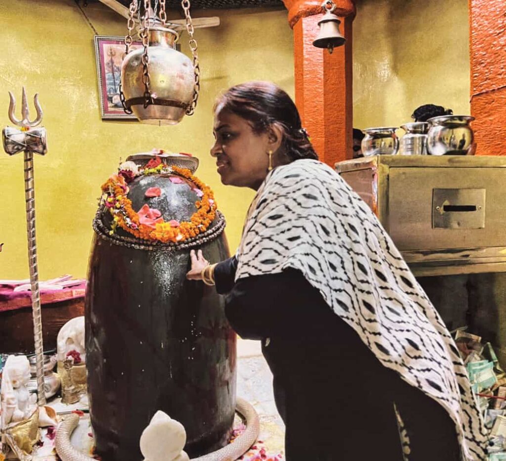
The present re-constructed structure of the temple dates to the 6th century CE. The temple rests on solid rock with a 20 ft high octagonal base supporting the square building on top, which is 30 feet high. The temple has a circular sanctum sanctorum with two lintels supporting the load of the roof on four octagonal columns in the center. The dome-shaped ceiling and brick roof over the sanctum are of recent construction, though the base of the structure is ancient. The sanctum houses the presiding deity, Jyesthesvara, in the form of a Shiva Linga. The Linga is large and oval-shaped, made of reddish black stone, probably sourced from the Narbada River valley in Madhya Pradesh, and was brought during the period of Sikh rule.
.
.
There are 240 steps to reach the temple from the road. The road was built by the Border Roads organization in 1969. The hill is also occasionally referred to as the Takht-i-Sulaiman or simply Takht Hill. The Dogra King Gulab Singh (1792-1857 CE) constructed the steps to the hill from the Durga Naag temple side. Steps existed before as well, leading further, to the Jhelum. Nur Jahan used the stones of these old steps for the construction of the Pathar Mosque. The Buddhists called the hill as Pas-Pahar.
.
.
On our way up the hill, we came across a steady stream of vehicles. Since we got delayed, the crowds had built up. The road is quite narrow, and about 2 km short of the top, our van could proceed no further. The balance of the way we had to trek up the hill. Not a pleasant task in the hot sun. There were two security check posts – one was at the base of the hill itself, where all occupants of vehicles had to dismount and walk across the barrier, while the car/van drove separately across, where you again got in. The second check was at the base of the steps to the temple. Here all devotees are thoroughly scanned and no cameras, bags, etc are allowed. After managing to reach the top of the steps, it was a sight to see the ancient temple with its unique shape standing in majestic glory at the summit of the hill. To enter the temple itself, one had to climb another small flight of steep steps to the octagonal platform, and then a few more steps taken inside the garbh griha. The large Shiva Linga dominated the small circular space and it was with great reverence one offered salutations to Shiva, remembrance that this place existed since prehistoric times flashed through the mind. The view from the top gave a 360°panoramic of the valley, with the city and the lake in front. It was spectacular. On the way out, by the side of the stone platform was a small entrance leading to a cave-like room where Adi Sankara had stayed during his visit and performed meditation in the 8th century. Fortunately, the room was empty and I could still for a while in the energized surroundings and reflect within.
.

.
To read more about the history of the Shankaracharya Temple, read my blog Kashmir – The Land of Rishis: Part 2 – History.
.
Shalimar Bagh
.
Our next destination was the famous Shalimar Bagh. It is a Mughal garden, linked through a channel to the northeast of Dal Lake. The Bagh was built by enlarging an ancient existing garden by Mughal Emperor Jahangir for his wife Nur Jahan in 1619 and was initially known as Farah Baksh. Jahangir and his wife Nur Jahan were so enamored by Kashmir that during summer they moved to Srinagar with their full court entourage from Delhi at least 13 times during his rule. Shalimar Bagh was their imperial summer residence and the Royal Court. They crossed the arduous snowy passes of the Pir Panjal mountain range on elephants to reach Srinagar. The garden covers an area of 31 acres built with a size of 1,926 ft in length on the main axis channel and with a total width of 823 ft. The garden has three terraces fitted with fountains and with chinar (sycamore) tree-lined vistas. The Shah nahar is the main feeder channel to all the terraces, each of which has a specific role. The first terrace is a public garden or the outer garden ending in the Diwan-e-Aam (public audience hall). The second terrace garden along the axial canal, slightly broader, has two shallow terraces. The Diwan-e-Khas (the Hall of Private Audience), which was accessible only to the noblemen or guests of the court, now derelict, is in its center. The royal bathrooms are located on the northwest boundary of this enclosure. On the third terrace, the fountain pools of the Diwan-e-Khas, the Diwan-e-Aam, and in turn, the Zenana terrace are planned in succession, with 410 fountains. At the entrance to this terrace, there are two small pavilions or guard rooms (built in Kashmir style on stone plinths) that are the controlled entry zone for the royal harem.
.
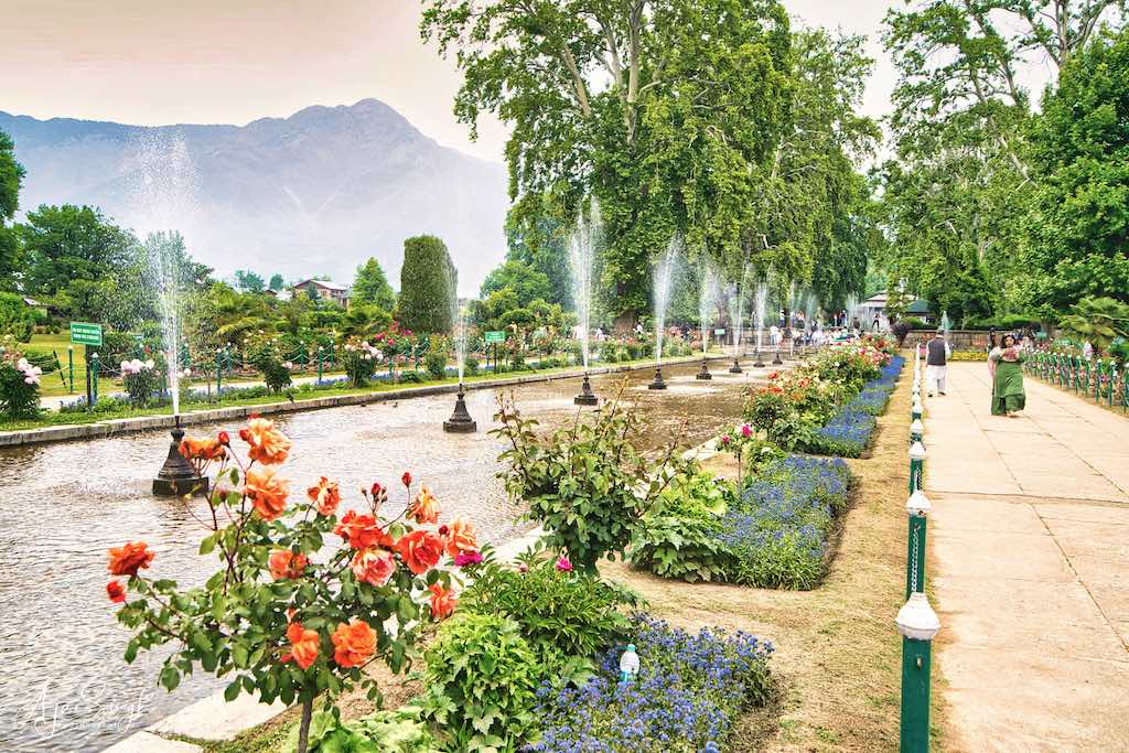
.
The black pavilion built during the early part of Jahangir’s reign (1569–1627), in the top terrace of the Shalimar Bagh, has a famous inscription in Persian, which says:
اگر فردوس بر روے زمین است
همین است و همین است و همین است
Agar Firdaus bar rōy-e zamin ast,
hamin ast-o hamin ast-o hamin ast.
This is a couplet wrongly attributed to the poet Amir Khusrau; it was written by a Persian poet ‘Orfi Shirazi during his visit to Kashmir, and is inscribed on many buildings in the Indian subcontinent.
Translated to English, it means:
If there is a paradise on earth, it is here, it is here, it is here.
.
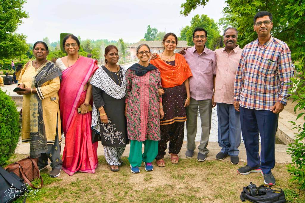
.
Nishat Bagh
.

.
The other famous garden along the Dal is the Nishat Bagh. A terraced Mughal garden was built on the eastern side of Dal Lake. It is the second-largest Mughal garden in the Kashmir Valley. ‘Nishat Bagh’ in Urdu means the “Garden of Joy.” The Bagh was built in 1633 by Asif Khan, the elder brother of Nur Jahan. Nishat Bagh has a broad cascade of terraces lined with avenues of chinar and cypress trees, which starts from the lakeshore and reaches up to an artificial façade at the hill end. Rising from the edge of the Dal Lake, it has twelve 12 terraces representing the twelve Zodiacal signs. However, it has only two sections, namely the public garden and the private garden for the Zanana or harem vis-à-vis the four sections of the Shalimar Bagh; this difference is attributed to the fact that the latter Bagh catered to the Mughal Emperor, while Nishat Bagh belonged to a man of his court, a noble.
.
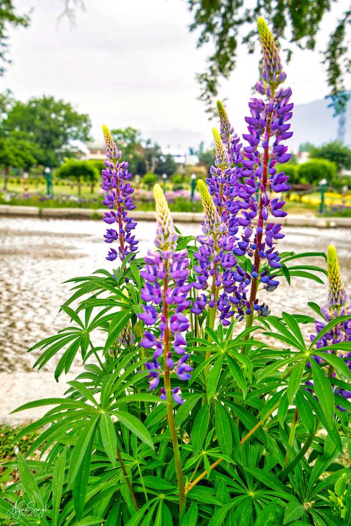
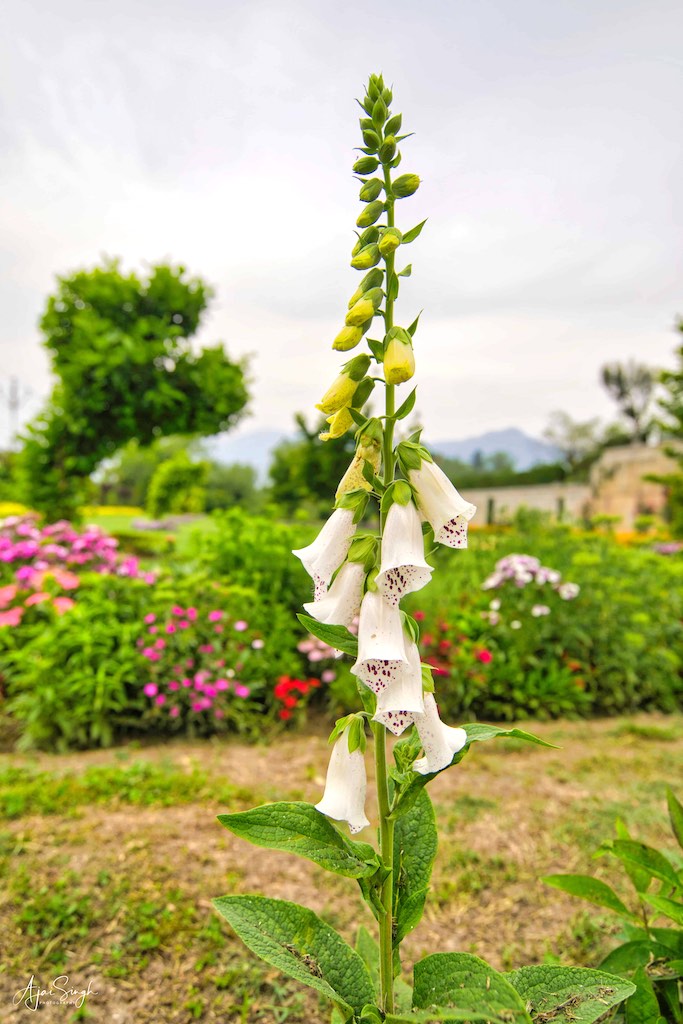
Beautiful flowers everywhere
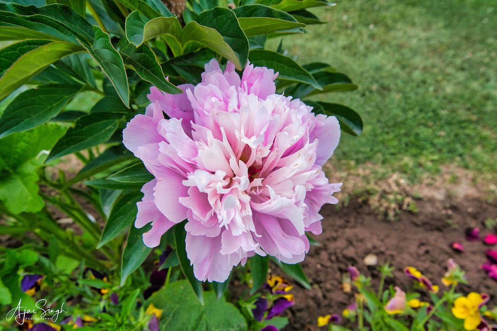
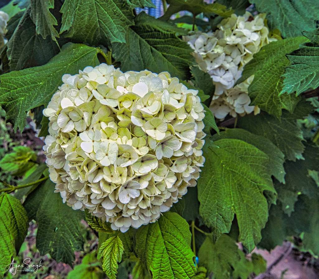
.
The gardens were well maintained and the gardens were full of tourists. One could see a large variety of flowers, some quite unique, blooming in the flower beds lining the canals.
.
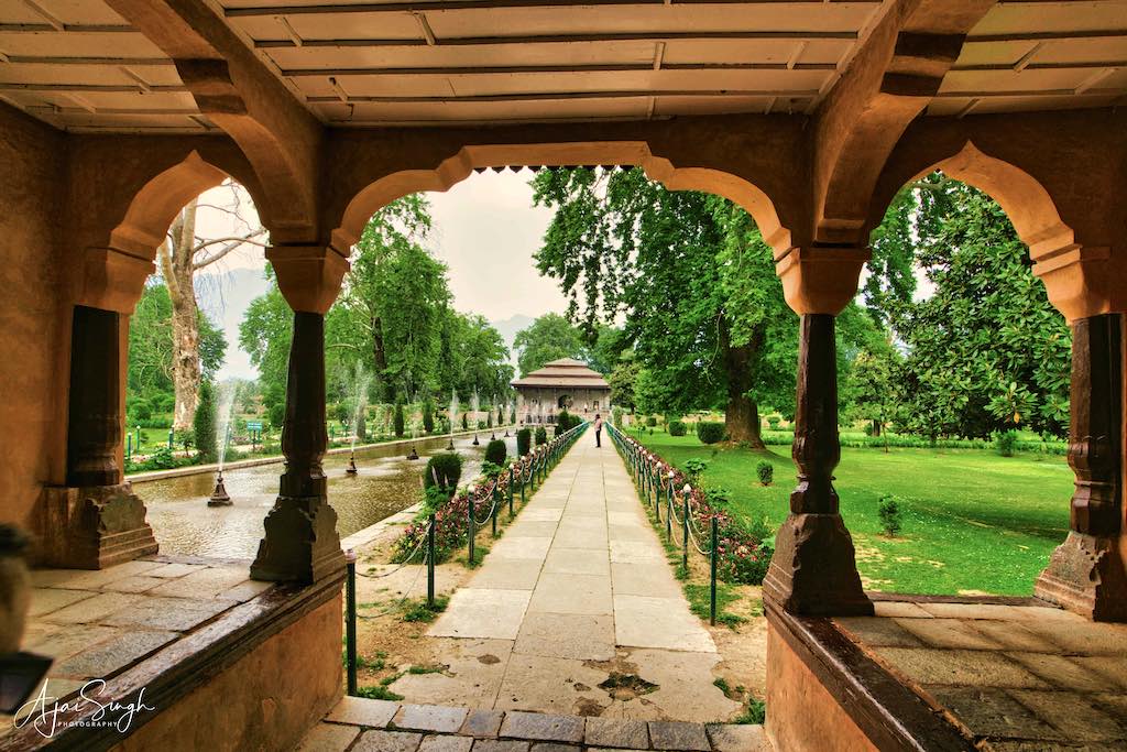
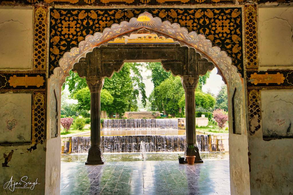
.
Tulip Garden
.
The next destination was the only tulip garden in India, the Indira Gandhi Memorial Tulip Garden, which is the largest tulip garden in Asia, spread over an area of about 74 acres. It is situated at the base of the Zabarwan range, built on sloping ground in a terraced fashion consisting of seven terraces with an overview of the Dal Lake. The garden was opened in 2007 with the aim to boost floriculture and tourism. It was formerly known as Siraj Bagh. About 1.5 million tulip bulbs, in multiple colours, were brought from the Keukenhof tulip gardens of Amsterdam. Besides tulips, there are 46 varieties of flowers, which were also brought from Holland. The tulip garden is home to around 68 varieties of tulips.
.

.
During our visit, on account of the early setting-in of warmer temperatures, the flowers had withered away and one could only see the rows of green plants minus the colour. Even then, the large area covered by the flower beds at the base of the mountains gave a majestic look.
.
Day 3
.
Gulmarg
.

.
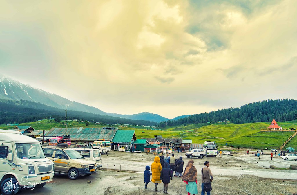
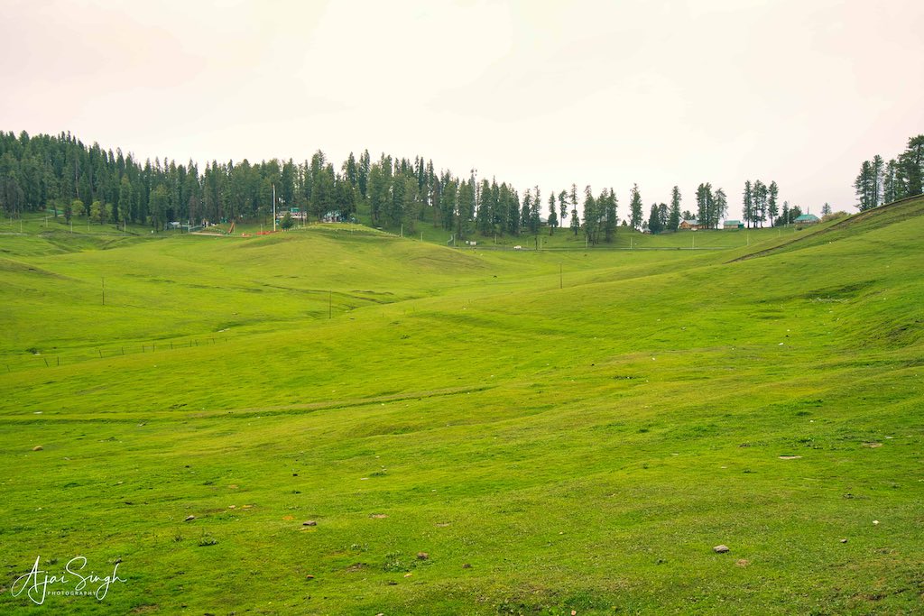
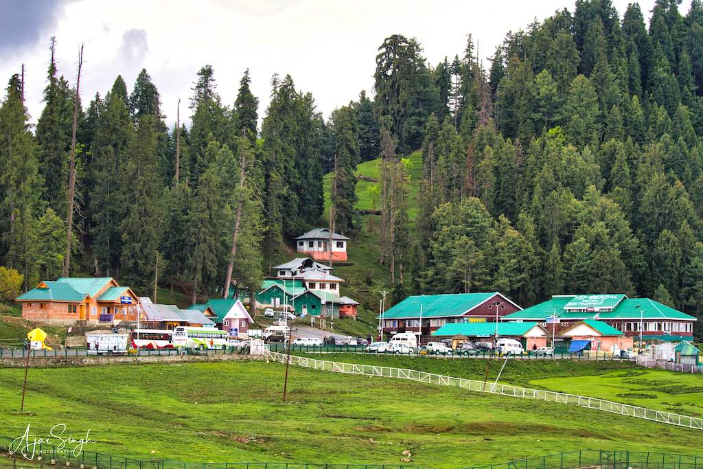
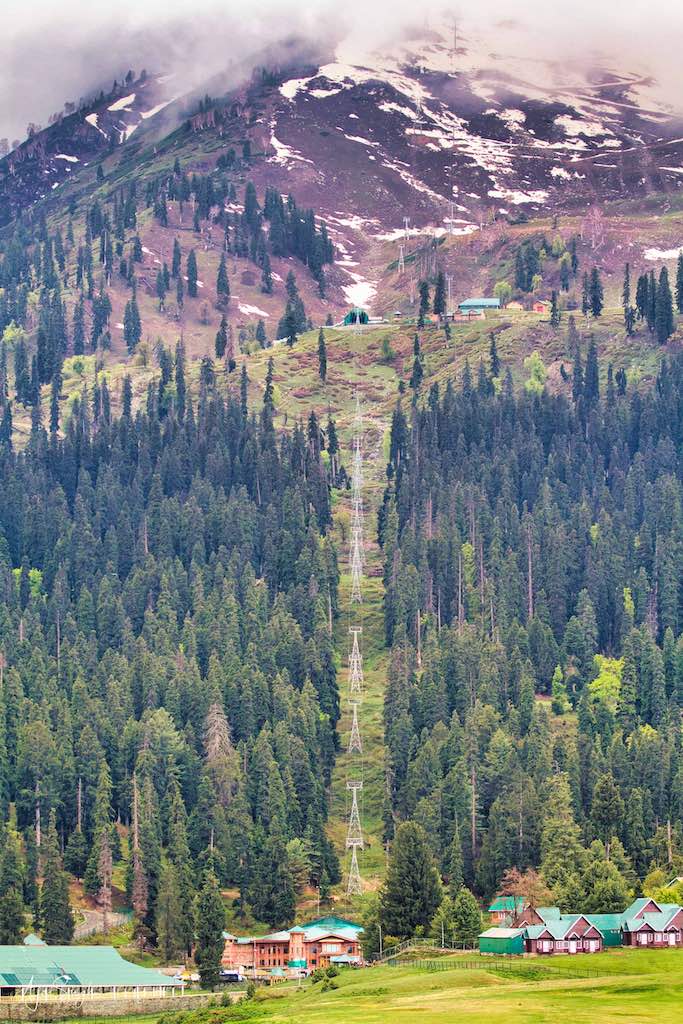
The next day we traveled to Gulmarg (meadow of flowers), a hill station and popular skiing destination in the Baramulla district. Originally called Gauri Marg (meaning “the path of Devi Gauri”), its name was changed to ‘Gulmarg’ in the 1500s by Yousuf Shah of the Chak dynasty. It is at an altitude of 8,694 ft, 56 km from Srinagar. The Gulmarg Gondola is a two-stage ropeway and is one of the highest in the world reaching an altitude of 3,979 metres.
.

.
In the 19th century, British civil servants started using Gulmarg as a retreat to escape the summers of the North Indian plains. Hunting and golfing were their favorite pastimes and three golf courses were established in Gulmarg including one exclusively for women.
.
.
The journey from Srinagar is along picturesque surroundings, initially the verdant green paddy fields and later the winding road climbs through dense jungles to the hill station. It was drizzling most of the way and added to the mystical surrounding we passed through. Gulmarg was covered in fog when we reached, with freezing winds, making everyone rush to the tents where warm clothing and high rubber boots could be hired to walk in the slushy meadows. Second-hand jackets were also on sale, with their price nearly at par with the hire charges. I went in for the purchase, as the jacket would also be required later during our travels. It proved to be a good decision and kept me warm and cozy throughout the trip.
.

.
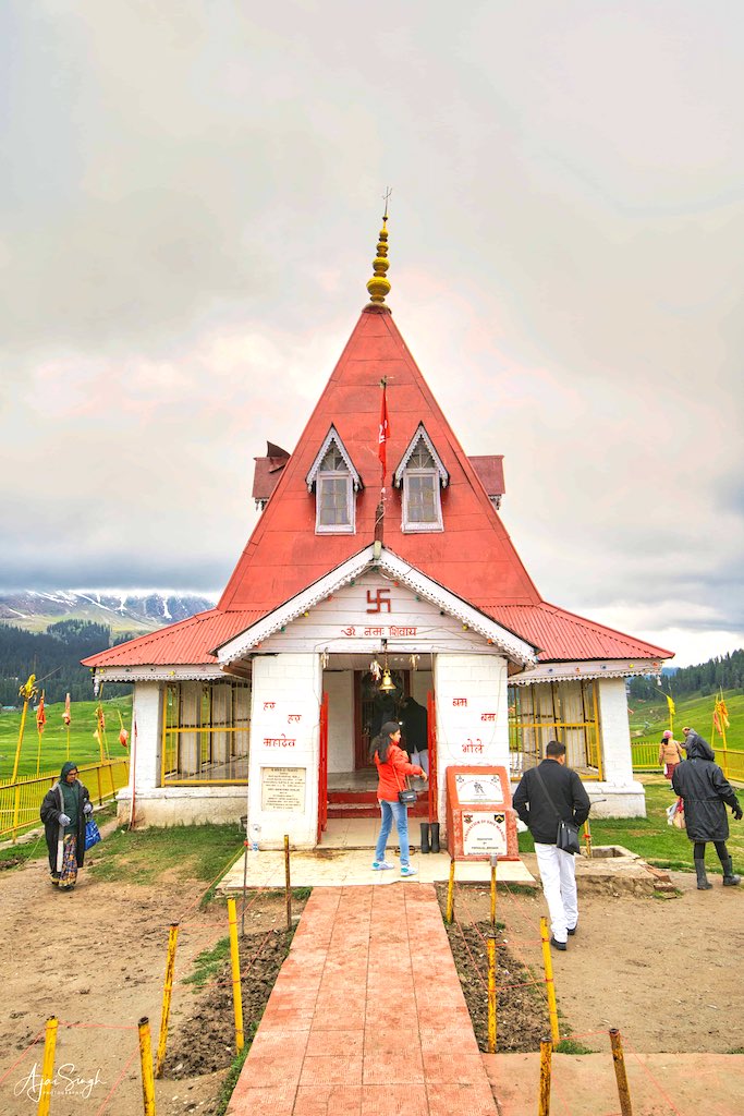
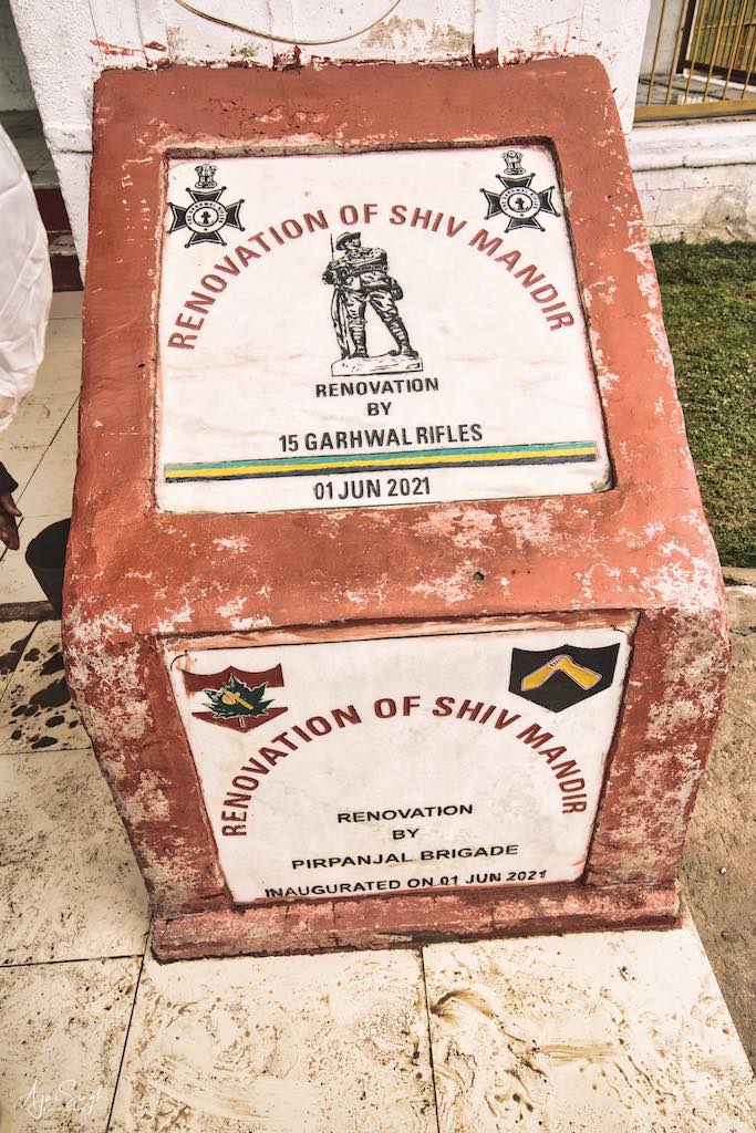
The existing Shiva Mandir, or Maharani temple, was the site of an ancient temple dedicated to Shiva and Parvati. The temple was demolished during Islamist invasions. But Hindus continued visiting the tirtha and it was not forgotten. In 1915, Dogra king Maharaja Hari Singh built a new temple at that spot for his wife Maharani Mohini Bai Sisodia. It was then known as Maharani Temple (commonly known as Shiv Temple of Gulmarg). This temple was the royal deity of the Dogra kings and is situated on a slight hilltop with greenery and it is visible from all corners of Gulmarg.
.

.
As with many temples in Kashmir, the temple was locked, with no pujari available to cater to the demands of the temple and devotees who came to offer prayers. The temple, like many others we later visited, was looked after by the Army and they provided a soldier who carried out the duties of a pujari, whenever he could be present. The Shiva Linga has the figure of a nag sculpted in the front, a unique feature of the temple.
.
.
To read more about the history of the Gulmarg, read my blog Kashmir – The Land of Rishis: Part 2 – History.
.
Day 4
.
Kheer Bhawani Temple
.

.
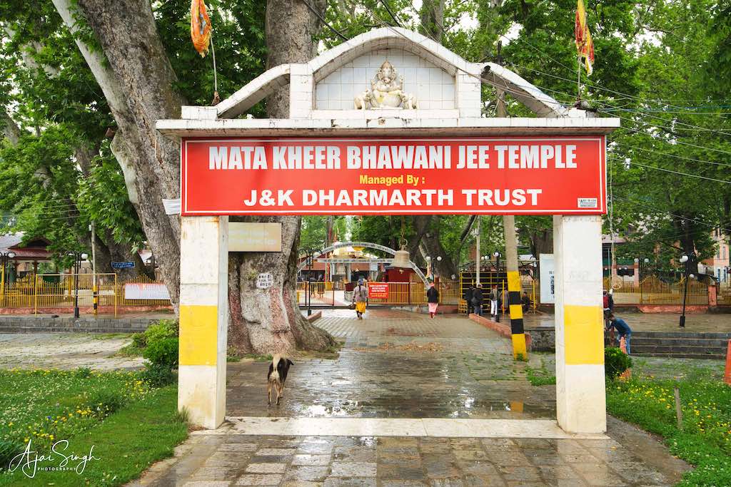
Day 4 promised to be a busy day, with a number of visits planned. The first was to the ancient Kheer Bhawani (Ksheer Bhawani or the Ragnya Devi) temple situated 25 kilometers north-east of Srinagar in the village of Tulmul in Ganderbal [the original Sanskrit name was Gandharapura – ‘the place of Gandhara’ (Brahmins)]. It is dedicated to Kheer Bhavani and is constructed over a sacred spring. As is the custom, the devi has many names including Ragyna or Rajna, along with variations in honorifics such as devi, mata, or bhagavati. The term kheer refers to a milk and rice pudding that is offered to propitiate her. Kheer Bhawani, an incarnation of Durga, is sometimes translated as ‘Milk Goddess’. The worship of Kheer Bhawani is universal among the Hindus of Kashmir, most of them who worship her as their protective patron deity (Kuladevi).
.
.
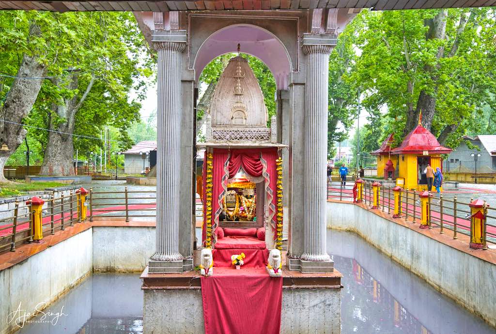
The temple is one of the most important temples for Kashmiri Pandits. The resident deity, Kheer Bhawani, is a favourite in this region. A heptagonal spring at the temple surrounds the devi. The holy spring is known to change its colour with various hues of red, pink, orange, green, blue, and white. A black/red or dark shade of the spring water is considered inauspicious. There have been numerous instances on record, when a dark colour presaged bad times, like before the 1965 Indo-Pakistan War, the 1999 Kargil War, the Kashmiri Pundit genocide in 1990, etc.
.

.
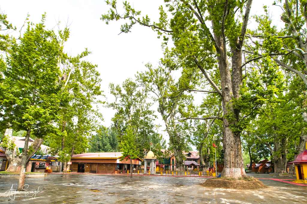
The temple has a strong contingent of security forces guarding it and the whole complex is well-barricaded. The temple itself is part of a large forested area, comprising massive Chinar trees which provide a peaceful and meditative environment. The spring water in the kund was whitish in colour when we visited. The prasad given to the devotees was kheer, as expected. The visit was exhilarating for all of us, and one could sense the ‘presence’ during the time we spent there. Since there were hardly any other devotees present, we had the luxury of carrying out our prayers without any hurry. Ganderbal was once a highly militance-affected area and I remember during my previous visit in 2018, while passing the area we had been warned to be careful as firing could be expected anytime!
.

.
Maharaja Pratap Singh of Jammu and Kashmir built the present temple in 1912, and Maharaja Hari Singh further renovated it. There are other temples to Kheer Bhawani in the region, such as Mata Kheer Bhawani Temple at Tikker, Kupwara, which has been renovated by the Indian Army.
.
.
A mela is held annually in May-June, on the occasion of Jesht Ashtami. It is one of the largest gatherings of Hindus in the region, after the Amarnath pilgrimage. An annual festival is also celebrated on the occasion of Shukla Paksha Ashtami. On this particular day, the spring changes colour and devotees observe a fast and gather at the temple to pay homage to the Devi.
To read more about the history of the Kheer Bhawani Temple, read my blog Kashmir – The Land of Rishis: Part 2 – History.
.
Ancient Temple at Manasbal
.
.
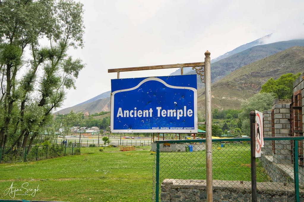
The Wullar-Manasbal Development Authority has unearthed an ancient temple on the eastern shore of the Manasbal Lake, built in the traditional architectural style of ancient Kashmir. The lower half of the temple, which was buried, was found during the restoration works undertaken for the lake. The temple is dated to 800-900 CE during the rule of Avantivarman or Sankaravarman, the founder of the Utpala dynasty, based on epigraphic writings. Presently, it is partially submerged. Constructed using local grey stone, the temple has a unique double pyramid-shaped roof with a triangular pediment on the western side with Corinthian or floral motifs. The cornice of the lower roof and the horizontal band that divides it from the upper story are decorated with a series of dentils and metopes. It is stated to be a new pilgrimage attraction for pilgrims who visit the cave shrine at Amarnath and the Kheer Bhawani temple at Tulmulla in Ganderbal district.
.

.
The temple appeared to be well maintained, though barricaded and locked. After a few inquiries, the person with the keys appeared and we could enter. Since the temple spire was in the center of a pond, one would only see it from a distance. The question which came to mind was that when the temple was discovered and partially excavated, why was not the whole structure exposed? This would have also brought to light the murtis and other sculptures at the lower levels of the temple.
.

.
Manasbal Lake
.
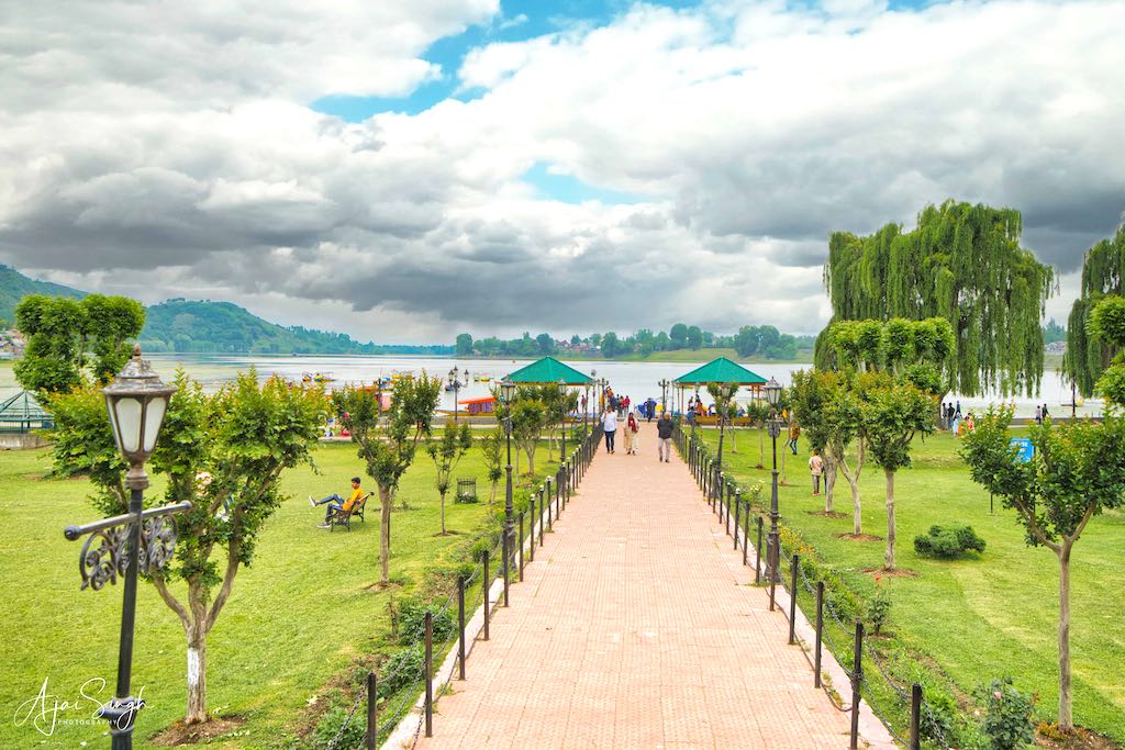
Adjacent to the temple, was the Manasbal Lake, a freshwater lake located in Safapora area of Ganderbal District, 30 km from Srinagar. The name Manasbal is said to be a derivative of Manasarovar. The lake is encircled by four villages viz., Jarokbal, Kondabal, Nesbal, and Gratbal. The large growth of lotus (Nelumbo nucifera) at the periphery of the lake (which blooms during July and August) adds to the beauty of the clear waters of the lake. The Mughal garden, called the Jaroka Bagh, (meaning bay window) built by Nur Jahan overlooks the lake. Manasbal Lake has been given the epithet of the “Supreme Gem of Kashmir Lakes”.
.
.
The lake is a good place for birdwatching as it is one of the largest natural stamping grounds for aquatic birds in Kashmir. The rootstocks of the lotus plant which grows extensively in the lake are harvested and form the mainstay of many local delicacies.
.
.
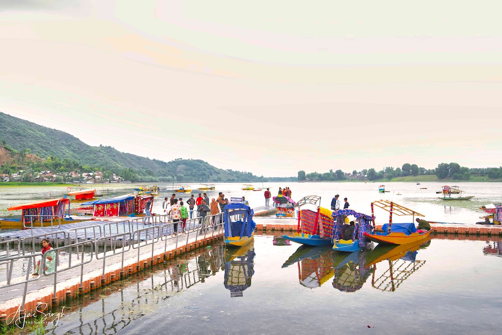
Close to the northern shore of the lake are the ruins of a 17th-century fort, called the Jharokha Bagh, built by the Mughals, which was used by caravans traveling from Punjab to Srinagar. Along the course of the Jhelum River, the Manasbal Lake falls under the third series of high-altitude lakes of the Himalayas. It is stated to be the deepest lake (at 13 m or 43 ft depth) in J&K.
.

.
The Jaroka Bagh was another of the beautifully manicured gardens we visited during our tour. The makeshift jetty catered to the shikaras who took visitors for a ride on the lake. Being located slightly off the main tourist route, the crowds in the gardens were mostly locals who were out on a picnic with their families.
.
Naranag Temples
.
.
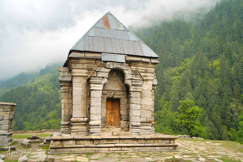
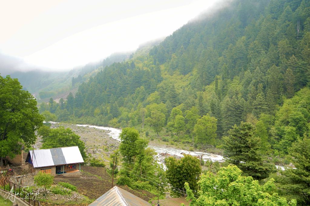
The next destination was a considerable distance, towards the eastern part of Kashmir. The later part of the journey was driving up narrow mountain roads, though the condition of the road was good even in this remote place. Naranag or (Nara Nag) is a picturesque hamlet in the Wangat Valley and an ancient pilgrimage site in Ganderbal district. Well known for its ancient but pillaged temple ruins complex, it is located around 8 km from Kangan, on the Srinagar-Leh highway, and 6 km upstream from the Sindhu River. Noted for its scenic meadows, lakes, and mountains, at 2,128 m altitude, Naranag serves as the base camp for trekking to the Mount Haramukh 16,870 ft (5,142 meters), Gangabal and Satsar (seven) Lakes. The village lies on the left bank of the Wangath River, which is a tributary of the Sindhu River. The village has been founded by Gujjars from Gujarat, who migrated to the foothills of the Himalayas.
.
.
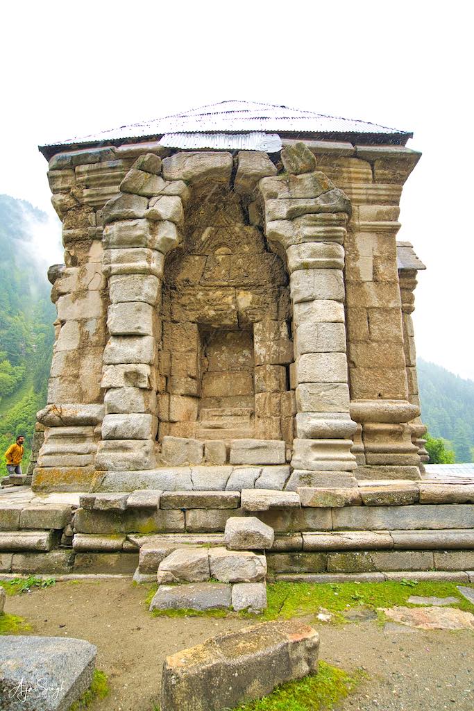
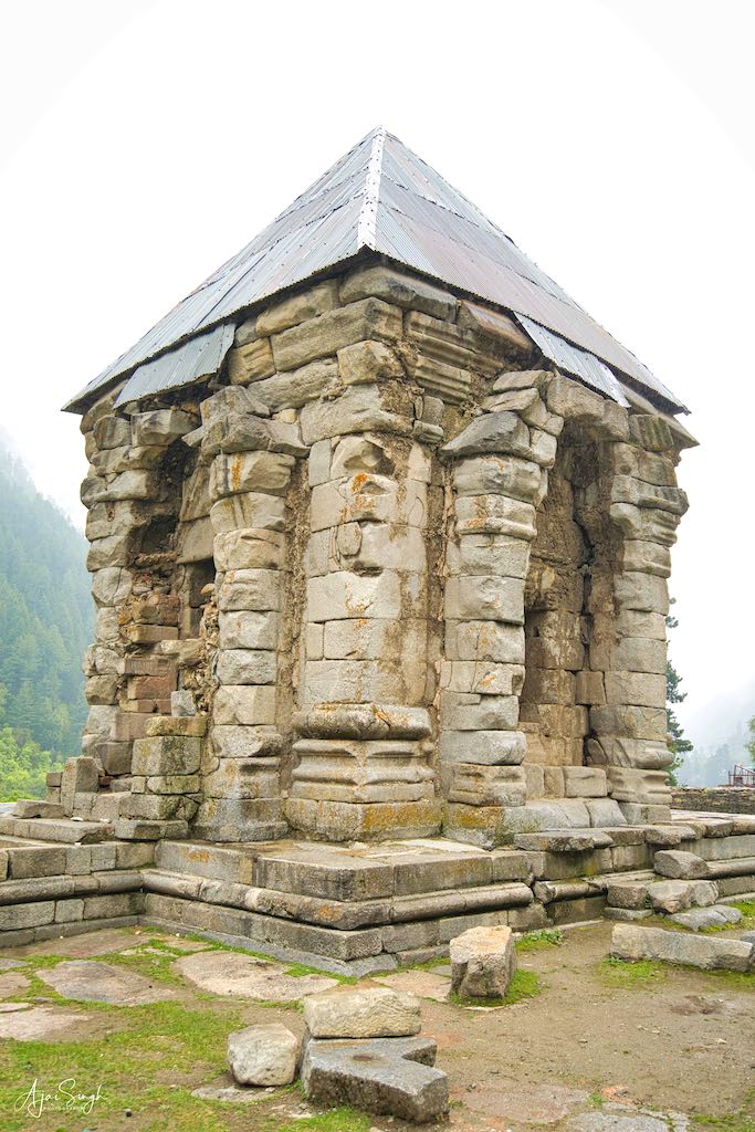
The Naranag temples are the main attraction for tourists. It is also known in texts as the Wangath Temple complex and is one of the important archaeological sites of the country. The site consists of a cluster of temples facing each other at a distance of about 200 meters. The temple is dedicated to Shiva and was built by Emperor Lalitaditya Muktapida, of the Kayastha Karkota Naga Dynasty in the 8th century CE.
.
.
The temples are under the protection of the Archaeological Survey of India and are surrounded by an enclosure. This, however, has not stopped encroachments from taking place and the site being used as a thoroughfare by locals and their donkeys/ponies. W Bishop Crowie and Major Cole have identified the ruins of seventeen temple structures of various ages and dimensions in Buthser (Naranag) in two distinct groups: the first on the western side and the second on the eastern side. Each group is enclosed by a separate stone wall, and lies a short distance from one another. The temple complex is located along the Kanka nadi or the Kanaknai and is constructed of local grey granite. Between the two groups of temples stand a number of structures of a third group, the Mathas.
.

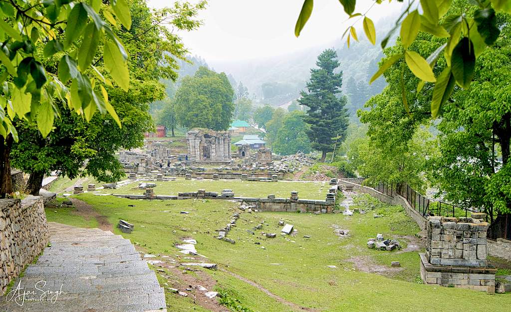
.
The Western Complex: As you enter the temple complex from the village, you come to a group of six temples of the Western group. This temple complex is known as the Shiva-Jyeshthesa or Jyestharudra and is situated inside an enclosure. The main temple is partially standing, although the spire is missing and the structure is covered with tin sheets. The principal structure is a square of 25 feet externally and 17 feet internally, and has two entrances opposite each other, facing the northeast and southwest. In the centre of the floor is a square space that is unpaved, marking the site of the pedestal of the original deity. Internally, it has a domed ceiling. Externally, the roof is pyramidal. The temple is dedicated to Jyeshthesa or Shiva and has subsidiary temples surrounding it.
.
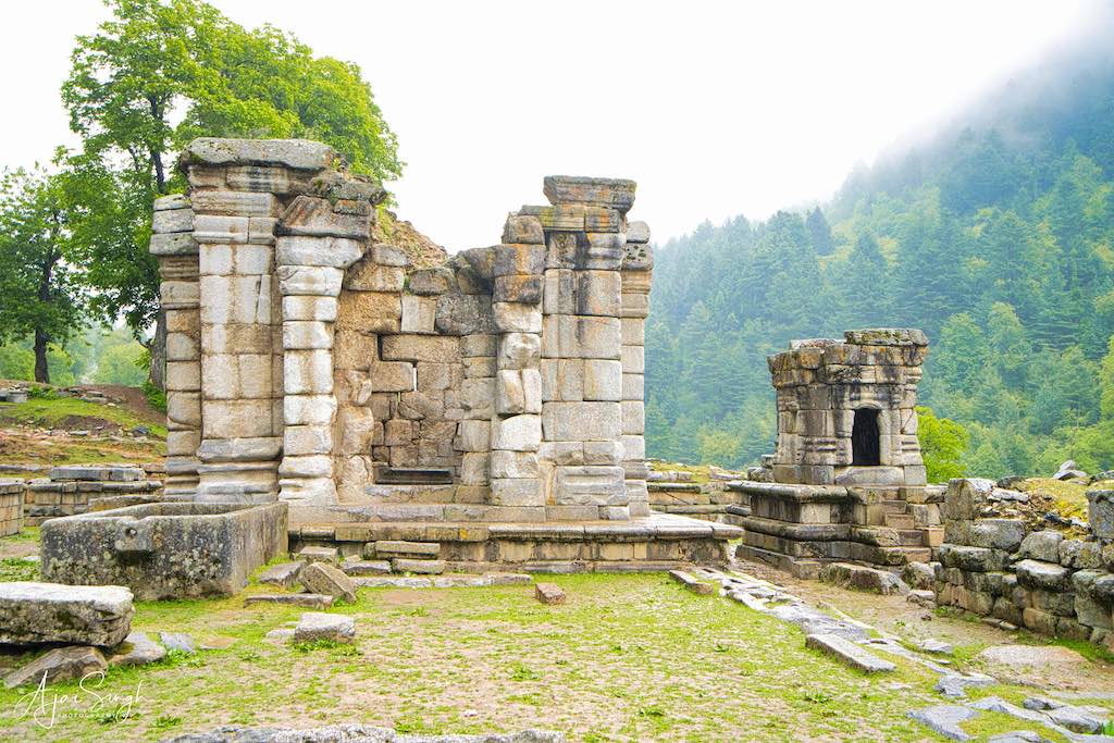
.
The Eastern Complex is the second group of temples, also enclosed inside a massive stone wall. The six temples in this complex are completely in ruins. The largest one is dedicated to Lord Buteshwara (again Shiva). The largest temple has a 17-foot square base internally, similar to the largest temple in the western complex, and has two entrances, each facing the rising and setting sun. The sanctum of the temple houses a huge Shiva Linga. There is also a plinth wall measuring 100 feet by 67 feet, and it would have housed a magnificent structure on it.
.
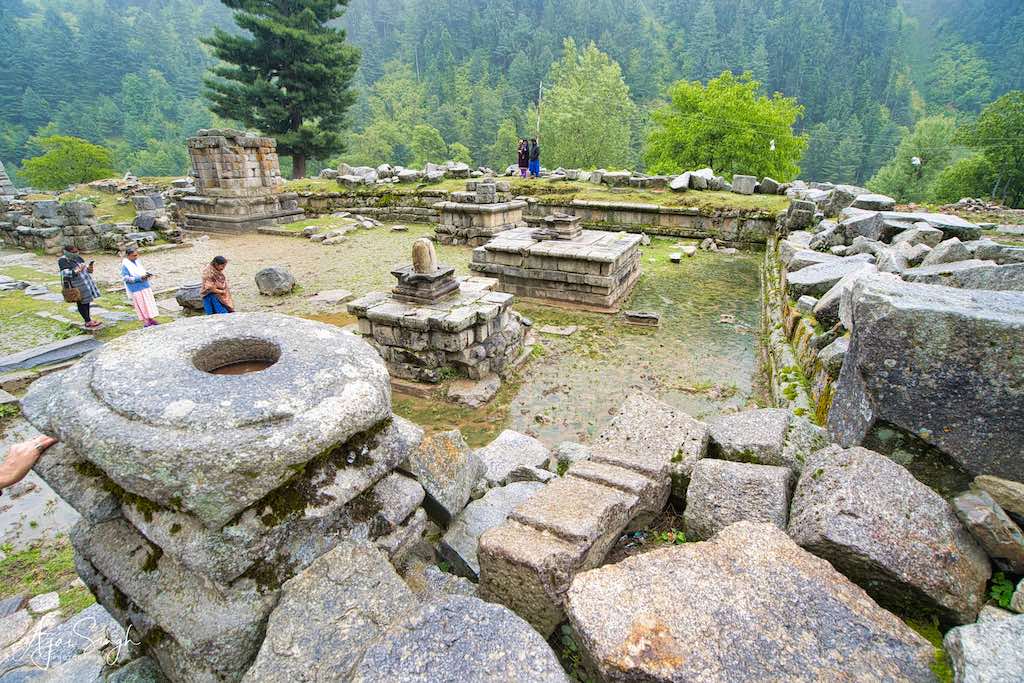
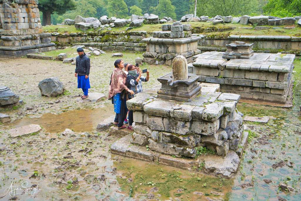
.
Between the eastern and the western group of temples lies the central pavilion which is completely in ruins. There are almost 30 monolithic bases that seemed to be a part of a pillared pavilion. All the temples in the complex are dedicated to various forms of Lord Shiva. An impressive 18 feet rectangular cistern, hammered out of a boulder, is nearby.
.
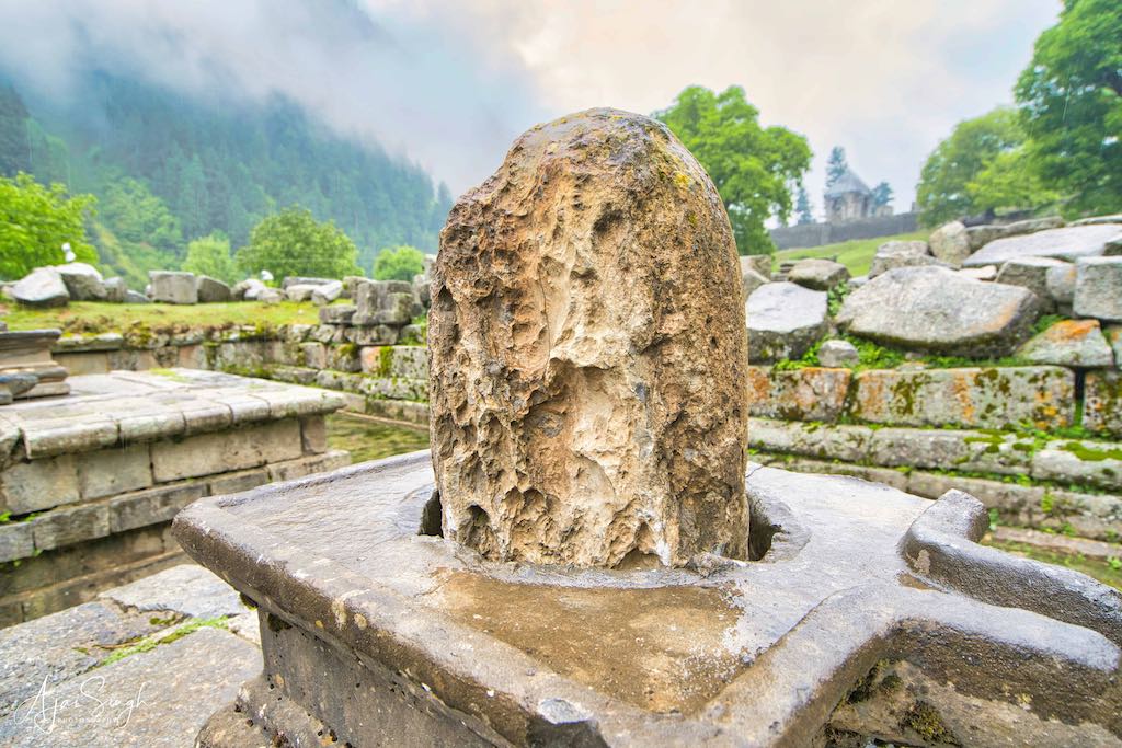
.
Its architecture reveals the art of the 8th century and follows the style of the temples of Bumzu, Awantipora, Parihaspur, Pattan, and Mattan. The government has only constructed walls to protect it from encroachments and nothing else has been done. It is now left in ruins of which only faint traces have survived. It is hoped that in the future the ASI takes up the restoration of the temples to restore the important archaeological site to its former glory, to the extent possible.
.
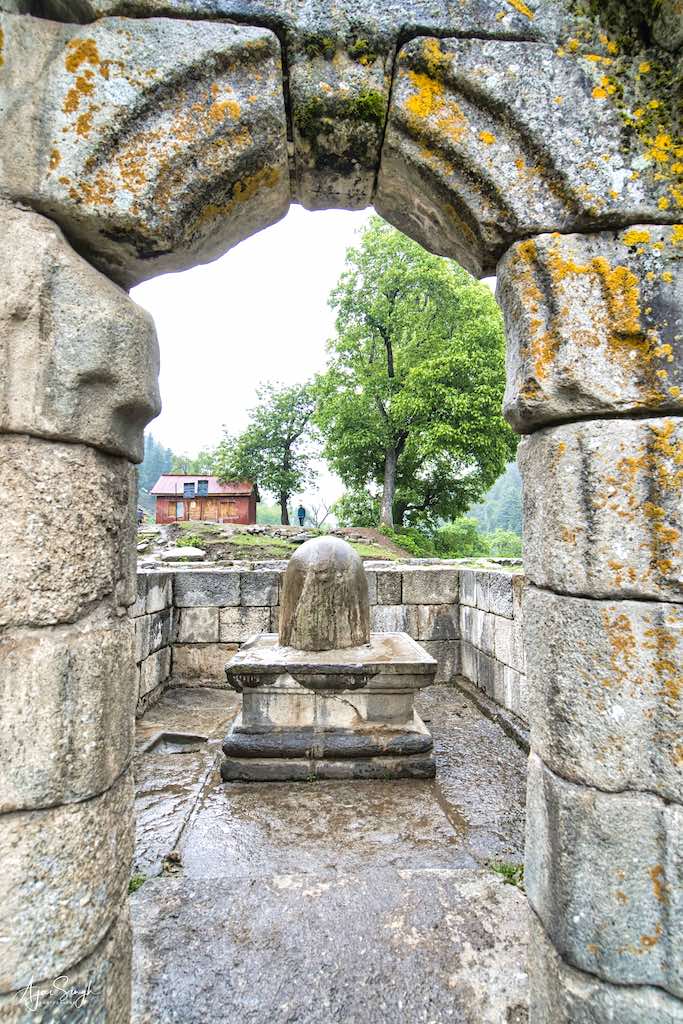

.
After the long drive to reach Naranag, the weather changed suddenly and it started drizzling soon after we started exploring the site. The light rain however did not deter us from going through the three groups of ruins, though it did restrict our movement due to water logging. The grandeur of the original temple complex seemed mind-boggling, keeping in mind the logistics involved in the transportation of craftsmen, labour, and construction material in ancient times, halfway up a mountain having no approaches, and keeping the work progressing through the years. But then, Lalitaditya was no ordinary emperor, and with the geographical extent of his exploits, I am sure he would be halfway across the world and back multiple times during the period the temple was being constructed!
.
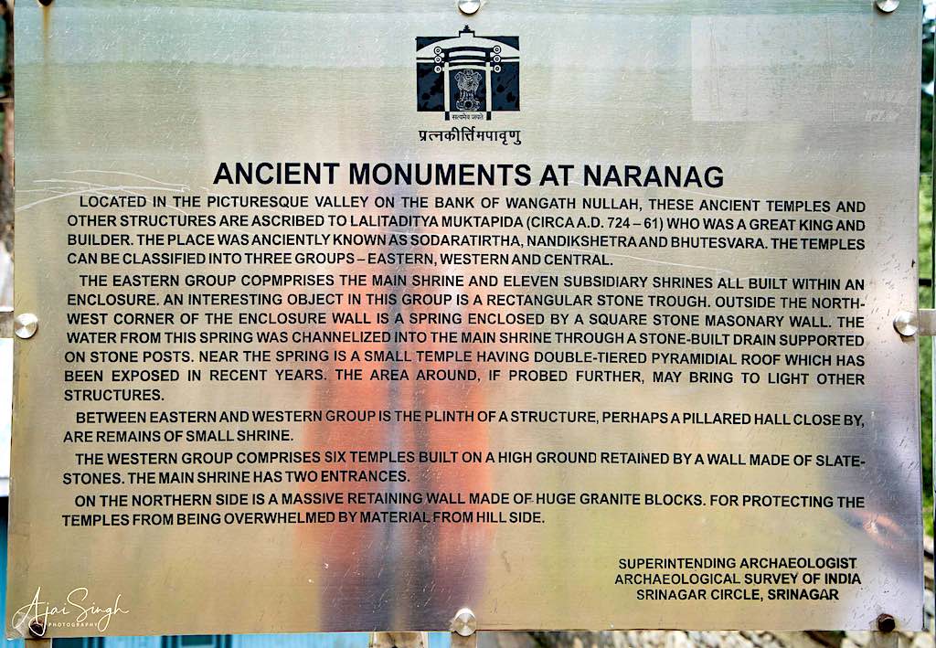
.
It was a long and tiring day by the time we reached back to our hotel in Srinagar after the long drive in the evening. It was also that last night we were to spend in that hotel.
.

To protect your personal data, your connection to YouTube has been blocked.
Click on Load video to unblock YouTube.
By loading the video you accept the privacy policy of YouTube.
More information about YouTube’s privacy policy can be found here Google – Privacy & Terms.
.
To read more about the history of the Naranag Temples, read my blog Kashmir – The Land of Rishis: Part 2 – History.
.
Day 5
.
Mata Bhadrakali Temple Handwara
.
.
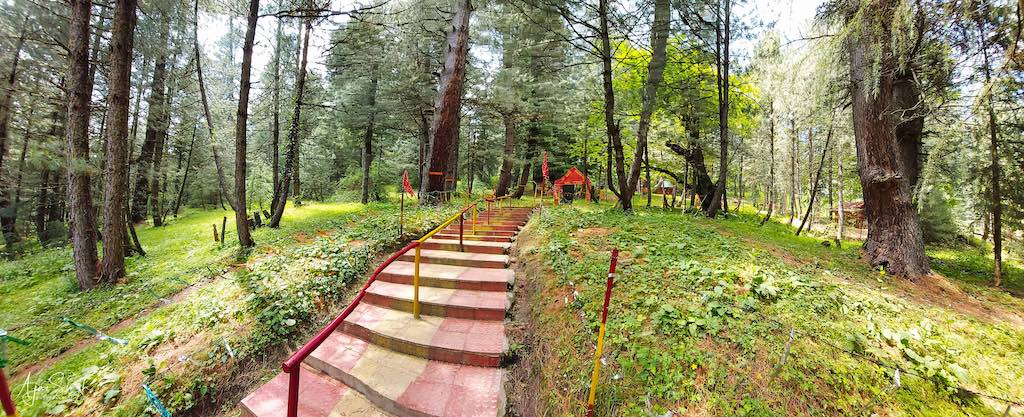
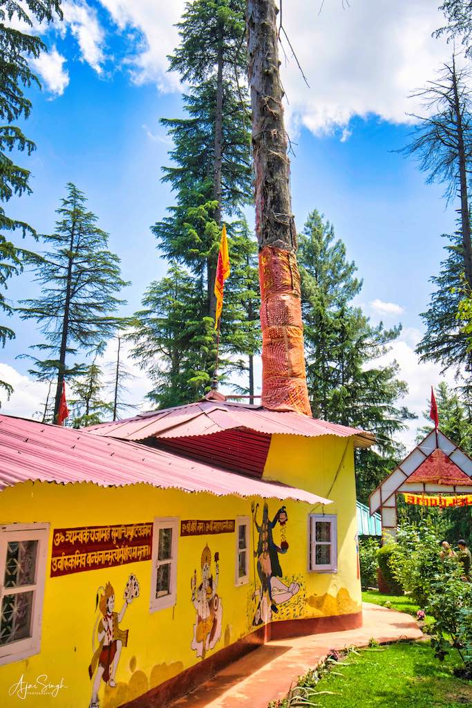
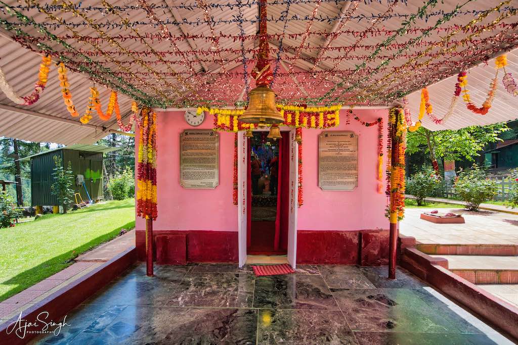
I had to get up early as we had to pack our luggage and vacate the hotel room before we left that morning. And another long day awaited us with a packed itinerary. We were to travel to the remote north-western part of Kashmir, a place out of the regular tourist route, and where outsiders rarely ventured – the terrorism-affected region of Handwara. Mata Bhadrakali Temple is situated on a hilltop inside a thick coniferous deodar forest about 8 km from Handwara and 4 km from Wadipora in District Kupwara. The ancient temple has been worshiped for millennia. Mata Bhadrakali, also called Siddhidhatri, is worshiped in Kashmir from the period of Nagas and Saraswat Brahmins as mentioned in Nilamat Puran. Shaivite Scholar Abhinav Gupt (933-1015 CE) was an ardent devotee of Mata Bhadrakali. Sir MA Stein, who stayed in Kashmir from 1843-1888 CE, made a mention of Mata Bhadrakali Asthapan. He recorded Bhadrakali Tirtha as a small village about 4 miles South-East of Kramhar marked by a spring and old linga which confirm the antiquity of the Shila murti.
.

.
A Ganesh Kund, Rishi Muneshwar Asthapan and a Sadhu Niwas halfway up the path (stairs) en route to the temple existed. A big Yatri ground (Mata’s Angan) where infrastructure like Dharamshala, Keshav Ashram, Yagya Shalla, Kothars for Yatri Niwas, Langer block, and Tonga stand was also in existence. A stream (Bhadra Ganga) flows through the Asthapan land and seven springs called Sapt Rishi kunds were spread on the bank of Bhadra Ganga at different locations. The stream finally joins the bigger stream Talar coming from Zachaldara. Further, chinar, willows, mulberry, walnut, almonds, cherry, and forest trees existed in the Asthapan land as per Revenue records of 1968. The immovable property of the Asthapan was looted, damaged, or gutted in a fire during the period of militancy. Due to the suspension of pilgrimage after 1990, some of the Saptreshi kunds have either dried up or got eroded.
.

.
In 1993, all ancient Shila’s (murtis) were vandalized, the temple at the hilltop, dharmshalas, Hawan Kund, kuthars, Keshav Ashram, etc were burnt to ashes by the militants, thereby destroying the complete infrastructure of the Asthapan. The two pujaris were beheaded and their heads were thrown into the kund.
.

.
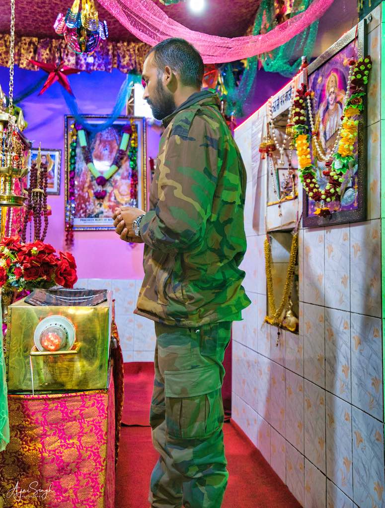
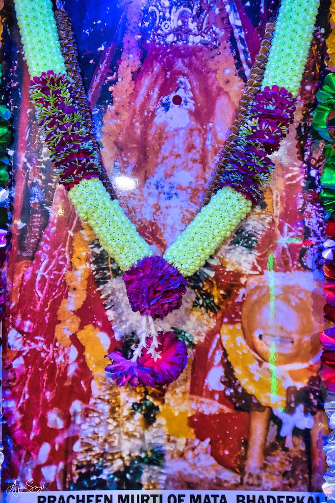
The destruction and desecration of the Asthapan and its assets by militants made the Army step in and take over its control after the migration of Pandits from the valley. The Army with the co-operation of President Sanatan Dharam Sabha Handwara Sh Bushan Lal Pandita and the local Administration (on the intervention of then Chief Secretary J&K Govt Sh SS Balouria) took up the reconstruction work of temple – Durga Kund, concrete stairs or footpath, Ganesh Kund, Rishi Muneshwar Asthapan and Dharamshala, and the Keshav Samadhi were built. Thereafter, from 2004 onwards the Army authorities encouraged the locals to recommence the traditional bi-annual hawans during both the Navratras. The first pilgrimage was conducted in 2004 under tight Army security from Jammu. These hawans continue, though the daily maintenance of the shrine remains with the Army detachment which maintains a tight security presence and has barricaded the complete area to prevent any untoward incident in this sensitive region. The astadhatu murti of Mata Bhadrakali was restored in the shrine after a period of 38 years on 18 March 2018 by Maj Gen AK Singh, GOC CIF (K), to great jubilation of the Kashmiri Hindu community.
.

.
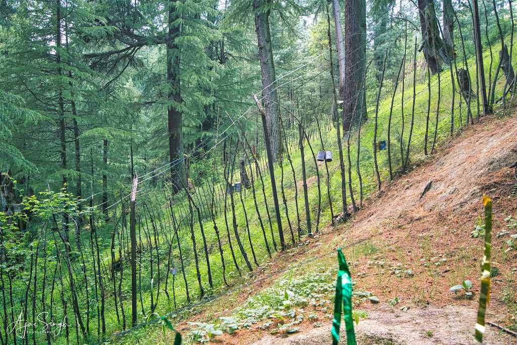
Our visit to this ancient shrine was one of the most enlightening of our trip. The otherwise peaceful and beautifully forested surroundings, with hardly any human habitation, brought in a meditative mood. The climb up the hill on the well-maintained stairs was comfortable with a few smaller temples, kunds, etc, along the way. The entrance was visible from a distance, gaily decorated with colourful buntings and shimmering streamers. As is usual in Kashmir, we were “greeted’ at the entrance by an armed Amy picket, who inquired about our antecedents. Another standard practice at all temples here was to enter the details of the devotees/visitors in a register, with mobile numbers, etc. The formalities were completed, and coming to know of my army background, we were escorted to a sitting area overlooking the forests, and a hot cup of tea and biscuits materialized in no time! The soldier performing the duties of the pujari explained the antiquity of the shrine and the history of the surrounding region. Including the desecration of the ancient murti and temple complex in 1993 and how the pujaris were slaughtered. There was a memorial built for them, and their photo was kept inside the shrine. The ancient shilas (murtis) were broken in 1993, their remnants had been placed behind the ashtdhatu murti, and we were shown the three pieces which remained, which formed a part of the base. Seeing the smashed pieces of our ancient heritage was a sad moment for everyone, and the solemn occasion appeared as if a close relative had departed from our midst. Being the only devotees in the temple, our group sang bhajans and at some point in time forgot that we had a packed itinerary ahead of us! The singing continued and one felt the energy of this revered spot, as the mantras wafted through the air.
.
.
When we were coming down the steps on our return, we crossed an army patrol returning from the forests, who had been on a search operation after getting intelligence about the presence of terrorists in the area. However, none were found, probably having slipped into the dense jungles. Another not-acknowledged reality of Kashmir.
.
To protect your personal data, your connection to YouTube has been blocked.
Click on Load video to unblock YouTube.
By loading the video you accept the privacy policy of YouTube.
More information about YouTube’s privacy policy can be found here Google – Privacy & Terms.
.
To read more about the history of the Mata Bhadrakali Temple, read my blog Kashmir – The Land of Rishis: Part 2 – History.
.
Shailputri Temple, Baramulla
.
.
From there it was another scenic drive through the forests and hills to Baramulla, our next destination. Baramulla was originally Varahamula in Sanskrit (‘the place of Varaha incarnation’). It was here that Satisaras (Parvati’s Lake in Sanskrit) was struck by Vishnu in his Varaha incarnation, creating an opening for the water to flow out of the lake. The water was drained through a deep valley between two hills at Sheeri Narvaw, which resembles the mouth of Varaha, the Boar. This Varaha Muh changed its identity to Varmul and it started to be called Varahamulla. The region of Baramulla or Varahmula is of immense historical significance. The town was established by King Bhimsina in 2306 BCE and has witnessed the visits of famous travelers. People like British Historian Moorcraft and Chinese traveler Hiuen Tsang have visited Baramulla and written about the place.
.

.
There were about 1200 Kashmiri Pandit families in Baramulla prior to the mass exodus and it was considered the second town in Kashmir Valley to have such a large population of Kashmir Pandits after Anantnag. All the families migrated to other parts of the country after the outbreak of militancy in the valley in 1990.
.

.
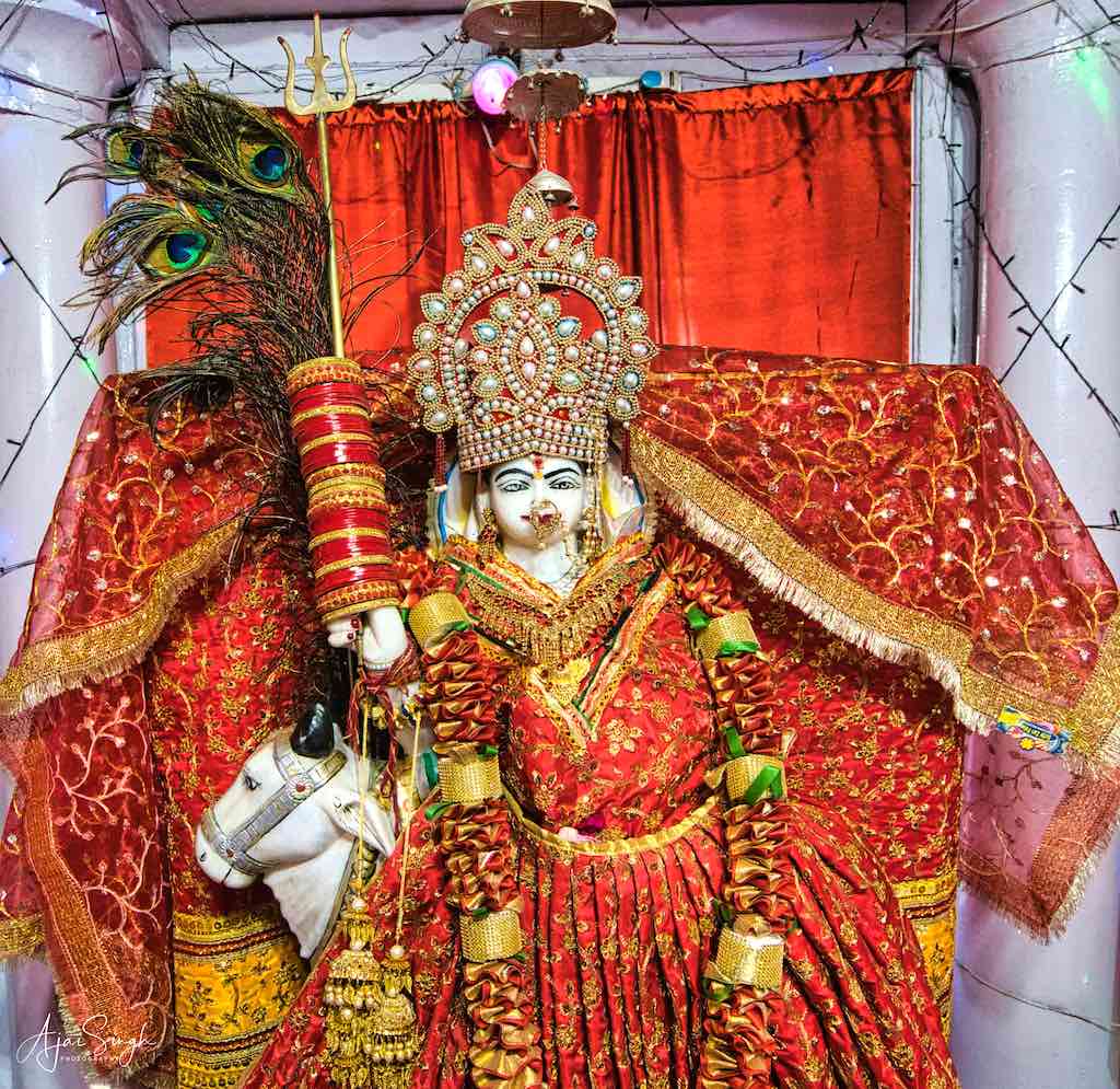
The shrine was burnt to ashes in October 1990. The main idol of the Shailputri riding on an ox was attacked and its arms and legs were axed. After the exodus of Hindus from the valley, the shrine remained without any care and started to wither from its pristine glory. However, the temple was again constructed by Rashtriya Rifles and re-opened on 28 November 1995.
.
.
The biggest congregation of devotees at the shrine takes place on Ram Navami.
It was around 3:00 pm by the time we reached Baramulla and we searched in vain to find a place where we could have lunch. In any case, no tourists reached here and the few restaurants in the town had shut for the afternoon. Finally, we found a run-down place, whose 3-member staff agreed to prepare basic chapatti and dal. The end result, as one can imagine, was hardly edible! A reminder that when traveling to such remote places, always carry packed food.
.
.
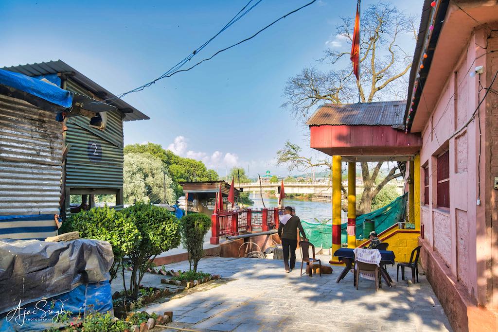
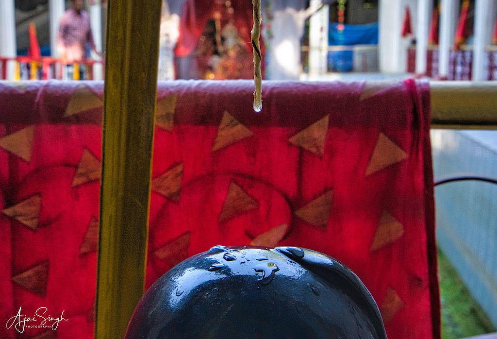
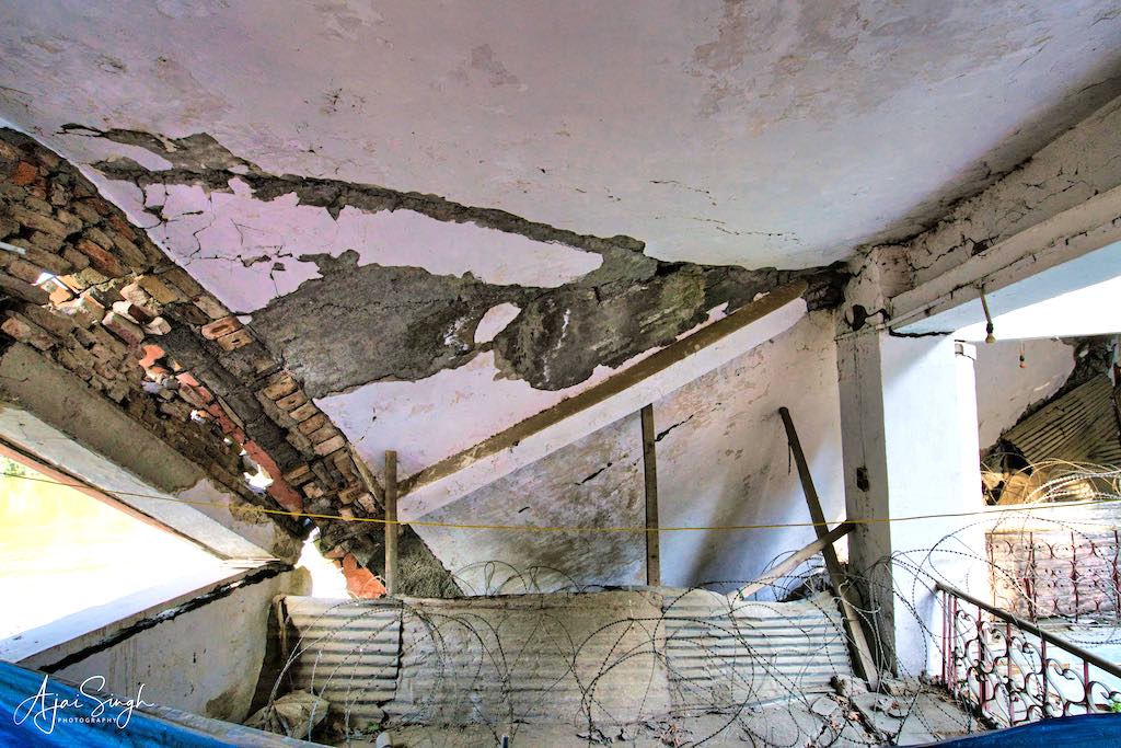
The main entrance of the shrine opened directly on the road. As usual, the temple premises was enclosed in heavy fencing, and entry gates were locked. There is a BSF contingent guarding the temple. Visitors have to shout to the sentry in the watchtower to check and open the gate. The beautiful temple is located on the banks of the Jhelum River and is surrounded by mighty Chinar trees, with walnut and poplar trees also growing in the premises, comprising about seven kanals of land. Within the premises is a holy spring, over which stands a marble shrine similar to the one at Kheer Bhawani, with a marble murti of Devi Shailputri facing south. The temple is 105 feet long and 47 feet wide and has space for circumambulation (parikrama). However, during our visit, the northern end of the temple roof collapsed due to the ground settling down in the direction of the river. Repair works were going on. There is a Dharamshala within the temple premises, which the security forces are occupying at present. There is a beautiful murti of the Devi, mounted on an ox in the central shrine which is supposed to be constructed over the holy spring. Unfortunately, the kund surrounding the shrine was dry, as apparently the spring had not been cleaned for long. A sad state regarding the maintenance of our ancient shrines.
.
.
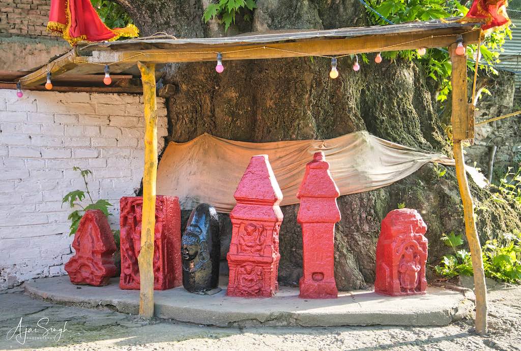
On the road opposite Shailputri Temple, there is a mountain called Bhairav Bal. A small temple has been constructed at its foothill near a Shila.
.
.
We performed puja and noticed that though the affairs were being managed by the security forces personnel, a young woman was helping in distributing prasad and in other activities. On being asked about herself, we learned that she was a local Kashmiri Pundit and her grandfather was one of the few who had stayed back during the Hindu exodus in the 1990s. A brave and courageous decision indeed!
.

.
To read more about the history of the Shailputri Temple, read my blog Kashmir – The Land of Rishis: Part 2 – History.
.
Koti Tirtha, Baramulla
.
.
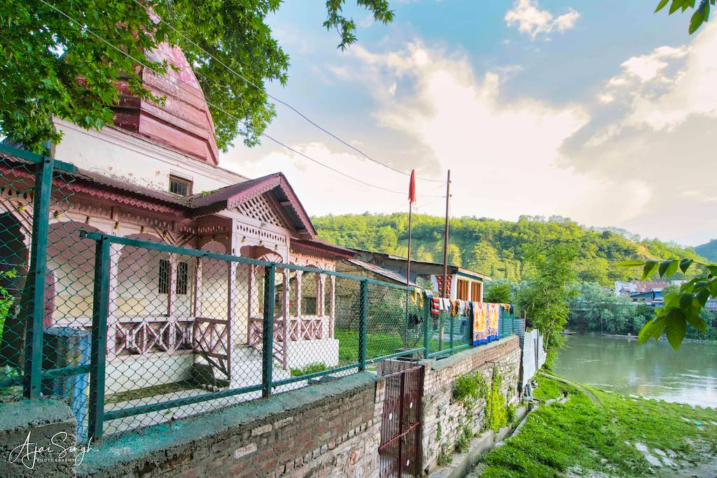
There is another story as to how Baramulla came to be known as Varahamulla. There was a shrine of Lord Vishnu here called Adi Varaha. The shrine was located on the eastern bank of Vitasta (Jhelum) near Koti tirtha. The name Varahamulla is also probably related to this shrine of Adi Varah, the Boar. It is held in great esteem since ancient times and has been repeatedly mentioned by Kalhana in Rajatarangini. The temple was vandalized by Afghan ruler Sikander Buthshikan. The ancient Shiv Linga and some stone images in Koti tirtha are said to belong to the shrine of Adi Varah.
.
.
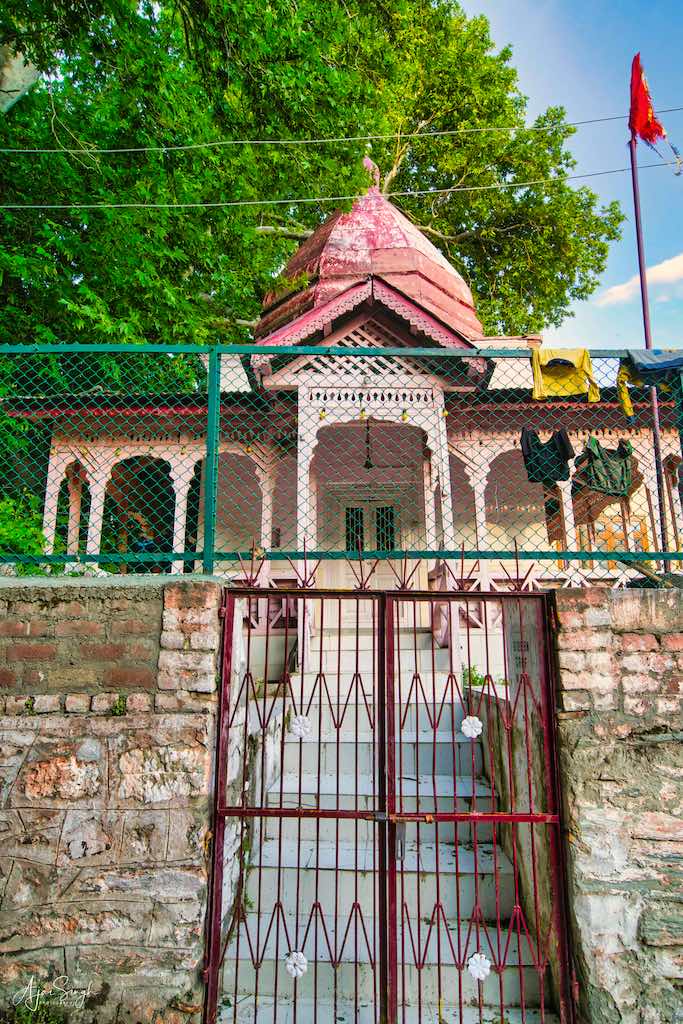
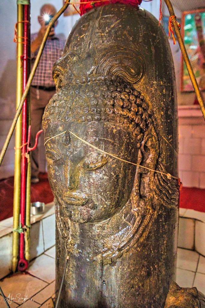
The importance of this shrine is described in Kotitirthamahatmya, a part of Bhringisha Samhita. Presently, the shrine is known for the Shiva temple, where inside the sanctum sanctorum stands a unique five feet Shivlinga with a face. The shrine has a dharamshala and a holy spring, Ganga Nour, the water flowing from “Gosain Teng” hill. The water of the holy spring is cold in summer and hot in winter. Presently, the dharamshala in the temple complex is occupied by CRPF, and maintenance of the complex is done by them.
.
.
The small by-lane leading down to the river can be easily missed, which we did. The pink-painted temple stood out in the desolate lane, the gate locked. After searching for the keys from the security forces’ detachment, we entered the premises. From looking at the state of the shrine, it was apparent that rarely did devotees reach here, and we were left to do puja by ourselves. Water was available outside and soon everyone was offering his salutations while pouring water on the Shivalinga. A round of mantras followed, and the unique Linga with Shiva’s face and hair was soon glistening in the flowing water, no doubt pleased with the devotion of our group. As in most temples, we visited which had no pujari present, agarbattis, dhoop, oil/ghee, matches, and even sandalwood were available. We used these and left more than enough in donations to cover the costs.
.
.
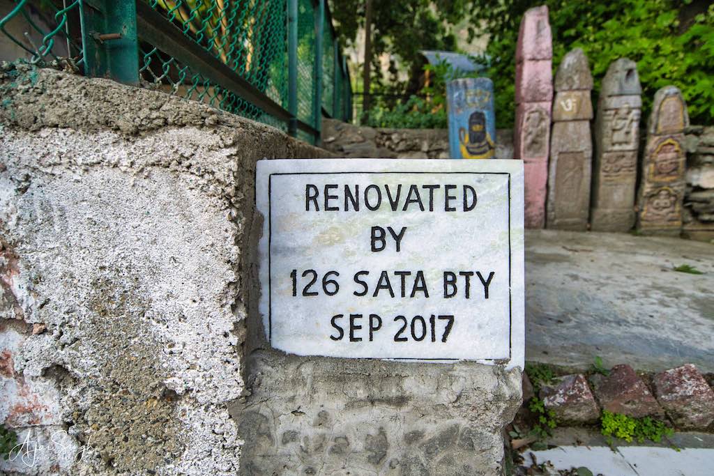
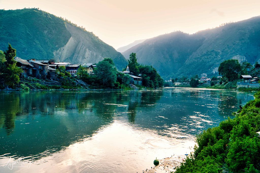
Adjacent to Koti tirtha, there is a ghat on river Vitasta called Koti Ghat. This place is used for the purpose of 10th day Kriya of the departed souls. The ashes of the dead were immersed in the Vitasta at Koti ghat. Adjacent to Kotighat is a cremation ground on five kanals of land. This place was held in great reverence and people came from all over north India here for performing the rites of the departed ones. The ghat was not maintained and undergrowth had started to cover the path and the steps.
.
.
Ganganor Prachin Temple, Baramulla
.
.
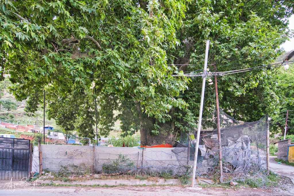
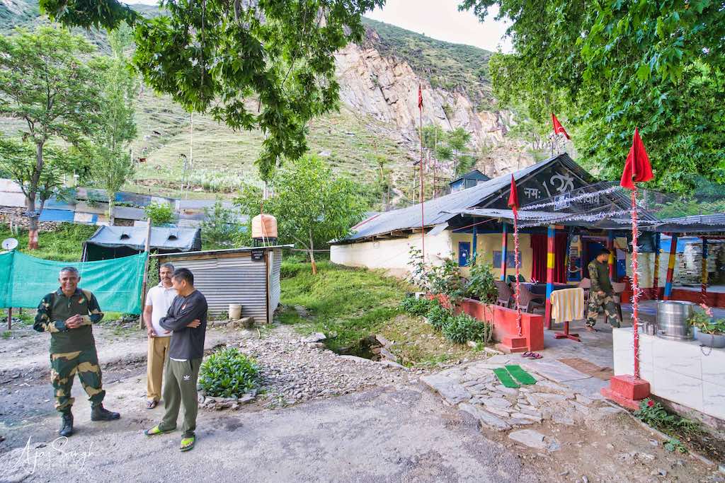
Near Koti tirath Shiv Mandir is one Asthapan known as “Ganga Nour”, or Ganganor in Mohalla Rajghat. It is also known as Gupt Ganga. The water flowing from “Gosain Teng” hill, a place on the top of the hill is cold in Summer and warm in Winter. At Gupt Ganga i.e. Ganga Nour, the water flows through the mountains and a small temple has been built on this sacred spring. This water channel then emerges at Koti Tirtha. It is said that the spring receives water from seven springs existing above at an elevation on the small hillock called Gousain Teng. There is also an ancient temple on this hill. Each spring has its name viz. Ram Kund, Sita Kund, Lakshman Kund, etc. Water from all the springs combines to form a brook and gathers at Ganga Nour. The temple at Gousain Teng is believed to be from Bhagwan Rama’s period and he performed a yagna at the place in Tretya Yug.
.
.
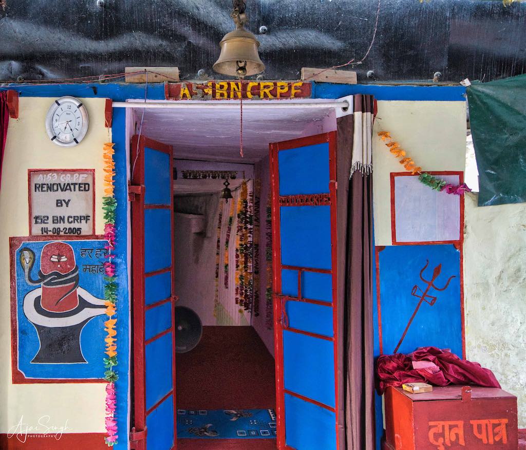
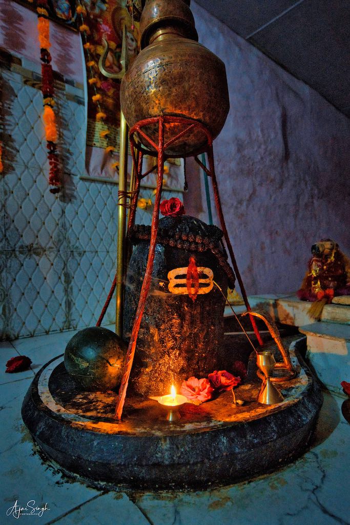
The orchard surrounding the temple was used earlier by sadhus coming for Amarnath Yatra for rest, as it provided spacious accommodation. The temple and orchard are again heavily barricaded and under the security of the CRPF. The gates of the compound are kept closed and opened only when a visitor’s identity is established. The holy spring is accessed by going down a few steps inside the small shrine. It is the place where many sadhus and holy people used to meditate in the old days. An ancient Shiva Linga is installed adjacent to the underground spring.
.
.
After offering our prayers at the shrine, it was late evening. We made a quick visit to the adjacent Chhatipadshahi Gurudwara (the 6th Sikh Guru had visited this place). The Gurudwara is between Koti Tirtha and Ganganor Spring. The striking thing I noticed is that both the temples are barricaded and guarded by the security forces, whereas there was not even a private security guard deployed at the Gurudwara! And while the temples were in a ramshackle condition, the Gurudwara was well maintained with beautiful gardens and large open spaces.
.
.
By the time we reached Srinagar, it was night. We headed straight to the Dal Lake, as tonight we were to stay in a houseboat. Though it was late to enjoy the sunset views on the Dal, we did manage to get a hearty meal before vanishing into our soft bed after a tiring day.
.
Day 6
.
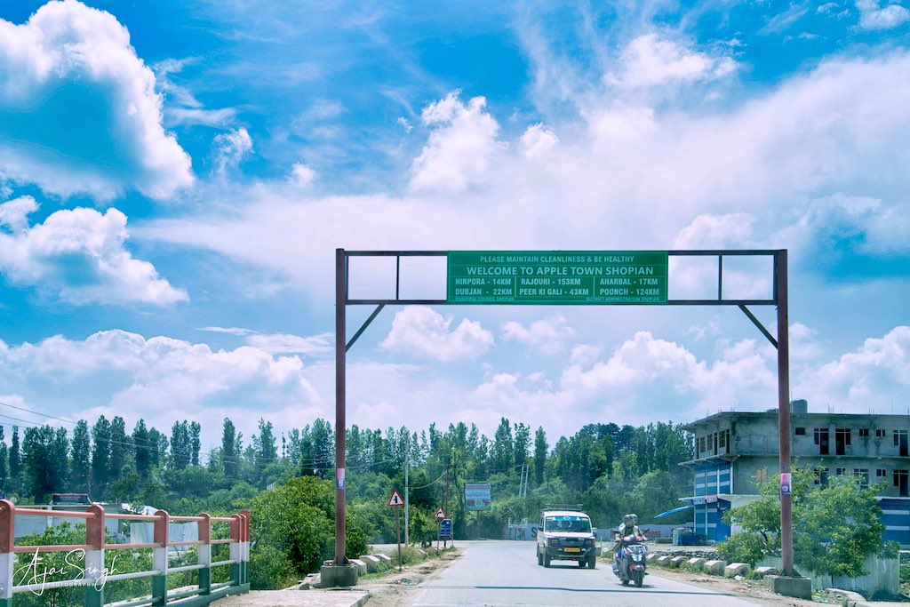
Today was another long day planned, with a visit to one of the remote and militancy-affected regions of Kashmir – Shopian. Normally a no-no for tourists due to the ever-present threat and consequently, no tourist operator will take the risk.
We were to visit the famous Martand Sun Temple on the way to Shopian. However, when we were approaching Mattan, the roads were barricaded and traffic to the temple was prohibited. We were informed that it being Shankaracharya Jayanti, a special Navgrah Ashtamangalam Pooja was being held at the Sun Temple, a first. And since the Lieutenant Governor was attending, all visitors were barred from the premises. It was disappointing news for us, as the temple was one of the most prominent sites in Kashmir. However, Vinod Pundit, our organizer promised that we would visit the place later, on our return from Pahalgam.
.
.
The drive to Shopian was again through beautiful apple and walnut orchards. Shopian is one of the apple baskets of Kashmir and had a big apple mandi. The villages and towns we drove through presented a picture of prosperity. This point I have already covered at the end of Part 1. The region definitely was affluent, down to the last man!
.
Kapaal Mochan Tirtha, Devigam, Shopian
.
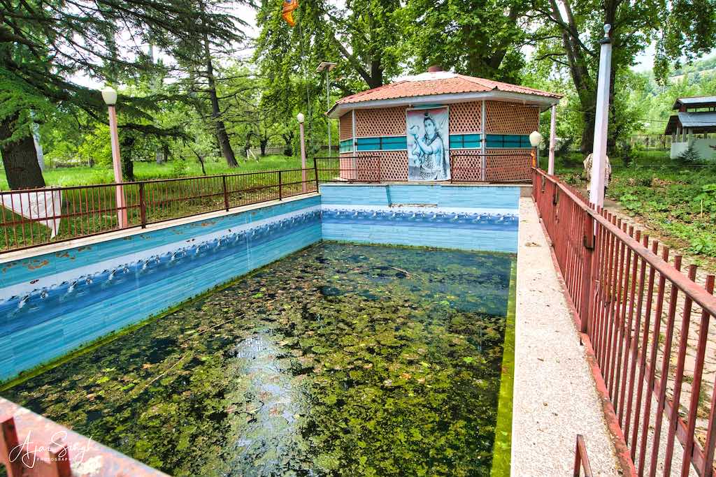
The valley of Kasmira with high mountain walls on all sides, is shaped like a basin. The lowest point in the valley is 5200 feet high above sea level and the lowest pass in the Pir Panjal range forming its outer boundary is 3000 feet above the level of the valley. The only outlet for the drainage of the water of the valley is the narrow rock gorge at Baramulla. Nearly half the area of this basin-shaped valley is occupied by the Karewas, which are flat-topped mounds composed of clay, loam, and slit with thin layers of greenish sand. Having a width from eight to sixteen miles along the southwest side of the valley and extending for a length of some fifty miles these Kare extend from Shopian to Baramulla. Sometimes they are cut into stripes but their flat tops and almost the same altitude indicate that once they must have formed one large plateau, later cut into isolated mounds by the streams descending from the mountains. One of the streams is called Rembyara in Shopian on whose banks Kapaal Mochan is situated.
.
.
In Nilamata Puran, it is mentioned that one is honored in the world of Vishnu by taking a bath at Narayanasthana, and similar merit is stated to accrue at Rembyara (Ramathirtha) at Supiyan (Shopian).
The tirtha is also where anyone who dies in an accident or children who die at an early age, their shradh is performed here and at one time people from across north India came here in such instances.
.
.
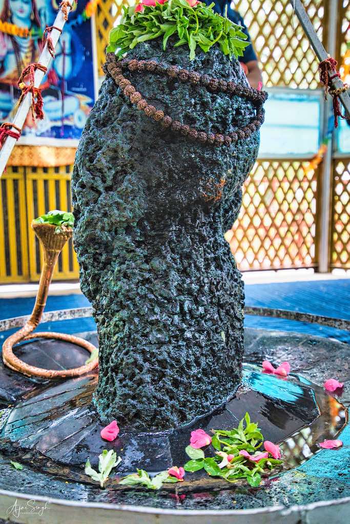
After the 1989-90 genocide and the exodus of Kashmiri Pundits from the valley, Kapaal Mochan became the target of terrorism. Two Dharmshalas there were burnt, and the temple of Kapaaleshwara was razed to the ground. But the unpardonable act on the part of terrorists was the sacrilege of the Linga and the Kund. The murti was broken and thrown into the spring. The spring was vandalized and other property of the tirtha was looted.
.
.
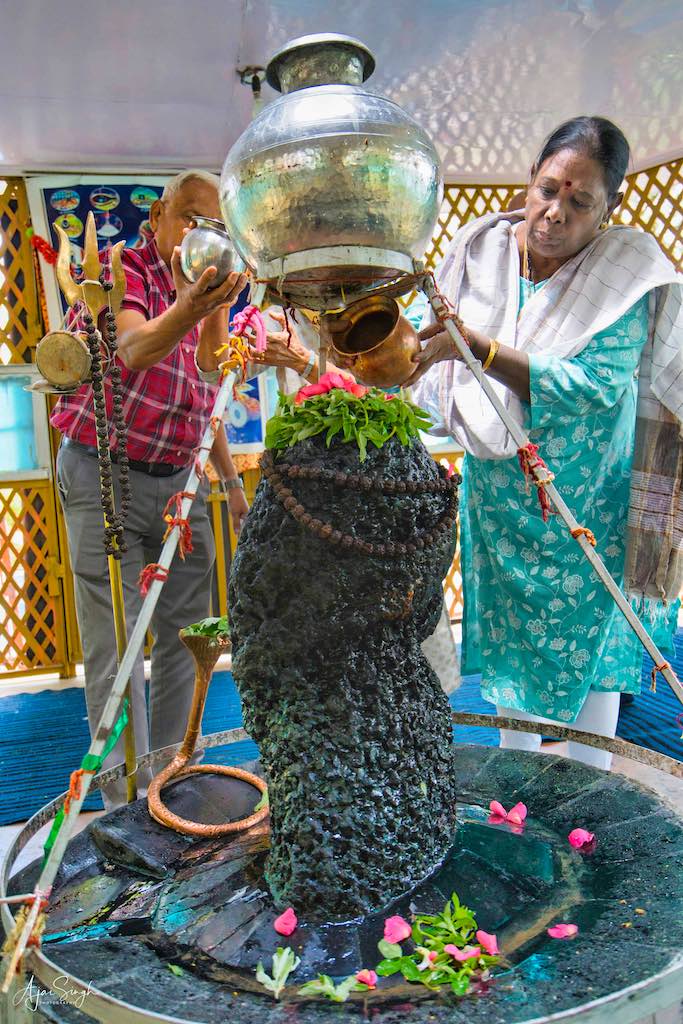
After the 1990s, the shrine remained closed for 18 years. It was only in 2008 when some Pandits, with the help of local Muslims, again threw its doors open for devotees. The complex was then renovated in 2012. However, the stream of pilgrims to this ancient tirtha remains a trickle, due to its location in a sensitive area.
.

.
The place was deserted when we reached it. An old man working in the compound came and let us inside. Reaching the Shiva Linga, our group set about making preparations for offering our salutations. The puja items were available, as was usual, and soon the fragrance of the agarbattis and sandalwood paste was wafting through the shrine, to the ringing of bells and chants of mantras.
.
To protect your personal data, your connection to YouTube has been blocked.
Click on Load video to unblock YouTube.
By loading the video you accept the privacy policy of YouTube.
More information about YouTube’s privacy policy can be found here Google – Privacy & Terms.
.
The calm and cool atmosphere of Kapaal Mochan tirtha, situated in the large grove of old and big chinars, the murmuring sound of nearby Rambiyara on the right side and that of the Laar Koal on the left, the cool breeze and scenic beauty of the forests provided an unforgettable experience. The perfect meditative place on can dream of. Unfortunately, this blissful experience cannot be experienced by the vast majority and the earlier buzz of people from all over India performing puja is sadly absent.
.

.
To read more about the history of the Kapaal Mochan Tirtha, read my blog Kashmir – The Land of Rishis: Part 2 – History.
.
Aharbal Waterfall
.
.
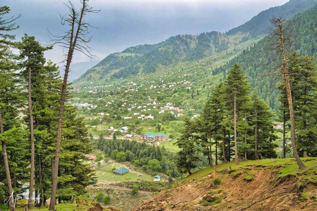
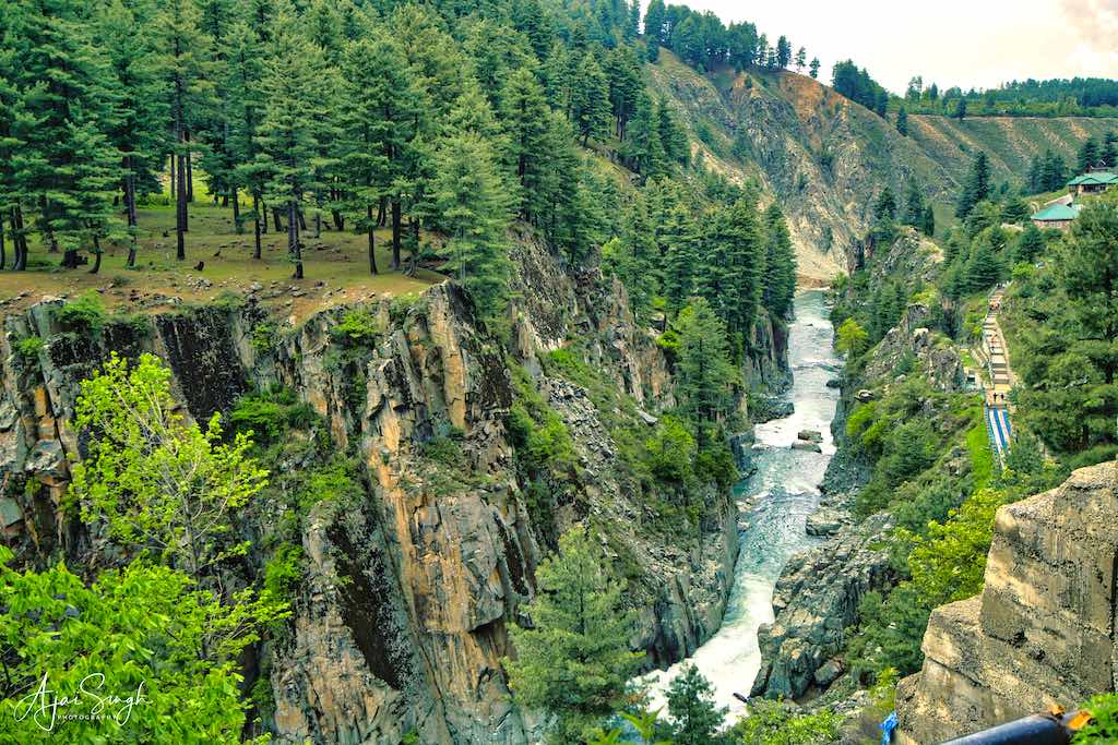
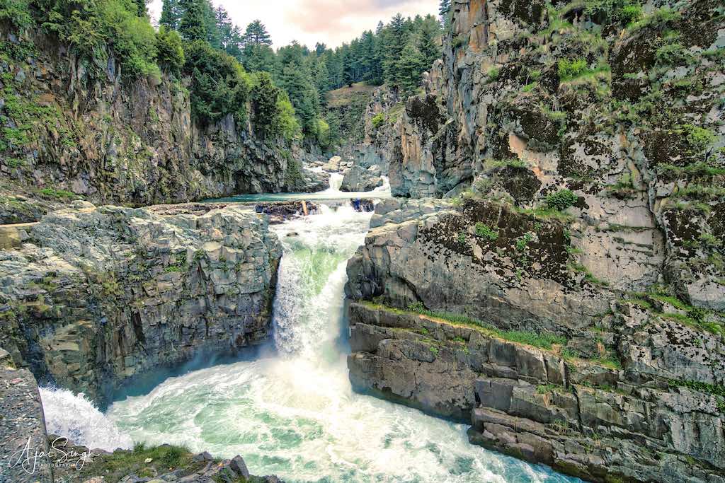
Aharbal lies in the Kulgam district’s Noorabad area of Kashmir, about 75 km from Srinagar. It is a short distance from the Mughal Road which connects Poonch to Srinagar and is located on the Veshu River, a tributary of the Vitasta (Jhelum) River in an alpine valley covered in pine and fir trees within the Pir Panjal mountains. This is one of the most picturesque waterfalls in the State. It lies at an altitude of 2266 meters above sea level. The waterfalls noisily 25 meters in stages through a narrow gorge of granite boulders. Aharbal Falls are also referred to as the Niagara Falls of Kashmir, owing to the volume of the water flowing through it.
.
.
The drive from Shopian was picturesque, through forests and mountain roads. The road was in good condition, so it was comfortable. This region was the ‘real’ Kashmir, off the main tourist circuit, with stunning views as we drove through. It’s then one realizes why Kashmir has been given the epithet of “Heaven on Earth”! And the reason why the Rishis in prehistoric times made their ashrams here was to immerse themselves in the peaceful and meditative environment.
The river came alongside the road for the last part of the drive, giving spectacular views of the gorge it flowed through. There was a reasonable crowd when we reached the parking. There was a counter where one has to purchase tickets for seeing the falls. Tickets to most places in Kashmir are cheap, the standard rate being Rs 10 per head. The actual falls are some distance from the entry gate, after going down the steps from the plateau above. Fortunately, the path was reasonably well maintained and fenced on the side of the river flowing alongside. The stone path ended at the viewpoint in front of the falls. The viewpoint was fenced heavily, as many people had lost their lives by slipping into the gushing waters below.
.
.
What the falls lack in terms of height, is more than made up by the ethereal beauty of the surrounding alpine landscape. Before descending the steps, there was a small garden with a cafeteria and some tourist accommodations. The place was crowded with locals and we seemed amongst the few ‘outsiders’ in the place.
The Veshu River is well stocked with trout. Treks can be taken from here, one being to the Kauser Nag Lake, which takes a few days to complete.
.
Mata Ragniya Bhagwati (Kheer Bhawani) at Manzgam, Kulgam
.
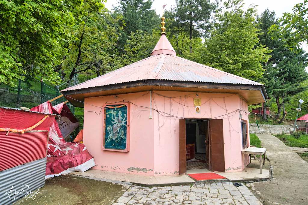
There are three Kheer Bhawani temples in Kashmir – Tulmula, Kikker, and Manzgam. When Sri Hanuman was bringing the murti of Devi Ragnya from Lanka after she could no longer stand the actions of Ravana, the murti is said to have been brought first to Manzgam, before it found its permanent place at Tulmula.
.
.
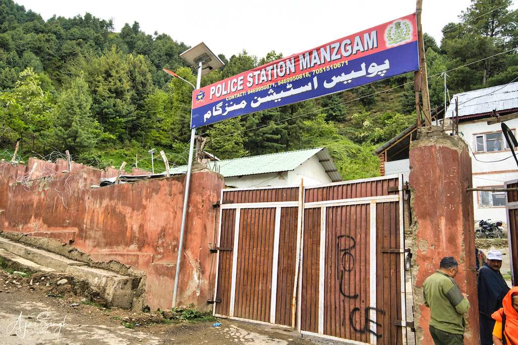
The shrine is, as expected, inside the compound of the Manzgam Police Station and heavily barricaded all around, with gates locked. On reaching the entrance, from behind the barricaded gate inquiry was made about our antecedents, before we were allowed inside. It was a large compound and the shrine was located at one corner, accessible after crossing the police station building. Inside, the small shrine building was quite barren, with only a well in the center. There was no murti, except for one placed inside a niche on one of the walls. It was pitiable to see another ancient shrine reduced to this state. Except for the historicity of the place, nothing much was left of it.
.
.
Originally, this temple was consecrated to Devi Ragnya. In 1990, the temple of Mata Kheer Bhawani (Devi Ragnya) was attacked as terrorists exploded a bomb and killed a pujari by slitting his throat. The murti in the pond was desecrated and looted. The Dharamshalla, having two stories, was completely gutted. It was so large that it could accommodate 5,000 pilgrims at a time. The walnut and poplar trees growing within the tracts of land measuring 100 kanals were cut. Small wooden chowkies and huts in the complex were also looted and burnt, although they were rebuilt later
.

.
The Zeshta Ashtami festival is celebrated as the birth anniversary of Ragnya Devi Jayanti. The birth anniversaries of three Vaishnite Devis – Mata Kheer Bhawani in Tulmula (Ganderbal district), Devi Tripur Sundari in Devsar (Kulgam district), and Devi Rajnya Bhagwati in Manzgam (Kulgam district) is celebrated by Kashmiri Pandits with great reverence in the valley amid hawans and community kitchens. After the 1990 incidents, the celebrations only re-started in 2010, a gap of 20 years.
.
Holy Spring & Surya Temple, Mattan, Anantnag
.
.
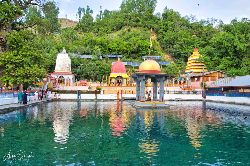
The ancient temple of Martand (Surya Bhagwan) is situated at a site called Mattan or Bavan in Anantnag district of South Kashmir about 61 km from Srinagar. The pilgrim village is just off the road that leads to Phalgham and the holy cave shrine of Shri Amarnathji. The place is notable as a very old Hindu pilgrimage place in the valley and enjoyed prominence for Kashmiri Pundits among other religious shrines of Kashmir, holding similar importance as Haridwar has for Hindus. It is held sacred to Surya Bhagwan, who is worshipped here in his Martand manifestation. The pilgrimage to Martanda is connected with visits to several temples and springs at Mattan. Although many religious festivals are celebrated throughout the year at Martand, the main celebration is the birthday of Martand Ji, which falls every year on Magh Shukla Paksha Saptami i.e., the 7th day of Magh (February) as per the Hindu calendar.
.
.
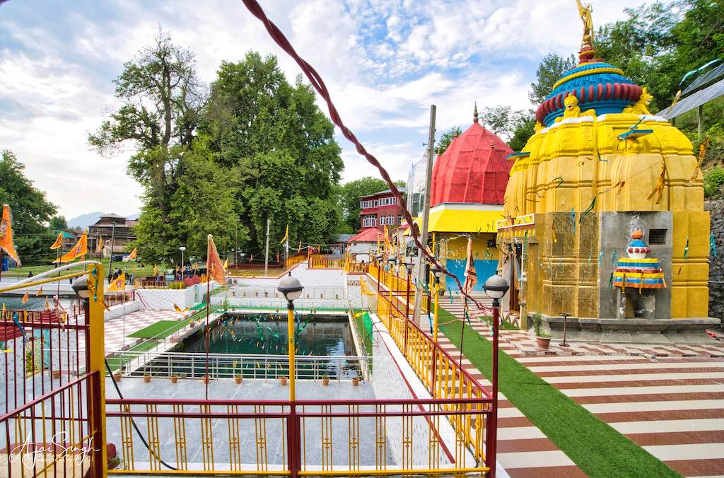
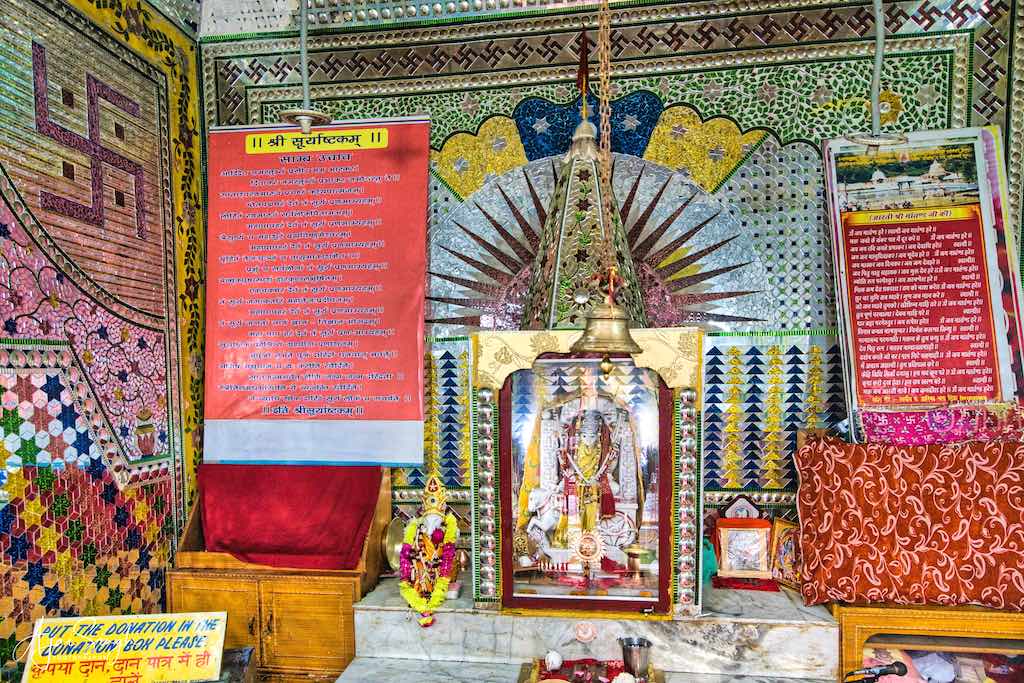
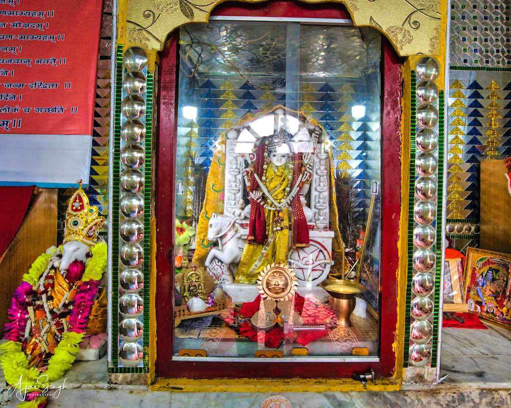
The main and ancient site of Martand is in a large Chinar-shaded complex and lies beneath the mountain called Devi Bal. The Tirtha is marked by two famous springs and temples. The temples are the ancient Martand temple, Mata Durga temple, Radha-Krishna temple, Shri Ram-Lakshman-Sita with Hanuman Ji temple, Lord Ganesh temple, and the newly constructed Surya temple with 12 sun gods, behind whom the hill starts. All these temples are situated on a raised platform by the side of the two sacred springs, known as Vimala and Kamala kunds. There is a Shiva Linga in the middle of Kamala kund. Sacred fish are found in large numbers in these springs and the folklore is that the Amarnath yatra is not complete until the fish are fed on the return journey. The waters of these springs are sacred and taken home by devotees. The shrine is also famous for the family records of Kashmiri Pundits that are maintained here for generations.
.
.
The place was well maintained and as evening approached, the crowds kept increasing. Quite a few of the visitors were from the local Muslim community, for whom it is also a place of reverence. They don’t enter the temples though, we were told. The water is also supposed to be holy for all communities and has curative properties. On speaking to a pujari, we learned that this was among the few shrines that were not touched during the period of militancy. However, the temple still had its protection from the security forces on a permanent basis.
.

.
When we were watching the fish in the holy waters, suddenly the sound of whistles was heard, and in no time the temple complex was emptied out by the security forces on duty. We came to know later that there was some incident nearby and the temple was emptied as a precautionary measure. That is the reality of visiting places in Kashmir, especially temples.
.
.
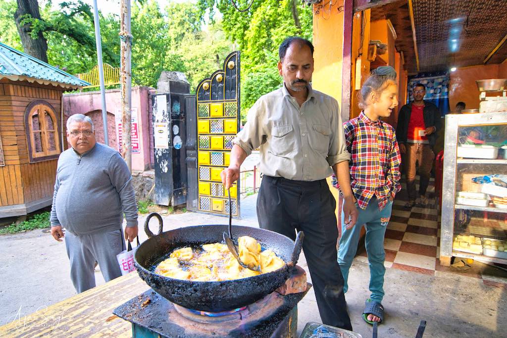
The samosa shop run by a Pundit near the entrance gate is a popular food outlet and it was a pleasure to eat hot samosas as they came out of the boiling oil, and for which there was a long queue as the samosas kept vanishing from the plates.
Apart from the Surya Temple, Mattan is also sacred to the Sikhs as Guru Nanak Devji came and stayed here for 13 days. This brings me to the observation that many Gurudwaras are located near ancient Hindu religious sites in Kashmir. And that the Sikh Gurus made it a point to visit these places during their lifetime. This is because of the intrinsic connection between Hinduism and Sikhism, a connection that is now under threat.
To read more about the history of the Holy Spring & Surya Temple, read my blog Kashmir – The Land of Rishis: Part 2 – History.
.
Pahalgam
.
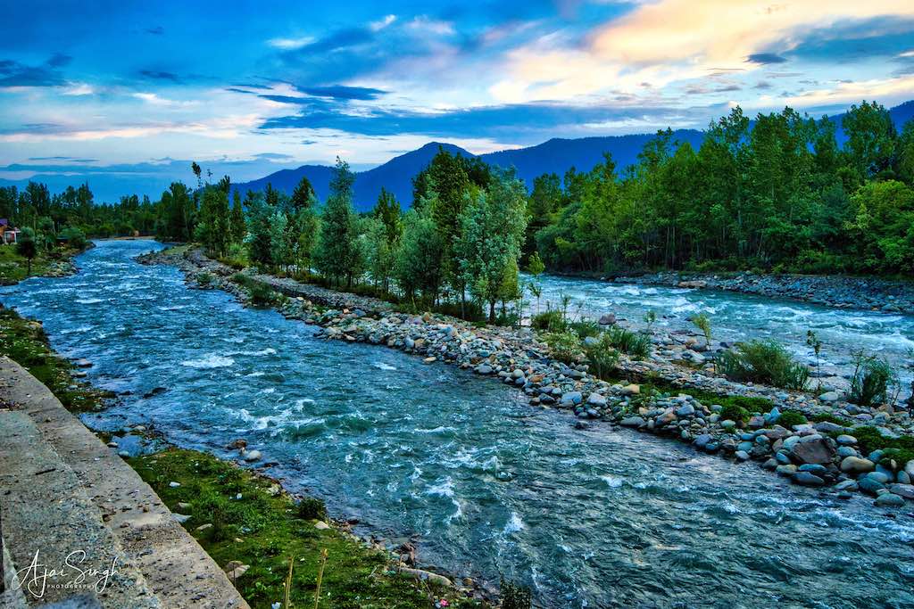
The drive to Pahalgam, about 60 km from Mattan was along the Lidder (ancient name Lambodari) River, a tributary of Vitasta (Jhelum), which joins it at Anantnag. The late evening drive was picturesque as the sun went down across the river and the forests alongside. A short distance before Pahalgam, we came across a traffic jam on the highway. On coming closer, we saw a large contingent of the Army had stopped all traffic. It was learned that a few terrorists had been located in the jungles nearby and an operation was underway to capture them, thus all traffic had been stopped. Later, the news at night announced that two hardcore terrorists had been eliminated during that Army operation.
.
.
We reached our hotel in Pahalgam at night. It was tucked away in a small street at the other end of town. The town was buzzing with tourists and the traffic was as bad as in any metro! This was peak tourist season. It had been another tiring day and I was in bed as soon as dinner was over.
.
Day 7
.
Aru Valley
.
.
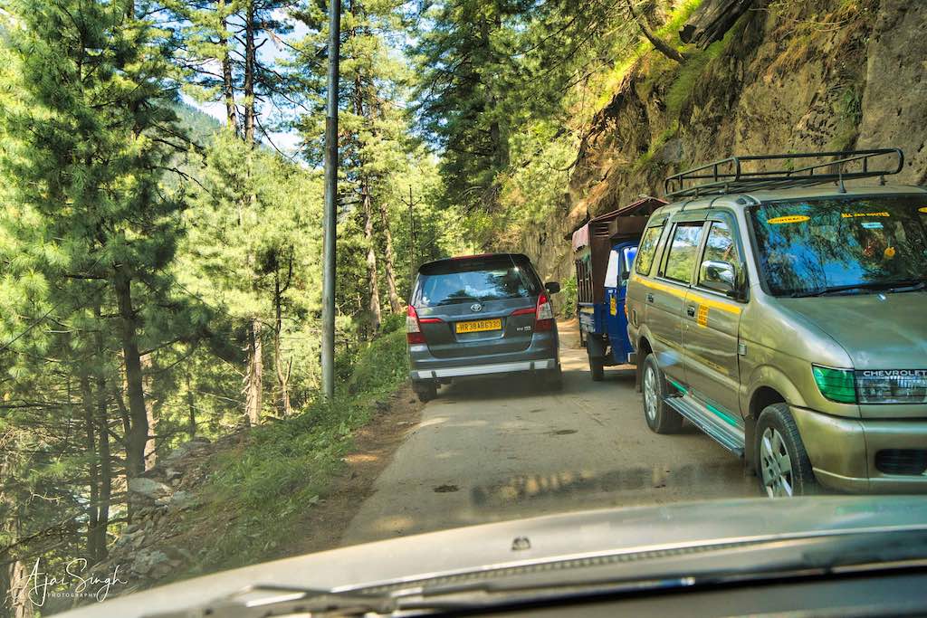
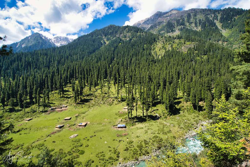
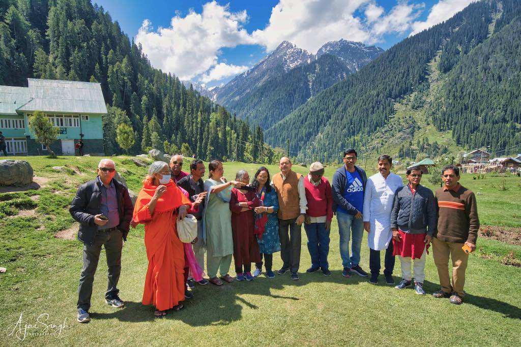
Today was scheduled for sightseeing, with no temple visits. First on our itinerary was a visit to the famous Pahalgam destination of Aru Valley. Though only about 13 km distant, this was one of the few roads we encountered which was one-way and with the huge tourist rush, it led to massive traffic jams when vehicles from opposite sides got stuck on the narrow stretches. The Lidder River continued alongside all the way to Aru, and the beautiful alpine vistas of cedars, pine and oak trees, and snow-covered mountains kept us enthralled, the traffic notwithstanding. The ethereal beauty of Kashmir makes it among the most beautiful destinations in the world, and I have seen quite a few! However, as with most destinations in India, tourist facilities are minimal. What exists are not maintained. The same was the case with this popular destination. The road should have been widened long back.
.
.

.
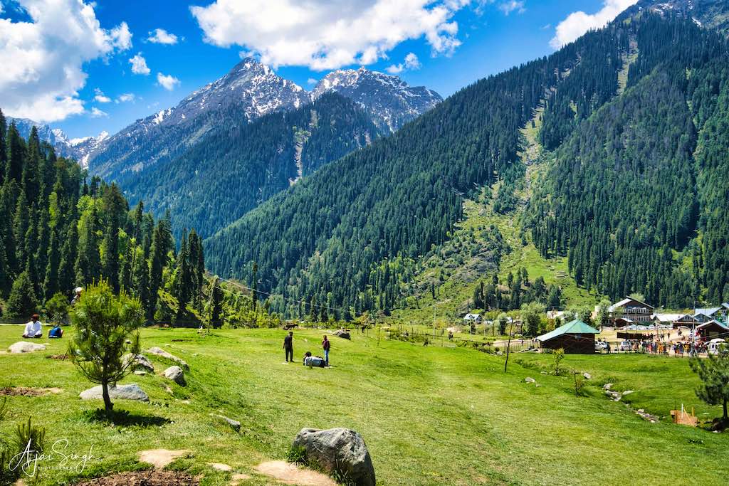
The last scenic village of Lidder Valley, Aru Valley is known for its scenic meadows, lakes, and mountains. It is also the central point for most of the treks in Pahalgam especially the trek to the Kolahoi glacier (18,000 feet), and for more serious trekkers, one to Sonmarg. Skiing can be done in winter. The tiny village is located at the end of the valley and is surrounded by pine trees, green hills, and vast meadows. It is one of the most beautiful and popular destinations in Kashmir, besides Gulmarg.
.
.
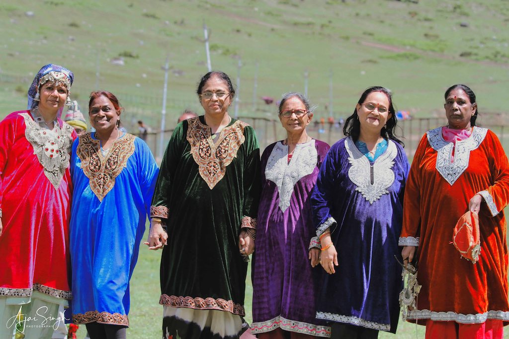
The weather was sunny and perfect for visiting the place. The vast meadow was teeming with tourists and there were numerous locals displaying their wares, starting from stones to a variety of local products. One of the most popular attractions was putting on local Kashmiri dresses and getting photographed. Everyone got the opportunity to become a model for a day!
.
.
Chandanwadi
.
.
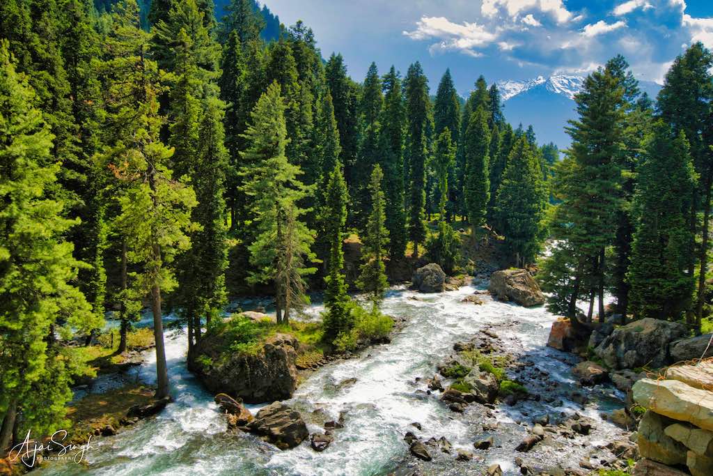
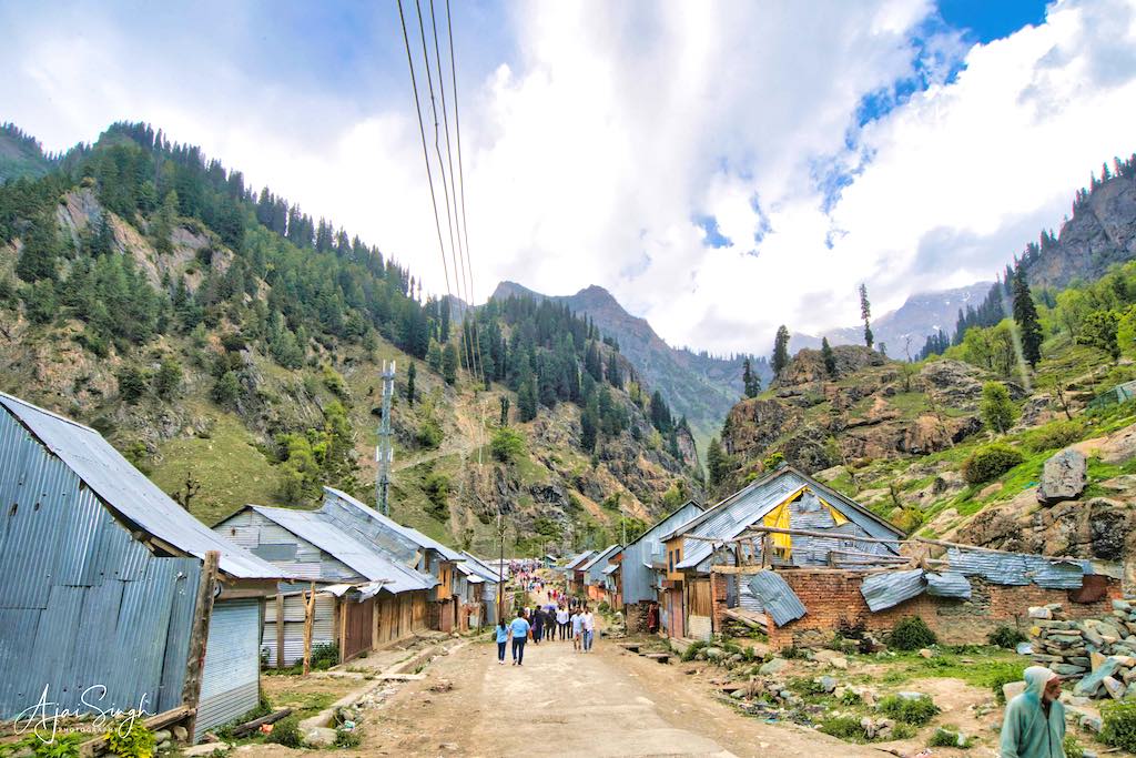
Pahalgam is the starting point of the biggest annual gathering of Kashmir – the Amarnath Yatra, which commences around end-June. Yatris can move by vehicle to a place known as Chandanwadi, from where it’s a 3-day return trek on foot/by pony. Amarnath is approximately 50 km from Chandanwadi. Our next visit was to Chandanwadi, situated at an altitude of 2,895 m.
.
.
The place is off the road to Aru Valley, towards the northeast. The distance from Aru is around 27 km, and 15 km directly from Pahalgam. This road is more winding and not in that good a condition, so takes a bit longer to cover. The surroundings are similar to those on the way to Aru and the beauty of the landscape as it kept unfolding past the car window soon led to a sensory overload! For me, and the memory card of my camera, both were soon in danger of running out of storage space!
.
.
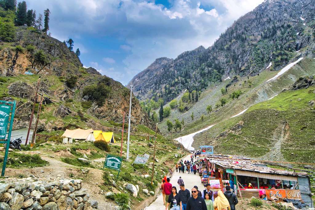
Chandanwadi had a large car park for the yatra, presently empty, and rows upon rows of railings that would be used for screening yatris when the Amarnath yatra started. I was told that during the period, the vehicles queue up more or less from Pahalgam itself due to the rush! Only vehicles which had requisite papers were allowed to proceed. The multiple checkings are for two reasons, one, because of the numbers involved, and secondly, for security reasons since this yatra is always a target for terrorists.
.
.
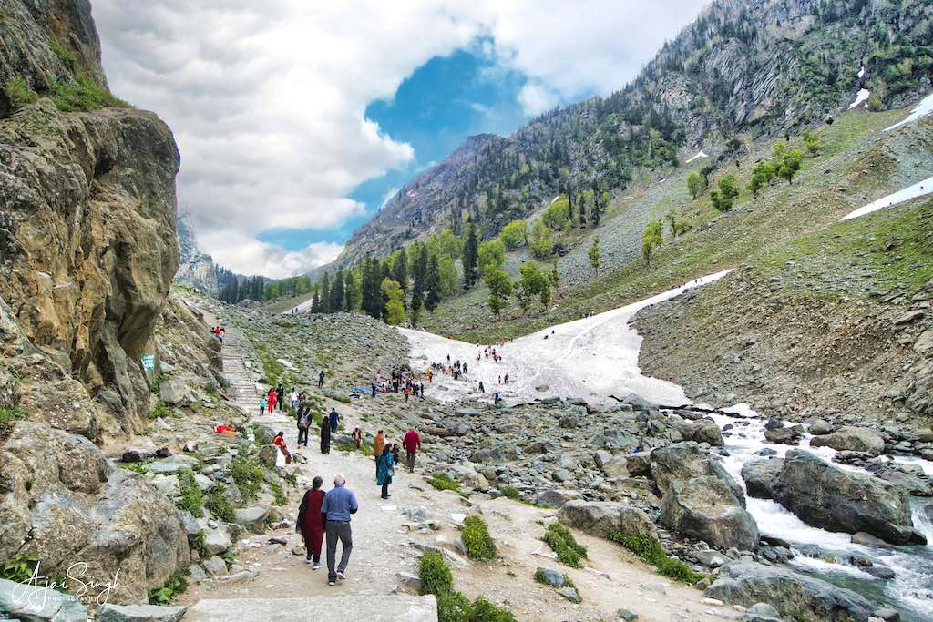
The car park for visiting the village is on the other side of town and was full. We got off and left the driver to find a place for the vehicles. A short walk through the village brings us to the ice bridge across the river, which is a small glacier coming down the slope of the mountain opposite and spans across the river making a bridge. Snowball throwing seemed to be a popular sport for tourists when we reached there! The scenery was breathtaking. From near the ice bridge, one can see the steps commencing on the route to Amarnath. It started drizzling slightly when we were there and I rushed back after a quick view from the ice bridge. The small river here is the one coming from Seshnag Lake
.
.
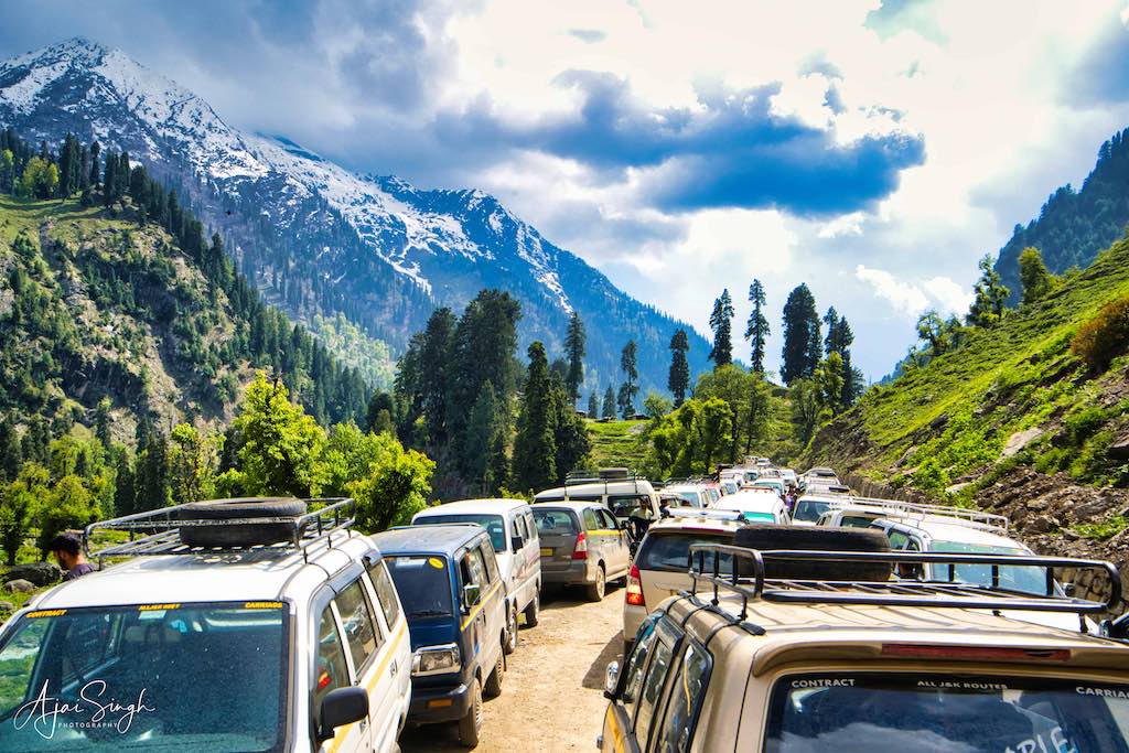
Exiting the car park and then the village was a major task, with vehicles everywhere and pointing in all directions. It is a miracle that we were able to negotiate through the mess in about half an hour.
.
Betaab Valley
.
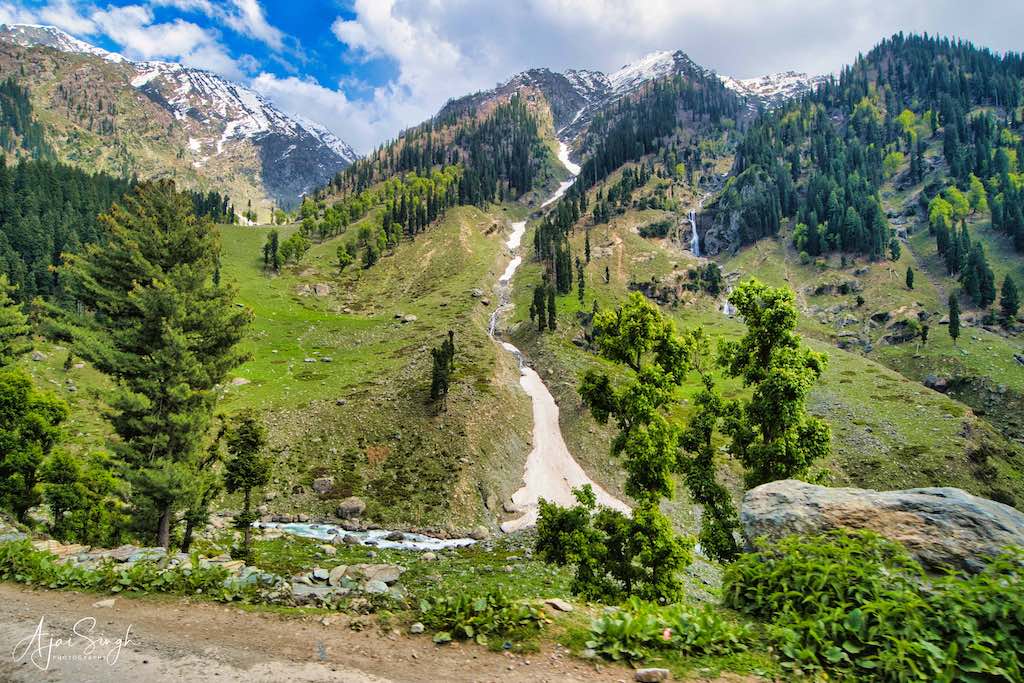
On the return journey to Pahalgam, we stopped on the road from where one could see the beautiful Betaab Valley from above. The place had become famous because of the shooting of the film Betaab here; it was earlier known as Hagan Valley. It was an exquisite location with the flat grassland lying in between the river and the mountain slopes in the background. A park had been developed for tourists adjacent to the river.
.
.
The road went down to the river flowing below, but the huge rush of tourists led to a massive traffic jam on the main road, as well as on the road leading down. We prudently decided to see the place from above itself. Even then we did caught in the traffic for nearly an hour due to cars and vans parked haphazardly along the road.
.

.
We reached Pahalgam after 3:00 pm, a bit late for lunch, which was had in the famous Punjabi Rasoi restaurant. It is run by a Sardar family and provides authentic dishes at very reasonable rates. By the time we finished lunch, it was tea time. The rest of the evening was spent relaxing at the hotel, enjoying the view of the surrounding mountains from the lawn.
That night a campfire had been organized in the lawns of the hotel, accompanied by music. The music did not take long to bring out the hidden talent in the group. Everyone was soon singing and dancing around the log fire under the clear moonlight, some because it was necessary to keep moving to stay warm in the open! Sufficiently warmed up, the fire kept burning till after midnight.
.
Day 8
.
Mamaleshwara Temple, Pahalgam
.
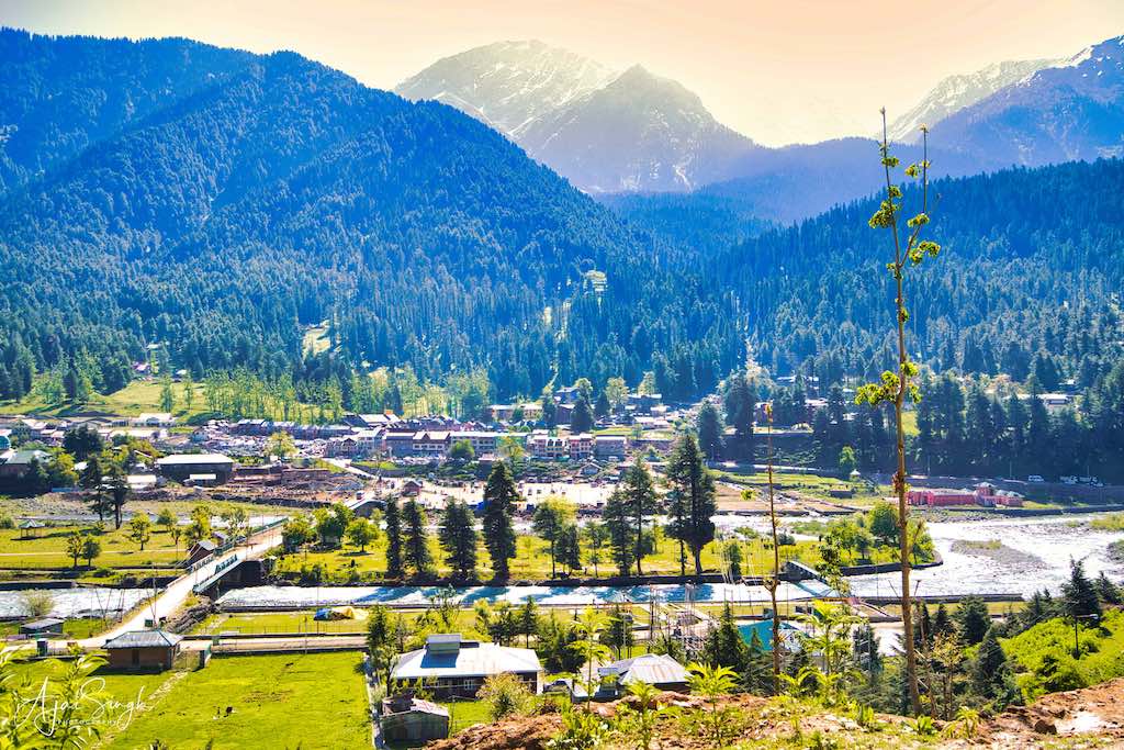
Early morning we were packed and luggage loaded, ready for facing the schedule of the day. Pahalgam itself has a few ancient temples and on our way out of the town, we stopped to visit one of them.
.
.
Mamaleshwara Temple is one of the ancient temples of Kashmir that dates back to 400 CE. It is located some 3 km from Pahalgam town on the south side. According to legend, this is the temple where Ganesha was placed as doorkeeper by Parvati, with the instructions to not allow anyone to enter the premises without her permission as she was bathing. When Shiva came to the door, and not recognizing who he was, Ganesha did not allow him to enter. Enraged, Shiva cut off the head of Ganesha. Subsequently, on learning that Ganesha was his son, he gave him the elephant head. Mam Mal translates to don’t go.
.
.
Local folklore about the origins of the temple is that it dates from the Mahabharata era and during exile and Agyatavas, the Pandavas and Draupadi worshiped Shiva at this place.
.
.
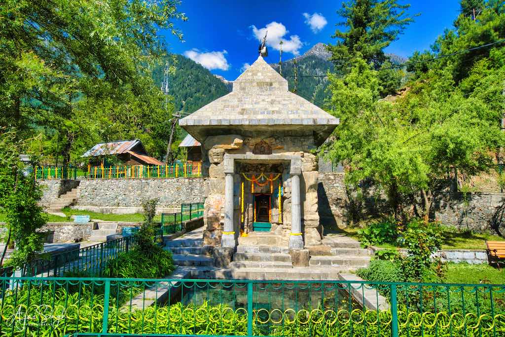
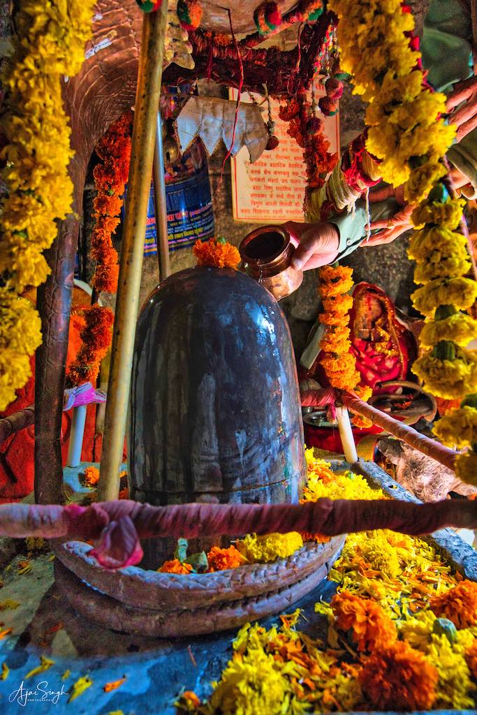
The temple is dedicated to Shiva and stands on the right bank across the Kohaloi stream up towards the mountain in a village called Mam Mal. Mam Mal was originally known as Mamlaka village. The square temple has a side of eight feet internally with a porch supported on two columns at its front and faces the southwest. Kalhana mentions the name Mamleshwar in Rajatarangini, in which King Jayasimha (1128-1155 CE) is said to have been adorned with a golden Kalsha at the top. The temple is made of sculptured stones. According to Kalhana the Shiva Lingam of the temple is dedicated to Shiva Mamaleshwara. A detail of this temple also forms a part of Amreshvarakalpa. It is said that this temple was adorned with gold during the reign of the early kings.
.
.
A stone-lined water tank forms the part of this temple. The area of the tank is about 12 square feet and is fed by a spring which at times rises under the site of the temple in front of stairs. The water of this spring is crystal clear and drinkable, being cold during summer and hot in winter.
The temple is under the custody of the Archaeological Survey of India. The complex is quite small and well-maintained. However, to our surprise, we found that the caretaker who looked after the shrine was a Muslim. He only opened the doors of the shrine, but any puja had to be done by us only. The caretaker was quite rude in his behavior and even when we were inside the premises, he locked the temple doors and was leaving, which led to an exchange of words with him. One hopes that the ASI, which is a Central Government organization is more sensitive in carrying out its responsibilities and appoints a pujari to look after this ancient shrine and cater to the requirements of devotees who come from long distances with great reverence
.
Sinthan Top
.
.
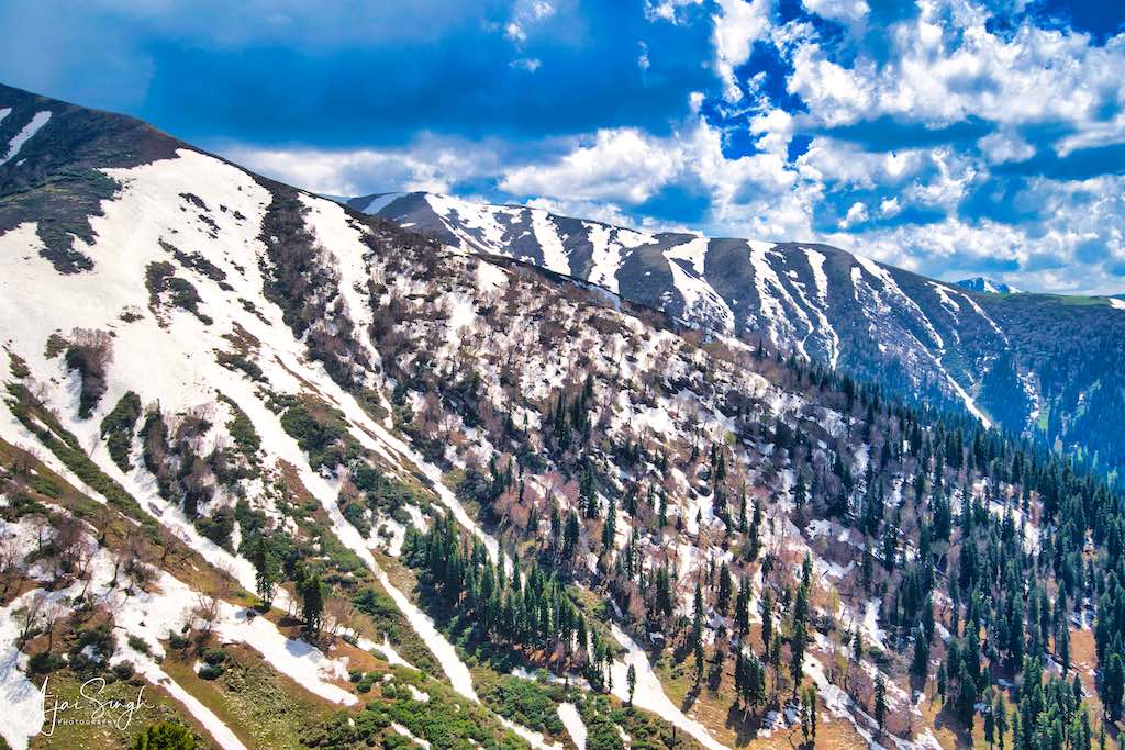
Our next destination was one of the hidden wonders of Kashmir, a place rarely visited by tourists, mainly because of it being located in south Kashmir, a fair distance from the hub of Srinagar. Sinthan Top is a mountain pass in the Pir Panjal mountain range and a popular tourist destination located between South Kashmir’s Breng Valley (Sub-District Kokernag) in Anantnag district and Kishtwar district of Chenab Valley. The pass connects Anantnag with Kishtwar and is at 12,500 feet (3,800 m) above sea level, remaining snow-capped for most of the year.
.

.
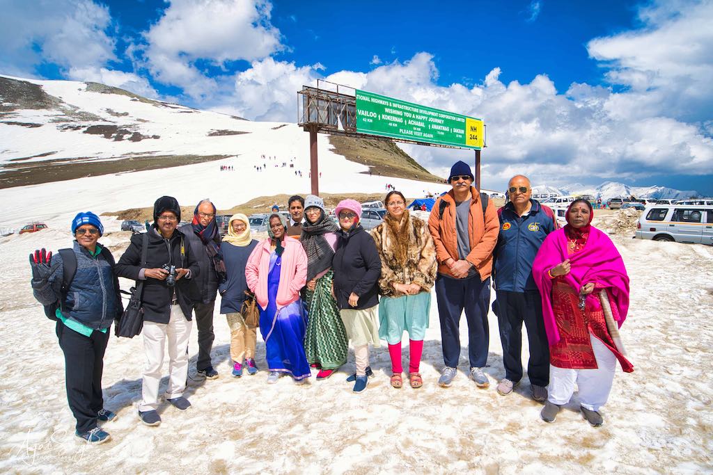
It is located roughly midway on the Anantnag–Kokernag–Kishtwar section of NH 244, and is 80 km from Kishtwar town, 130 km south of Srinagar, and 73 km from Anantnag. Sinthan Top has no local habitation. What was surprising to see was the 8-lane highway widening happening to NH 244, the quality at par with the best expressway one can see anywhere in India. No one can say that the infrastructure in Kashmir lacks that available anywhere else.
.
.
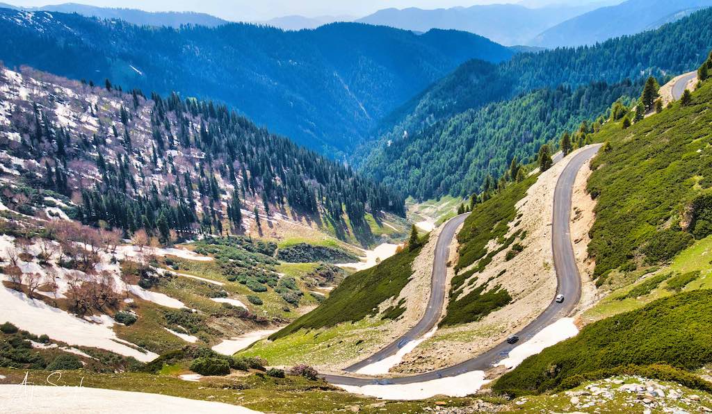
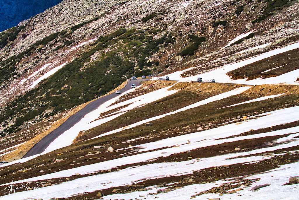
The route went back to Mattan and then onwards to Achabal and Daksum, from where the winding mountainous roads commenced for the last 37 km to the pass. The beauty of the drive is incomparable – difficult to compare because every day we thought what we saw is the best seen so far! But truly, the last mountainous road section was spectacular – alpine forests, snow-covered mountain peaks, the unique zebra-striped snow cover, and colourful pinkish-orange leafless trees, giving the impression of it being autumn.
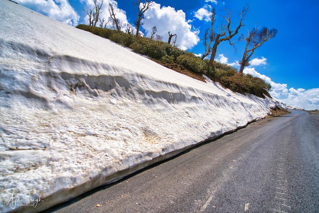
The last few kilometers of the road had high snow deposits on the side of the road, and often the drive was through a vertical snow wall on both sides. From the top there is a panoramic 360° view of the snowy mountain ranges as far as the eye could see, making it incomparable to what one sees at other viewpoints.
.
.
There is no permanent structure at the pass and there was one tented shop providing hot tea, which was most welcome in the chilly winds blowing across the top. On both sides of the road, the snow cover gently sloped off to a low height, making it a perfect place for tourists to walk the slopes and have fun with snow fights and slithering down.
After enjoying the raw beauty of nature in such an undisturbed environment, we set back on the return journey back the way we had come. The views continued to enthrall us to no end, another day when we suffered from sensory overload trying to absorb the beauty unfolding around us. Lunch had been arranged at Kokernag, about 45 km from Sinthan Top.
.
Kokernag
.

.
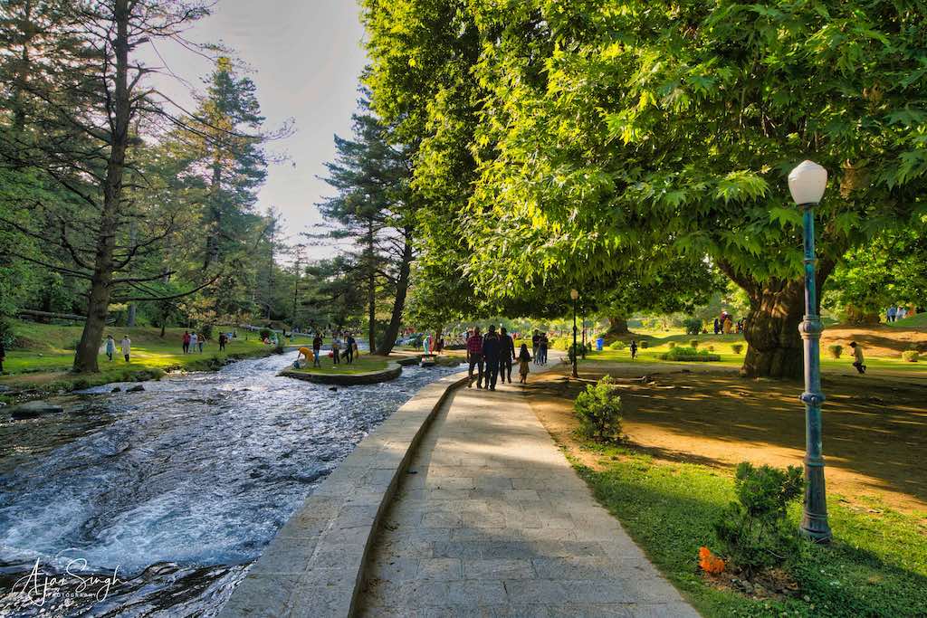
Kokernag is famous for its botanical garden and the freshwater springs in the area. It also has a trout hatchery. The name derives from two words namely, koker and nag. Koker has been taken from a Kashmiri word for chicken, while nag has been taken from a Sanskrit word for springs. The springs gush out of the base of a thickly wooded hill from where it divides into multiple channels, which resembles the claw-foot of a hen, hence the name. The spring is reputed to have curative powers.
.
.
The lunch at the J&K Tourism facility was excellent. The local delicacy Nadru Yakhni, lotus stem cooked in curd, is the most sought-after dish. That day was the anniversary of Swami Chinmayananda and in our group we had many of his followers, working in the Chinmaya Mission. The lunch was hosted by them as an offering to their Guru, and before eating, we had a short session of singing salutations to the Guru.
.
.
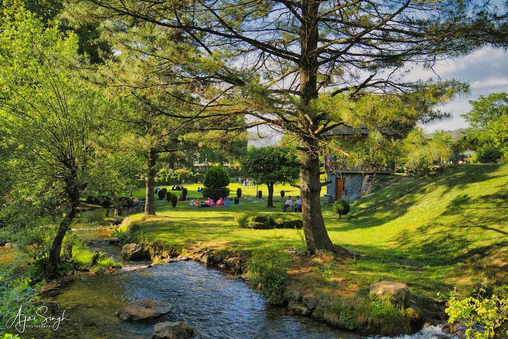
The restaurant overlooked the botanical garden and while having lunch one enjoyed the view of the beautifully laid out gardens spreading out in front of us, with the hills in their backdrop. After lunch, we went for a walk through the place. The garden was well managed and with a vast collection of plant and flower species. As usual, it was full of locals out in strength, whole families enjoying an outdoor picnic. A point I noticed whenever we went to a garden. Again, we seemed to be the only ‘outsiders’ and were cautioned to not wander off alone.
.

.
After lunch, we headed to Achabal, where we would be spending the night at the government tourist hut. We reached the place late in the evening, and since our large group had been accommodated in two places, by the time we settled in, it was time to have dinner and settle down to sleep.
.
Day 9
.
Achabal
.
When I got up the next morning, it was a surprise to see the view outside our hut. Beautiful green meadows with hills as a backdrop. There were two huts in a large separate compound, well appointed as a suite having two bedrooms with a common area in between. Quite comfortable. The caretaker arrived promptly with hot tea early in the morning, letting us enjoy it in such salubrious surroundings.
.

.
According to Kalhana’s Rajatarangini, Achabal (Sanskrit Akṣavāla) was founded by Akṣa, son of King Nara II of the Gonandiya dynasty.
.
Achabal Mughal Garden
.
.
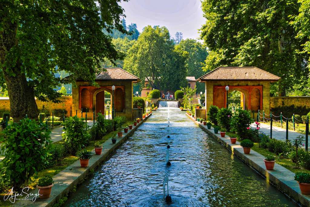
After a wholesome breakfast, we went to visit the famous Mughal gardens adjacent to our hut. The garden was built around 1620 CE by Jahangir’s wife, Nur Jahan. It was remodeled by Jahanara, who was the daughter of Shah Jahan around 1634-1640 CE. The garden was rebuilt, following its decay, on a smaller scale by Gulab Singh (who reigned in Kashmir till 1857) and it is now a public garden. The highlight of the garden is a waterfall that enters into a pool at one end.
.
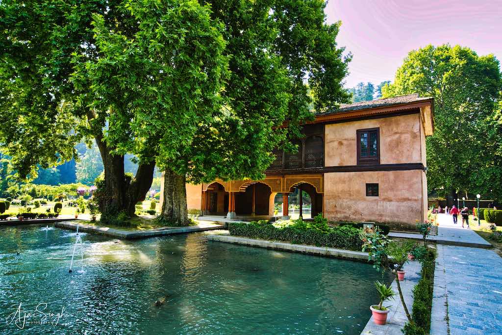
.
The design is an adaptation of the traditional Persian chahar bagh (four gardens). The chahar bagh takes its inspiration from the Quranic description of heaven having four rivers of wine, honey, milk, and water. The traditional chahar bagh is uniformly shaped, with a water source in its center and four (chahar) radiating streams that divide the garden (bagh) into four parts. As with other Kashmiri gardens, Achabal is located on a hillside, with its water source at the top. The typical chahar bagh design had to be altered to fit the site’s topography, as the source of water shifted from the traditional center to the highest point of the garden. In this manner, one axial stream is emphasized and the other streams were minimized or even removed from the design.
.

.
The garden is segmented into three terraces, with a central water stream along the north-south axis that features three fountain basins. Water entering the second pool passes under a two-story baradari, or large pavilion. This baradari has three arches on its southern elevation and one along its northern elevation. The third terrace is also the most private part of the garden; the zenana (harem, or women’s) garden, it has a rectangular water tank flanked by two small square pavilions. This water tank was used as a women’s bathing pool.
.

.
It was a beautiful garden and well-maintained. There were a large variety of flowers in bloom and the traditional chinar tree towering over the waterways. There was a ticket to enter the gardens, and it being early, it was relatively empty. This garden was another not-so-well-known sight to visit, tucked away in a corner and off the main tourist routes.
.
Martand Sun Temple
.

.
SN Dhar in his book “Kashmir: Eden of the East” (1945) mentions that Raja Ramdev of the Pandava dynasty built the original Martand temple in 3007 BCE, devoted to Surya Bhagwan. This conforms to local folklore, which still refers to the temple as Pandav Lou. Many subsequent kings and monarchs repaired and renovated the original temple complex. However, it goes to Emperor Lalitaditya (8th century CE) who gave a complete facelift to the ancient temple and made it known all over the world.
.

.
A second base exists under the existing temple base giving credibility to an older temple having existed at the site before the one built by Lalitaditya. According to Kalhana’s Rajatarangini, the main image of Surya made of copper was destroyed by a King named Kalasa in 1075 CE. He replaced it with a golden murti, which was ultimately plundered by Sikandar the Iconoclast.
.
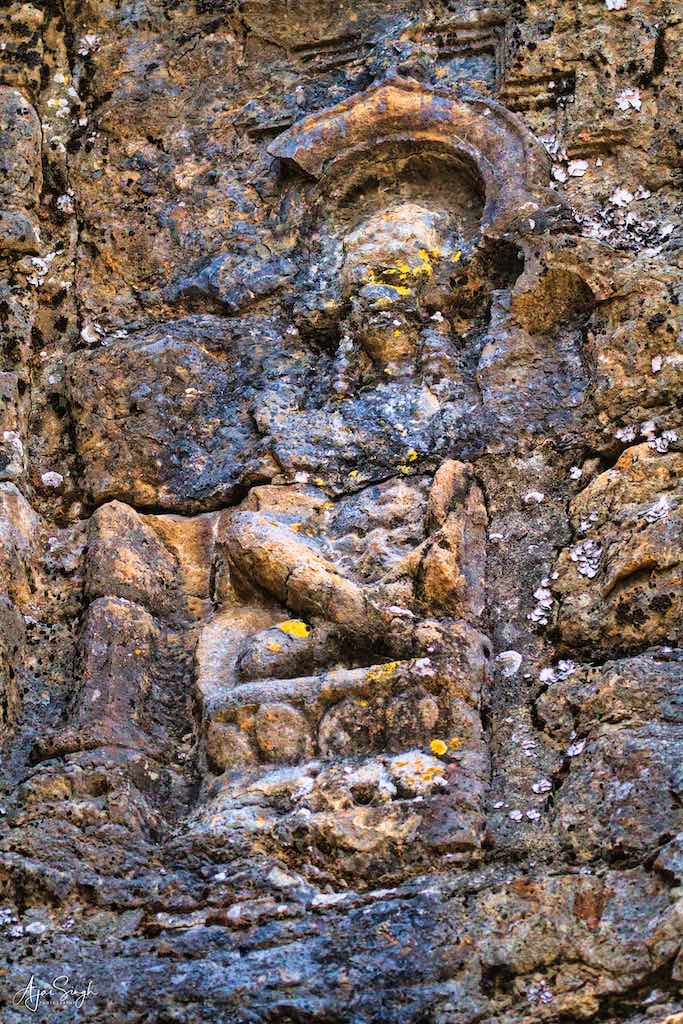

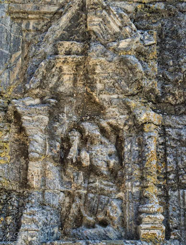
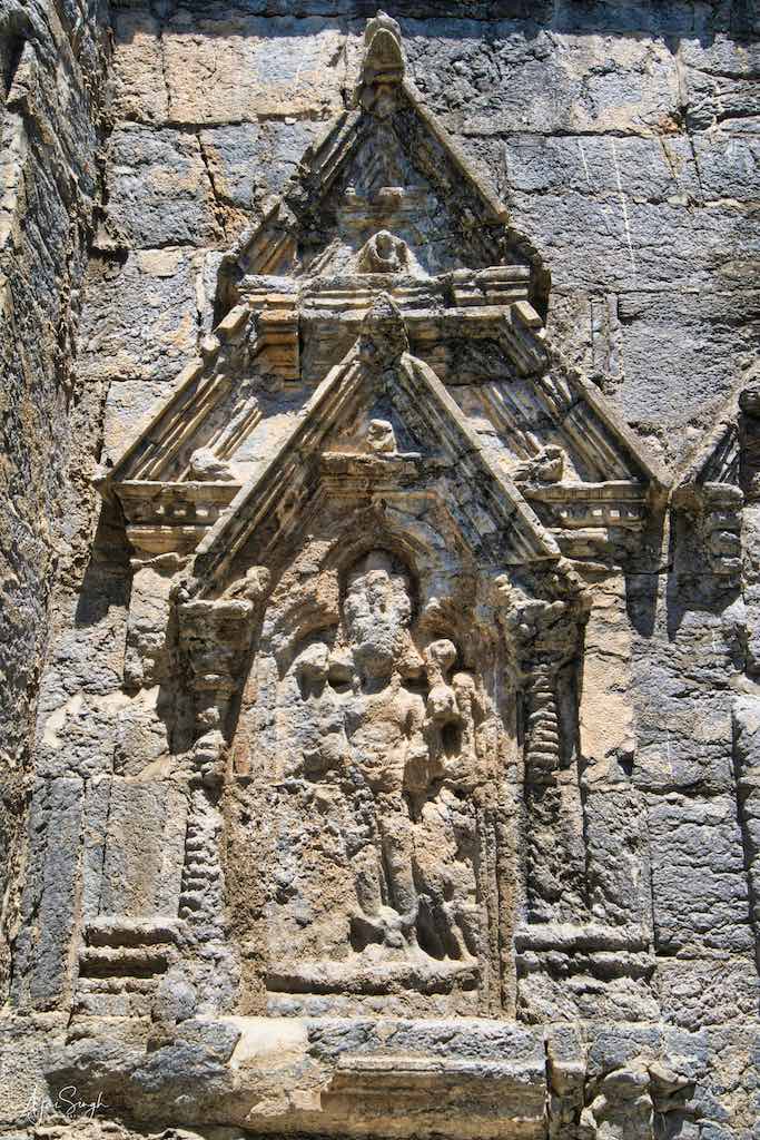
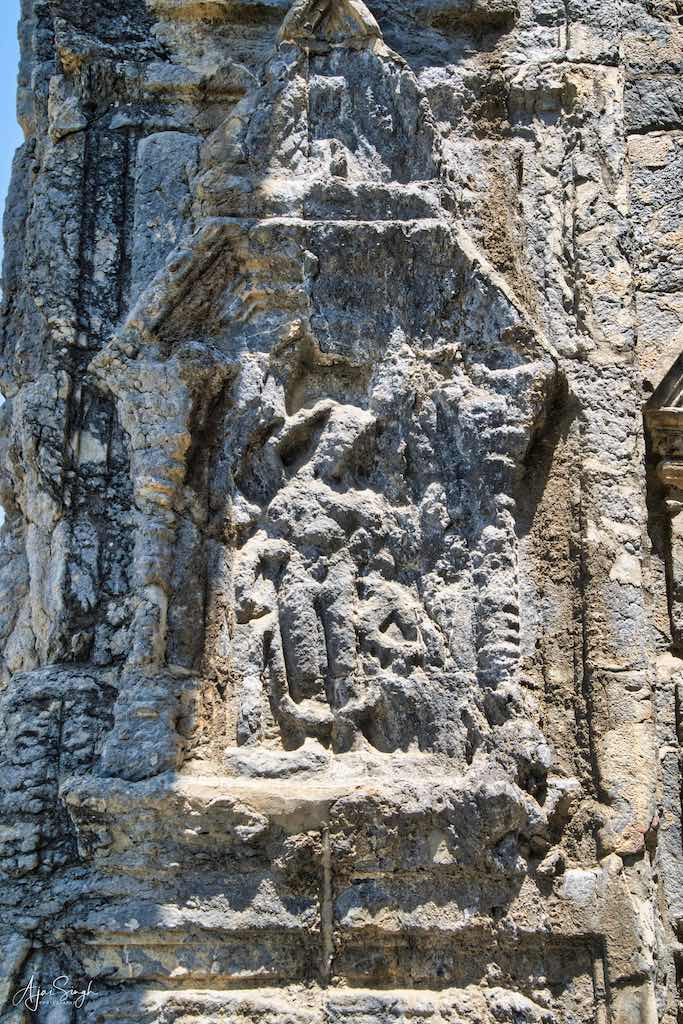
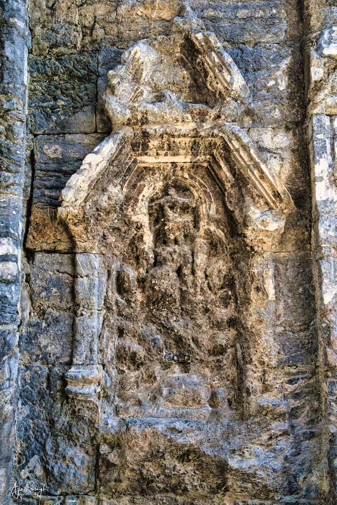
.
Surya is also known by the Sanskrit-language synonym Martand. The temple was destroyed by Sikandar Shah Miri (1389-1413 CE) in a zeal to Islamise society. Historian Ajit Bhattacharjee writes, “Sikandar (1389-1413) equaled the most blood-thirsty and iconoclastic Muslim conquerors anywhere in his zeal to obliterate all traces of the Hindu religion and convert its followers to Islam on pain of death. Temples were leveled and some of the grandest monuments of old (were) damaged and disfigured. Thousands of Hindus escaped across the borders of Kashmir, others were massacred.” He further records, “Hindu temples were felled to the ground and for one year a large establishment was maintained for the demolition of the grand Martand temple. But when the massive masonry resisted all efforts, the fire was applied and the noble buildings cruelly defaced.” According to M. Mujeeb, Sikandar, the iconoclast of Kashmir, made forcible conversions a sustained political policy.
.
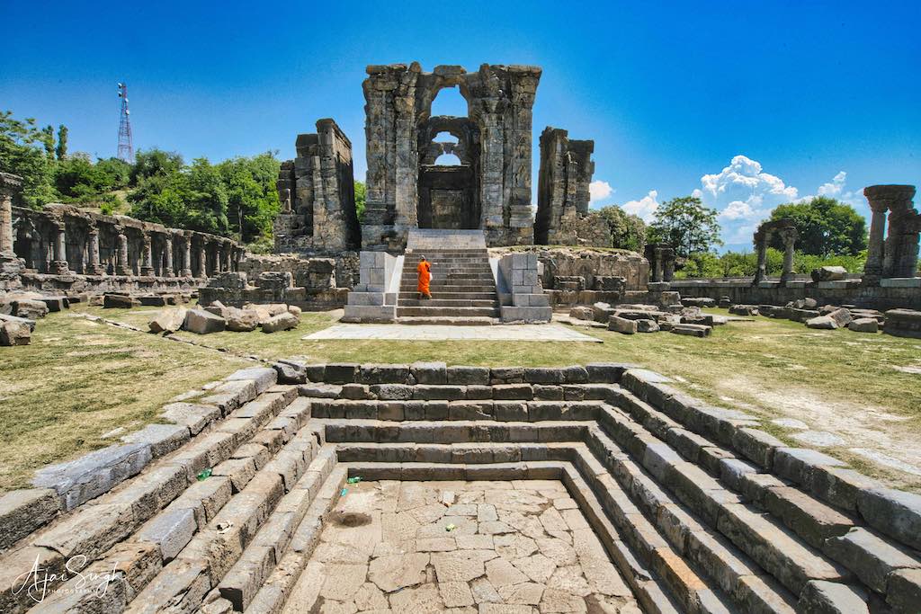
.
According to Walter R. Lawrence, the noted historian and a Kashmir expert of his times,“The ruins of the Hindu temple of Martand, or as is commonly called, the Pandav-Koru House – the Cyclopes of the east are undoubtedly, occupying the finest position in Kashmir. This noble ruin is the most striking in size and situation of all the existing remains of Kashmir grandeur”.
.
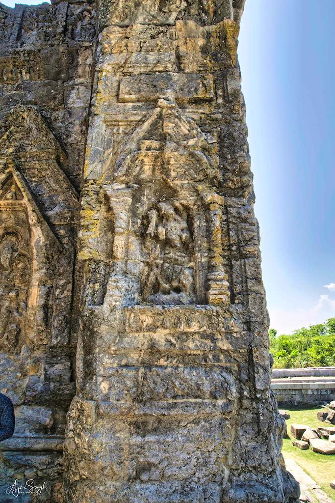
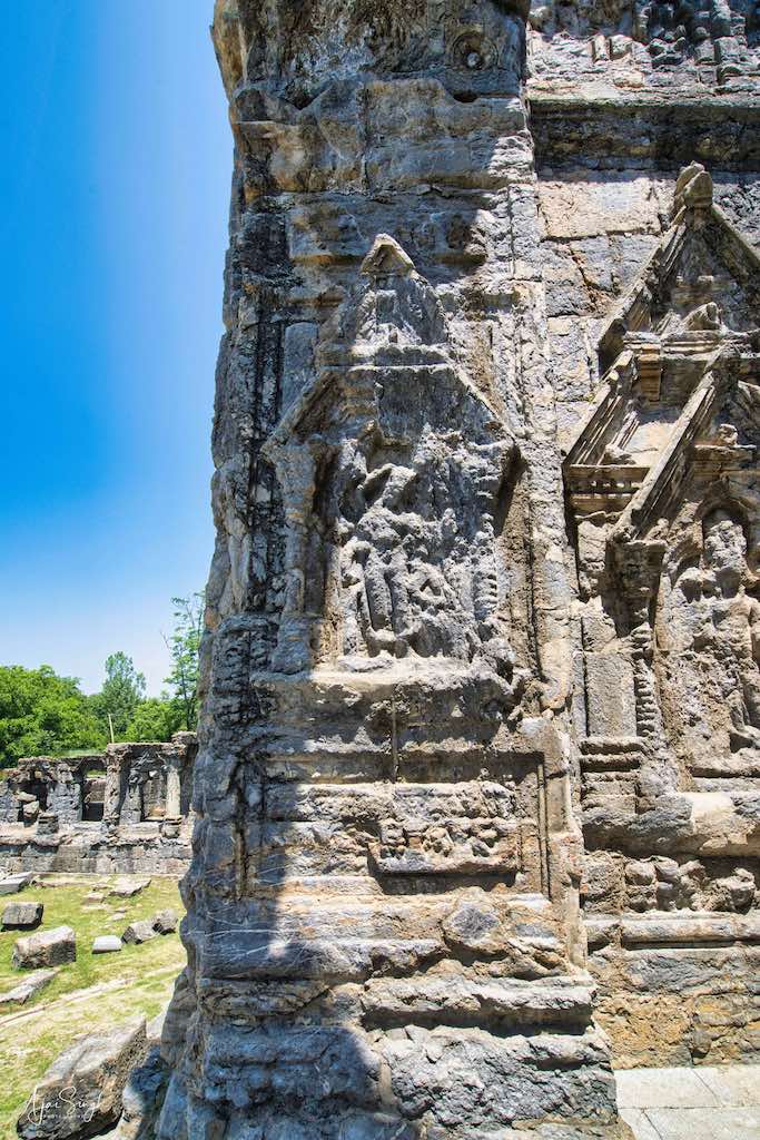
.
The Martand temple was built on top of a plateau (udar) from where one can view the whole of the Kashmir Valley. From the ruins and related archaeological findings, it can be said it was an excellent specimen of Kashmiri architecture, which had blended the Gandharan, Gupta, and Chinese forms of architecture.
.
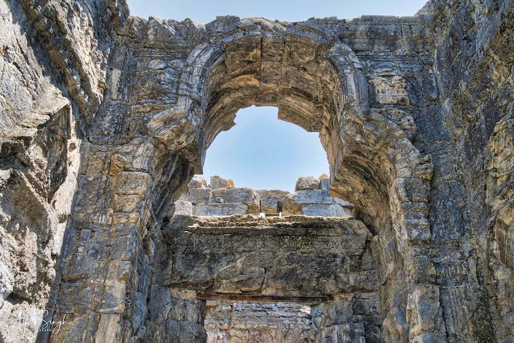
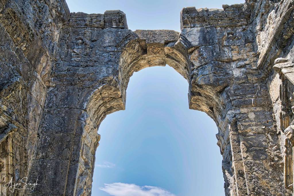
.
Cunningham, another historian, commented on the location of the temple: “It overlooks the finest view in Kashmir and perhaps in the world. Beneath it lays the paradise of the east, with its sacred streams, orchards, and green fields, surrounded by vast snowy mountains, seem to smile upon the beautiful valley below.”
.
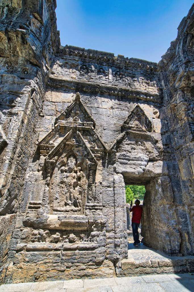
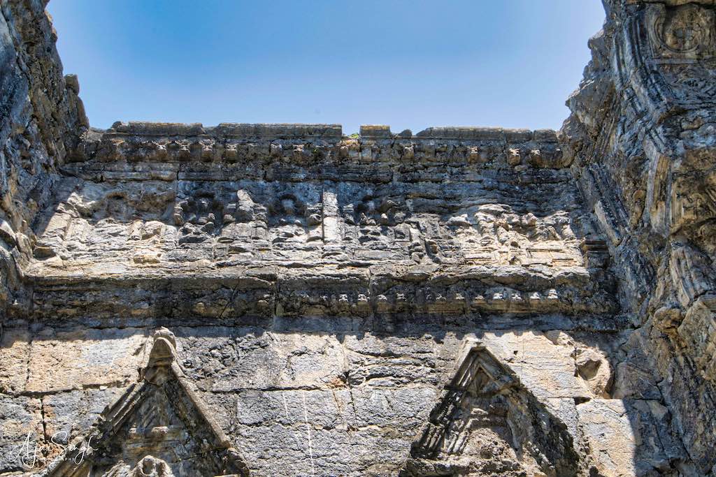
.
The temple has a colonnaded courtyard, with its primary shrine in its center, about 40 feet high, and surrounded by 84 smaller shrines, stretching to be 220 feet long and 142 feet broad and incorporating a smaller temple that was previously existing. The primary entrance to the temple is situated on the western side of the quadrangle. The primary shrine is located in a centralized structure (the temple proper) that is thought to have had a pyramidal top – a common feature of the temples in Kashmir. The main temple comprises of three chambers – the mandapa, antaralya and the garbh griha. Carvings of deities adorn the walls of the mandapa and antaralya, like Vishnu, Ganga, and Yamuna, in addition to Surya. The garbh griha is plain and closed on three sides. Two chambers flank the mandapa on either side, a novel feature of the temple. All images are disfigured, some to an extent making them beyond recognition. Martand remains one of the finest examples of ancient Indian temple architecture and engineering.
.

.
Such is the brilliance of the architecture that the main entrance of the temple is of the same width as the main temple in the center of the courtyard, making it look dramatic, grand, and larger than life. The main entrance was profusely covered with carvings and decorations, which reflect those in the main temple.
.
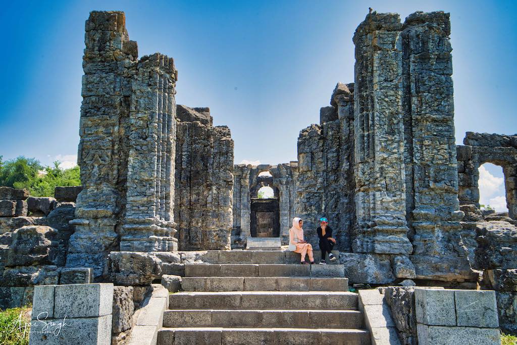
.
From Achabal our next destination was the famous Martand Sun Temple, a distance of about 10 km. When we reached the entrance, it was a sight to behold, in the middle of nowhere. I had no idea that it was built on the top of a plateau offering a bird’s eye view of the entire Kashmir valley beneath. As I entered the temple complex, a feeling of awe engulfed me. Though in ruins, it still looked majestic and stunning. The wrecked pillars and arches told the story of its grandeur once upon a time.
.
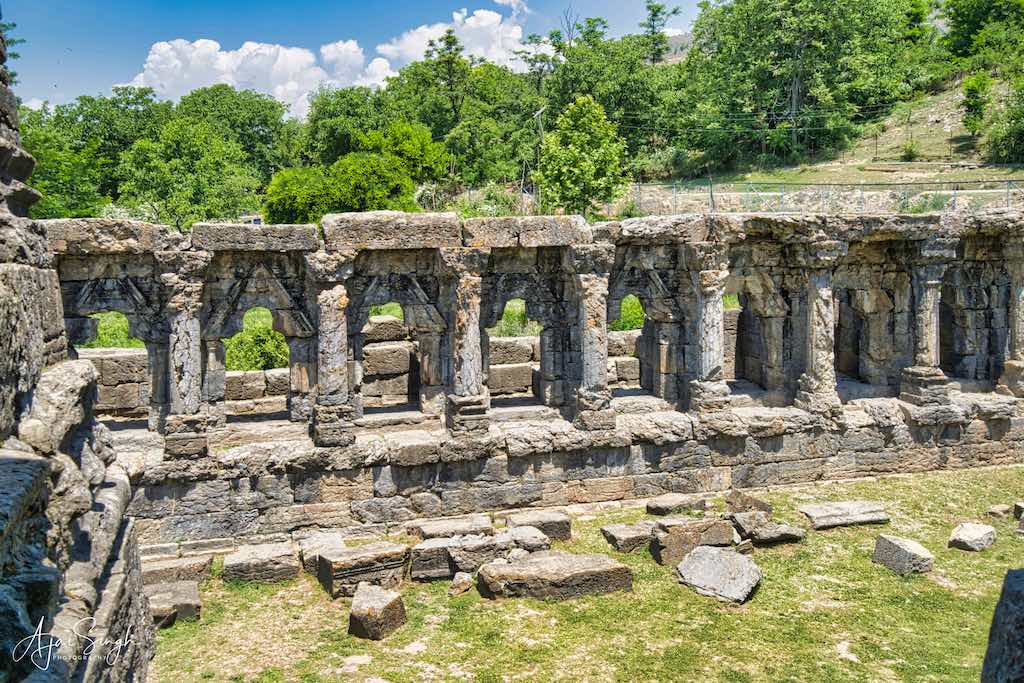
.
Surprisingly, broken intricate stone carvings of different deities and pieces of the structure lay scattered on the ground throughout the complex. If one was not careful, one could easily step on one of them, which may be an ancient murti. ASI needs to maintain the ruins better, to ensure that proper respect is given to these murtis and that the scattered pieces of our heritage are restored to some form of semblance.
.
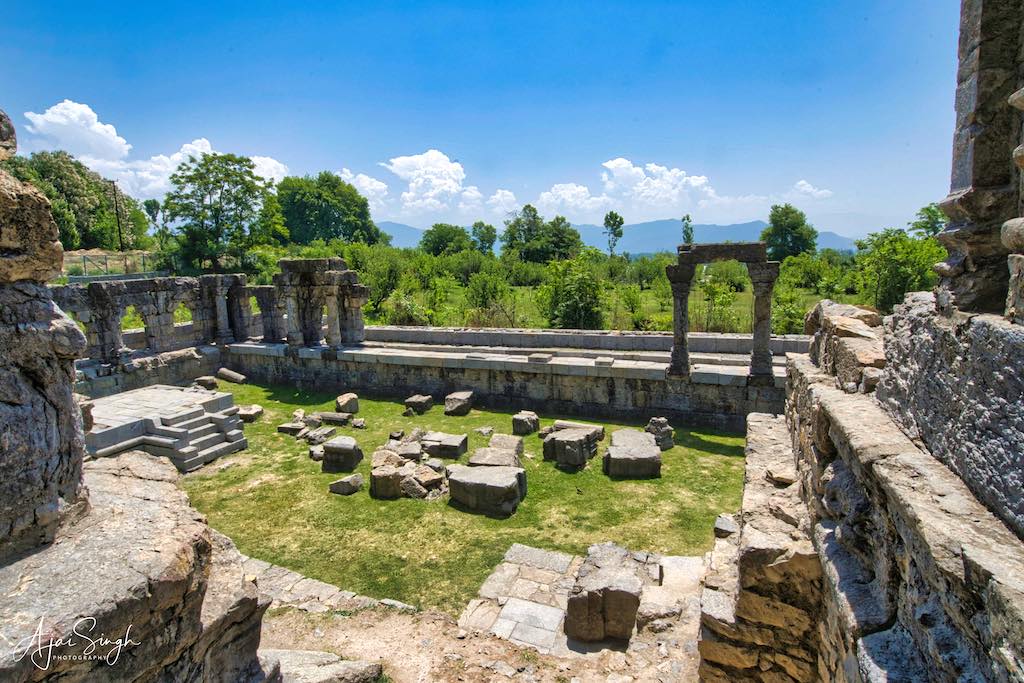
.
Despite the temple’s supposed fame, there was only one couple in the complex, besides us. Kashmir was flooded with tourists at this time, but none of them seemed to have time to visit our glorious heritage. A sad reflection of our sense of pride in our past.
.
To protect your personal data, your connection to YouTube has been blocked.
Click on Load video to unblock YouTube.
By loading the video you accept the privacy policy of YouTube.
More information about YouTube’s privacy policy can be found here Google – Privacy & Terms.
.
Verinag
.
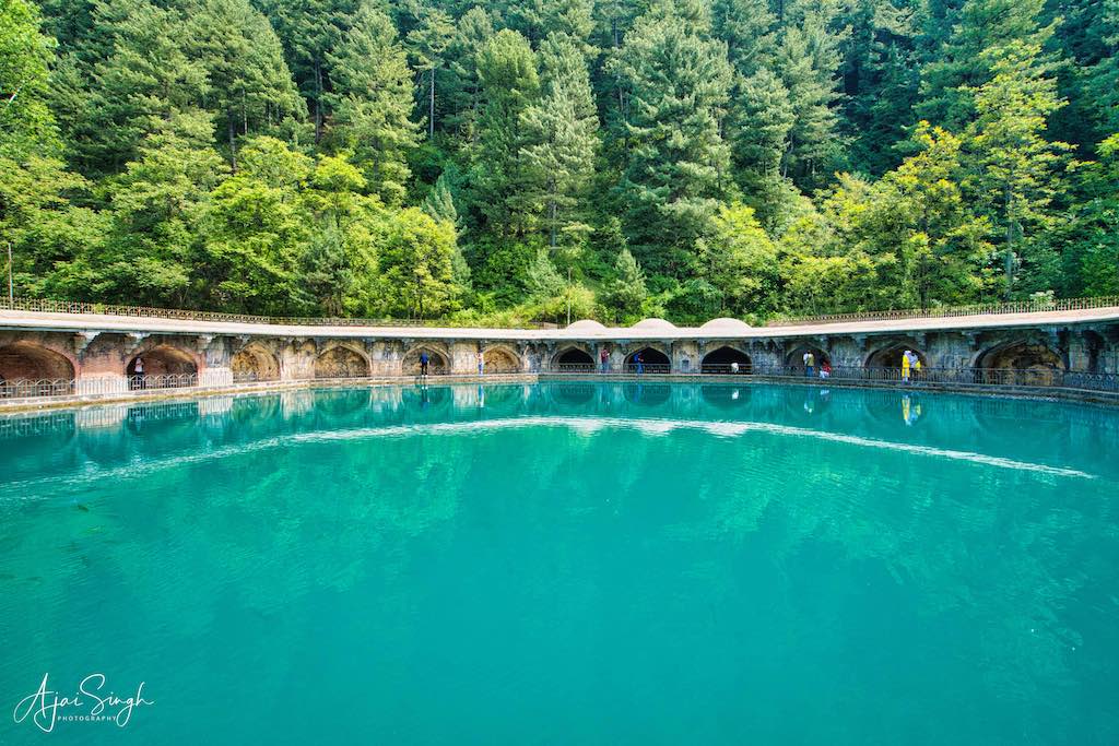
.
From Mattan, we drove to the ancient shrine of Verinag, a distance of about 30 km. The drive was through rural Kashmir, crossing small towns and villages enroute. The observation made earlier about the overall prosperity of Kashmir was reinforced during this journey.
.
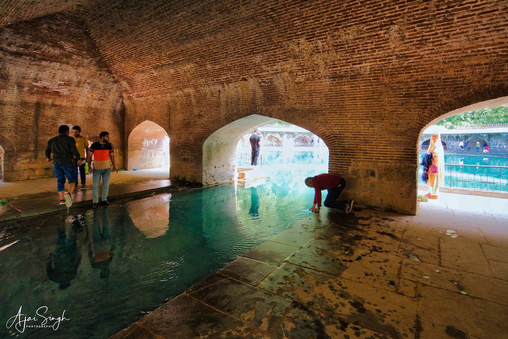
.
Verinag is a town named after and famous for the Verinag spring and Mughal garden, in Anantnag district. It is about 26 km from Anantnag and approximately 78 kilometers southeast of Srinagar. Verinag is also the first tourist spot of Kashmir Valley one encounters when traveling by road from Jammu. The Verinag spring comes out from a high scarp of a mountain spur and is the source of the Jhelum river. It is situated at the bottom of a hill covered by pine trees and evergreen plants.
According to a legend, Devi Vitasta (Jhelum) wanted to take rise from this spring, but it happened that when she came, Shiva was already present here, whereupon she had to go back and then she took her rise from Vithavatur (Vitastatra), a spring about a mile to the north-west of this place. Virah in Sanskrit means to ‘go back’ and ‘nag‘ means spring and, as Vitasta had to go back from this place, it came to be called Virahnag or “Vernag“.
.
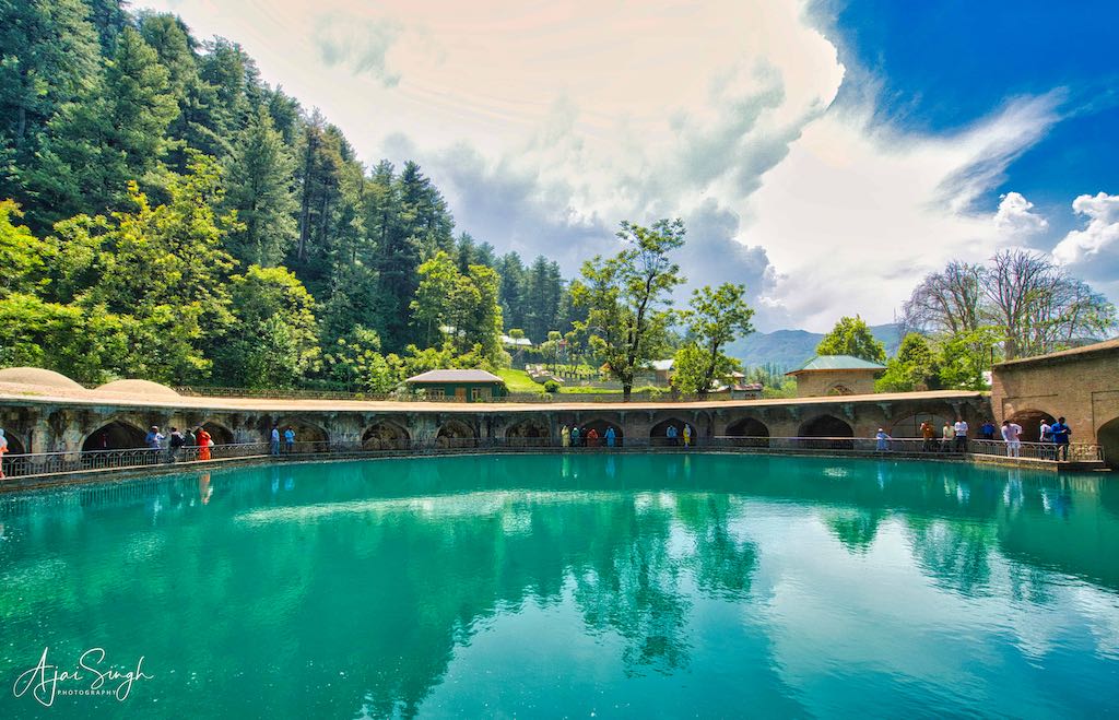
.
Presently, there is an octagonal stone basin at the Verinag Spring and an arcade with arches surrounding it, which was built by the Mughal emperor Jahangir in 1620 CE. Later, a beautiful garden next to this spring was laid out by his son Shah Jahan. The design of the Verinag garden is again an adaptation of the traditional Persian Charbagh (four gardens). Jahangir wished to be buried at Verinag Gardens, but his wife, Nur Jahan, disobeyed his wishes. Today nothing remains of the pavilions which once decorated the area.
The spring is at the center of the arcade, almost 50 feet (depth) underwater from where the water continuously comes up and flows into the gardens facing the spring. There is an ancient Shiva Linga in one of the arches (the very first on the left of the entry of the spring). The garden also has a temple inside it with murtis of deities in it.
.

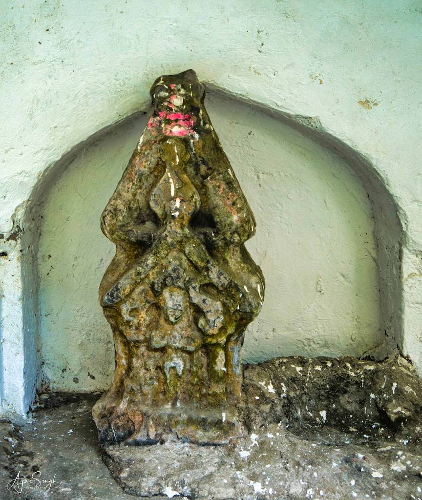
.
The birth of the river is celebrated annually with a fair on the thirteenth day of the bright fortnight of the month Bhadrapada of the Hindu Calendar.
Verinag is an ancient and important place for Hindus since prehistoric times. However, the visit was disappointing as the place looked to be only celebrating the Mughal Gardens there. And now it has become more-or-less a tourist destination, with its religious significance obliterated. The clear, greenish waters of the octagonal pond and the beautifully maintained gardens were a big tourist attraction, no doubt. The ancient Shiva Linga mentioned in the texts was found locked behind an iron door, not accessible to devotees wanting to offer prayers. It seemed that Shiva had been locked up in a jail, and the keys thrown away! Even the copper vessel on top of the Linga from which water drips was empty, probably never filled. The same was the case with the small temple in the gardens. It was locked up and unattended, though it appeared puja had recently been offered inside. This shrine is under the ASI, a Central Government agency, not a State body. No one seemed bothered about catering to the religious sentiments of the Hindus and at least provide the basic requirements for this ancient shrine.
.
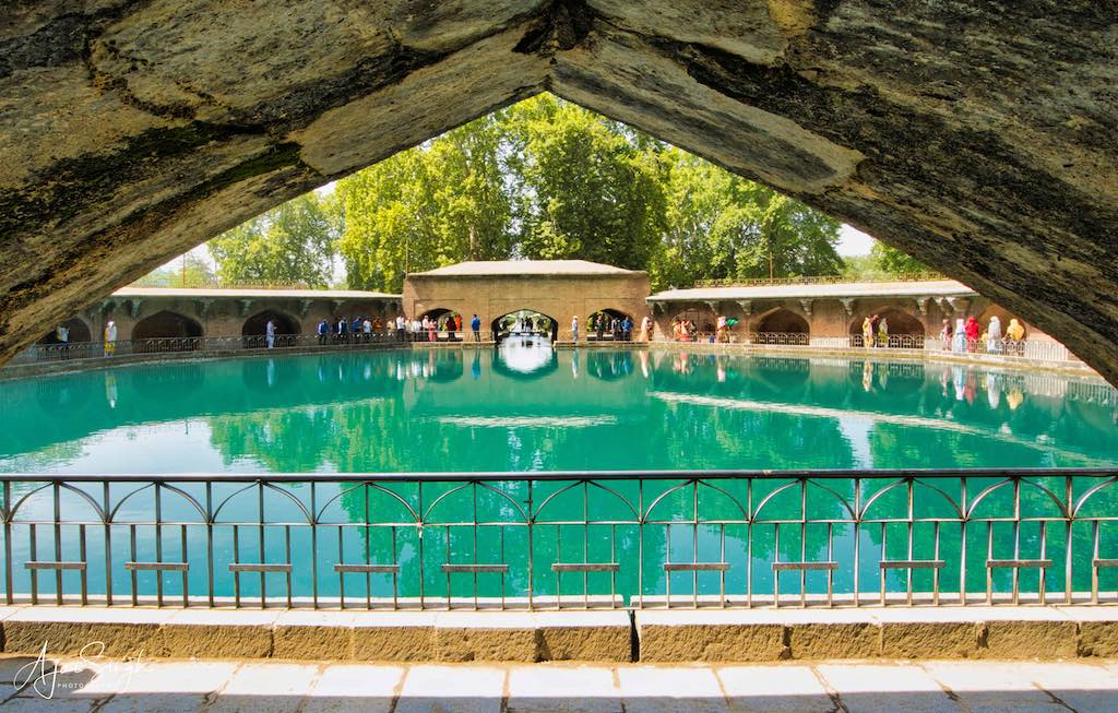
.
To read more about the history and significance of Verinag, read my blog Kashmir – The Land of Rishis: Part 2 – History.
.
Qazigund Tunnel
.
We were now in the southernmost part of Kashmir, and a visit to the famous Qazigund Tunnel on NH 44 (Jammu-Srinagar highway), about 10 km away was imperative. The 9 km long tunnel had been inaugurated in 2021, and was an engineering marvel while making the highway usable even during the winter months – a major relief for the whole of J&K and to the security forces. We drove in from one side and made a U-turn at the other end, the drive providing a new experience for most of us. One could see the new technologies incorporated in the tunnel as we drove through, to make the experience safer.
.

.
From the tunnel, it was an 80 km drive to Srinagar through the flat, beautiful green countryside of the valley. The highway was excellent and we made good progress, till a sudden, violent dust storm, accompanied by a downpour hit us. Once it cleared, the washed countryside looked even more beautiful, especially as the setting sun added to the rainbow of colours across the skies and the fields.
Today was our last night of the tour, which officially was completed after the visit to the Qazigund tunnel. By the time we reached Srinagar, it was night and the last portion of the drive through the city was nightmarish on account of the traffic. We were to stay the night in another hotel that we used during the first few days. This was closer to the Dal Lake, though the previous hotel was a tad better. But then for the amount we were paying for the whole yatra package, it was unbelievable what we had been provided and the places we visited. Some members went for the last night of shopping and sightseeing, I skipped that and relaxed in the room till dinner was served, to make it an early night.
.
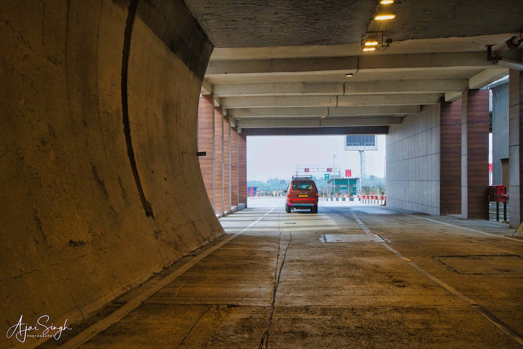
.
Day 10
.
My flight was around noon, but we had to leave quite early since the security checks at the airport were in two stages – all baggage had to be unloaded from the vehicles and screened once before reaching the terminal building, and then the normal practice was followed again. This took time.
It had been a wonderful journey for me, 10 days of visiting places some of which I had not heard of before, while some I had always dreamt of visiting one day. And since we were accompanied by a very knowledgeable Kashmiri Pundit, Vinod ji, the visits and the drive between them were always accompanied by a steady commentary on the places we passed through, and about the sites we visited. And lengthy conversations about the conditions of Kashmir in general, and historical background of events in the past, and a myriad of connected topics. Such an exposure was not possible during a normal visit and I am very grateful that I got this opportunity. This kindled my interest to research deeper into the history of Kashmir, which is a fascinating chapter of our past. It is from this region that mankind is supposed to have originated and from where our Bhagwans, Devis, and Devatas took form and imparted their knowledge and wisdom to mankind.
.
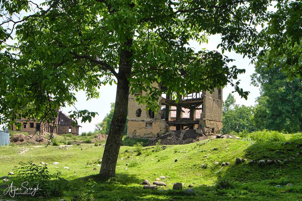
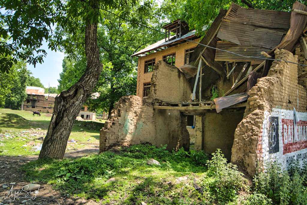
.
The saddening part of the tour was the realization that such savage destruction of our heritage on such a huge scale had occurred not in some distant past at the hands of a Turkish/Gaznavite invader, but it happened quite recently, during our lifetime itself! Most Indians, myself included, were unaware of what really had happened and its irreparable damage to our civilization. Even though I have served in J&K during my service, we remained involved in routine activities and day-to-day firefighting with terrorists – not much thought was given to these aspects of the jihad, which have a long-lasting impact on us. It’s only now that what transpired in the 1980s and 1990s is coming to light, that media and social platforms are playing a major part to uncover the hidden details.
Coming to think of it, so many ancient priceless murtis and revered shrines where hundreds of thousands of devotees thronged regularly, have been vandalized just a few decades ago, and the places of pilgrimages rendered extinct. This is my small contribution of recording what I saw during the yatra, so that people, especially Indians, can read about one of the important regions of our civilization and a bit about its itihaas from prehistoric times.
.
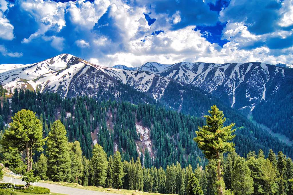
.
Kashmir – The Land of Rishis: Part 2 – History
.
To read more about the history of Kashmir and of the shrines we visited, go to Part 1 of my blog by clicking here.
.
Book
.
My blogs have formed the basis for my book on Kashmir, which goes by the same name, and was published in 2023. It went in for its second reprint in 2025. The book can be viewed on my website (link below).
https://iauthored.com/brigapsingh
.
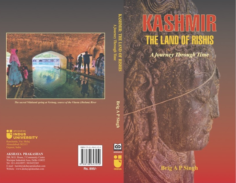
.
References
.
- https://hindutemples-india.blogspot.com/2021/10/shankaracharya-temple-srinagar-jammu-and-kashmir.html
- https://hindutemples-india.blogspot.com/2021/10/manasbal-temple-jammu-and-kashmir.html
- https://en.wikipedia.org/wiki/Manasbal_Lake
- https://www.jktdc.co.in/Manasbal-lake.aspx
- https://www.taleo
- https://hindutemples-india.blogspot.com/2020/06/wangath-temple-complex-naranag-jammu-and-kashmir.html
- https://tfipost.com/2018/03/maa-bhadrakali-handwara-01/
- https://www.jammukashmirnow.com/Encyc/2020/4/14/The-region-where-Baramulla-or-Varahmula-is-spread-is-of-immense-historical-significance-The-town-was-established-by-King-Bhimsina-in-2306-BCE.html
- http://thekashmirtemples.com/shailputri-baramulla/
- http://thekashmirtemples.com/kotitirtha/
- https://www.nationalheraldindia.com/national/unrest-in-valley-affects-tirathraj-kapal-mochan-pilgrimage
- https://en.wikipedia.org/wiki/Aharbal
- https://www.jammukashmirnow.com/Encyc/2020/4/24/Terror-Attacks-on-Temples-of-Kulgam–Home-to-two-temples-of-Mata-Kheer-Bhawani.html
- https://indianexpress.com/article/india/india-others/kashmiri-pandits-throng-manzgam-shrine/
- https://en.wikipedia.org/wiki/Mamal_Temple
- https://indiapl.com/jammu-kashmir/mamal-temple-369144
- http://thekashmirtemples.com/mamleshwar-temple/
- https://web.archive.org/web/20121223005814/http://archnet.org/library/sites/one-site.jsp?site_id=14962
- http://satisar.org/docs/apr-june2006.pdf
- https://www.sanskritimagazine.com/hindu-temples/the-legend-and-destruction-of-martand-the-sun-temple-in-kashmir/
- https://asoulwindow.com/martand-sun-temple-guide-the-lost-hindu-temple-of-kashmir/
- https://en.wikipedia.org/wiki/Verinag
.
Note: All watermarked photographs displayed above are my exclusive property and copyright; their use is prohibited without explicit consent, in writing.
.


12 Responses
Great sir, wonderful expression. Covered each and every locations we traveled. Pics are also appropriately placed which tell eveything of the place visited. Will definitely share in other groups 🙏
Thank you. Hope more people will read and know about our rich heritage.
Very well documented…my compliments…would love to speak to you on tele..request your mob No
Thank you. You can email me at: [email protected]
Absolutely mesmerising travelogue . Very descriptive and useful for those who love to visit Kashmir.
Thank you. Hope you visit too, to discover the wonders of Kashmir firsthand, if not already done!
Very Nice. Other than the Martand Sun temple all the others seem to be refurbished recently . I had been to Kashmir in 1966 with my father ..dont remember much other than Dal lake and house boat ..I have no desire to visit ever again to a place where temples need to be barricaded to protect it from its own citizens !
Most of the refurbishing you see has been done by the Army, or the other security forces.
Very nicely documented. Very sad to see the conditions of our temples.
Photographs are really nice.
Thank you.
First of all I would like to compliment you on an Excellent documentation, your photographs are too good. I am a Kashmiri Pundit and I have been to most of the places you visited, but in my childhood. Your write up has encouraged me to take a trip back home after 15 years. Though our ancestors homes have been totally destroyed, which breaks my heart, but love to be there once again.
Thank you for bringing out the poor conditions of our heritage and its negligence. I do hope that the ASI looks into this.
It never too late to visit the land of your ancestors! I hope you make it back soon. Do read Part 2 of this blog too, should be of interest to you.